RECORD \ GLOBAL RECORD \ 89-O
1: G. Buccellati, September 2009

Urkesh Global Record: The Outer City

Click to open within the website frame.
Click to open outside the website frame
     (this is useful to see multiple windows at the same time or if you use low resolution on your screen).
     The vast Outer City of Urkesh was not recognized during our first visits to the site, because on those occasions the wheat fields covered the entire area. But already in the fall of 1984, after the harvest, we noticed the marked rise that surrounded as an oval the entire mound, and we included that area in our topographic survey. We also assigned a full complement of zone labels.
     In the Fall of 1985, a complete foot survey was undertaken by Dr. Judith Thompson-Miragliuolo, which resulted in the publication of a chapter in the first volume of the Urkesh/Mozan Studies.
     In 1991, some of the ceramics was published in UMS2 (pp. 7-8 with Fig. 8), within the purview of a general assessment of the late third millennium ceramics from Urkesh.
     Subsequently, a number of operations were carried out, generally in response to requests from local field owners who wanted to dig wells for their farming needs. The most extensive operation in this respect was OH2 (an administrative sector).
     Other operations followed when our guards reported larger quantities of cermic material or of stones appearing surfacing in the wake of the spring plowing (especially Oa4 and Ob1 [graves], OD50 and OG50). (NOTE: The designation with the lower case letter in second position reflects an earlier labeling. In particular, Oa4 is now located in the inner part of zone OH.)
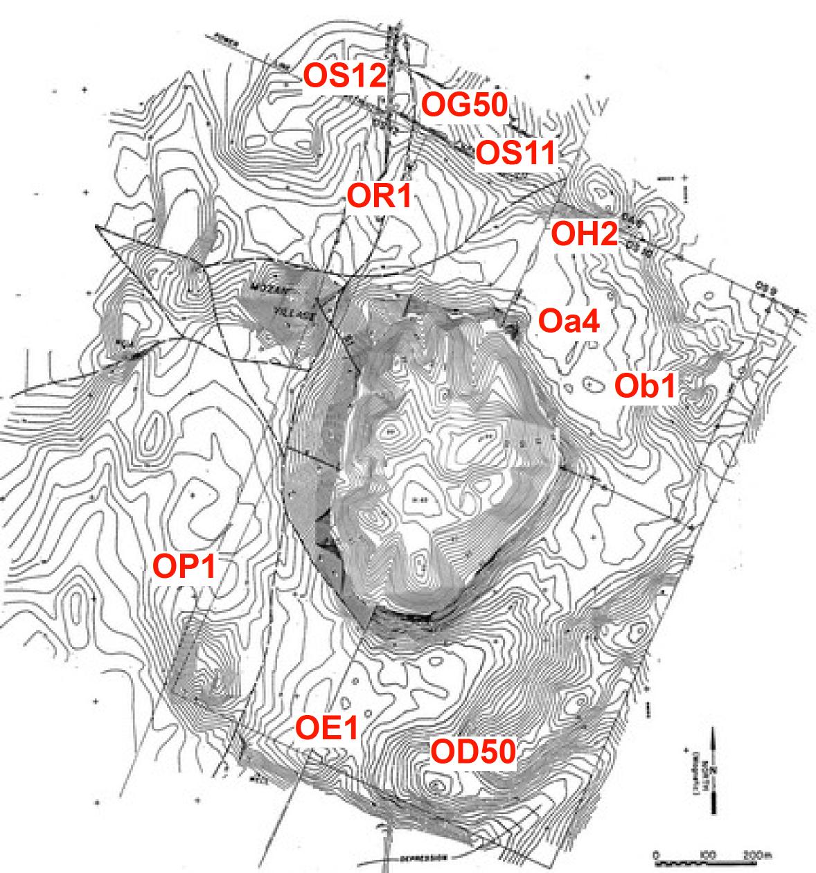
     In the years 1983-1984 a wide-ranging geophysical survey was undertaken, which revealed especially significant settlement patterns in the southern part of the Outer City. The surface collection conducted in concomitance with the survey was labeled OE1. Also, Mr. Anthony J. Mathys included the study of the Outer City in his work on the geography of the area, based on satellite imagery.
     In 2007, a special investigation was carried out by Dr. Kathleen Deckers to investigate the subsoil in the northern portion of the Outer City (OR1). This confirmed our hypothesis about a stream bed running through the city in its mid western portion, and also provided a date for the earliest levels of the stream.
     In 2008, we planned a systematic re-mapping, in 2009, of the Outer City as a special project of Dr. Hans Barnard. This would also entail several soundings to be undertaken under his direction. Because of his forced absence in 2009, this project had to be postponed.
     In 2009, the opportunity arose for an additional systematic study of the Outer City, to be carried out by Ms. Caitlin Chaves Yates as the main topic of her PhD dissertation (submitted in 2014). This would be have to be harmonized with the research by Mathys and Barnard, which pursue parallel, but not conflicting, goals. The immediate occasion for this were the surface finds in OG50, and resulted in a thorough pilot project that will serve as her proposal for the PhD dissertation.