

| photo of view (for views only) | 2008-7-30 | !!! | |
[Input File: A20VK9c.J] |
| photo web | 2008-7-30 | !!! | |
[Input File: A20VK9c.J] |
| 17-7-2020 | !!! | |
[Input File: A20_VWX.j] | |
| 17-7-2020 | !!! | |
[Input File: A20_VWX.j] |
| templates |
| |||||||
| photo of context (v view) |
| |||||||
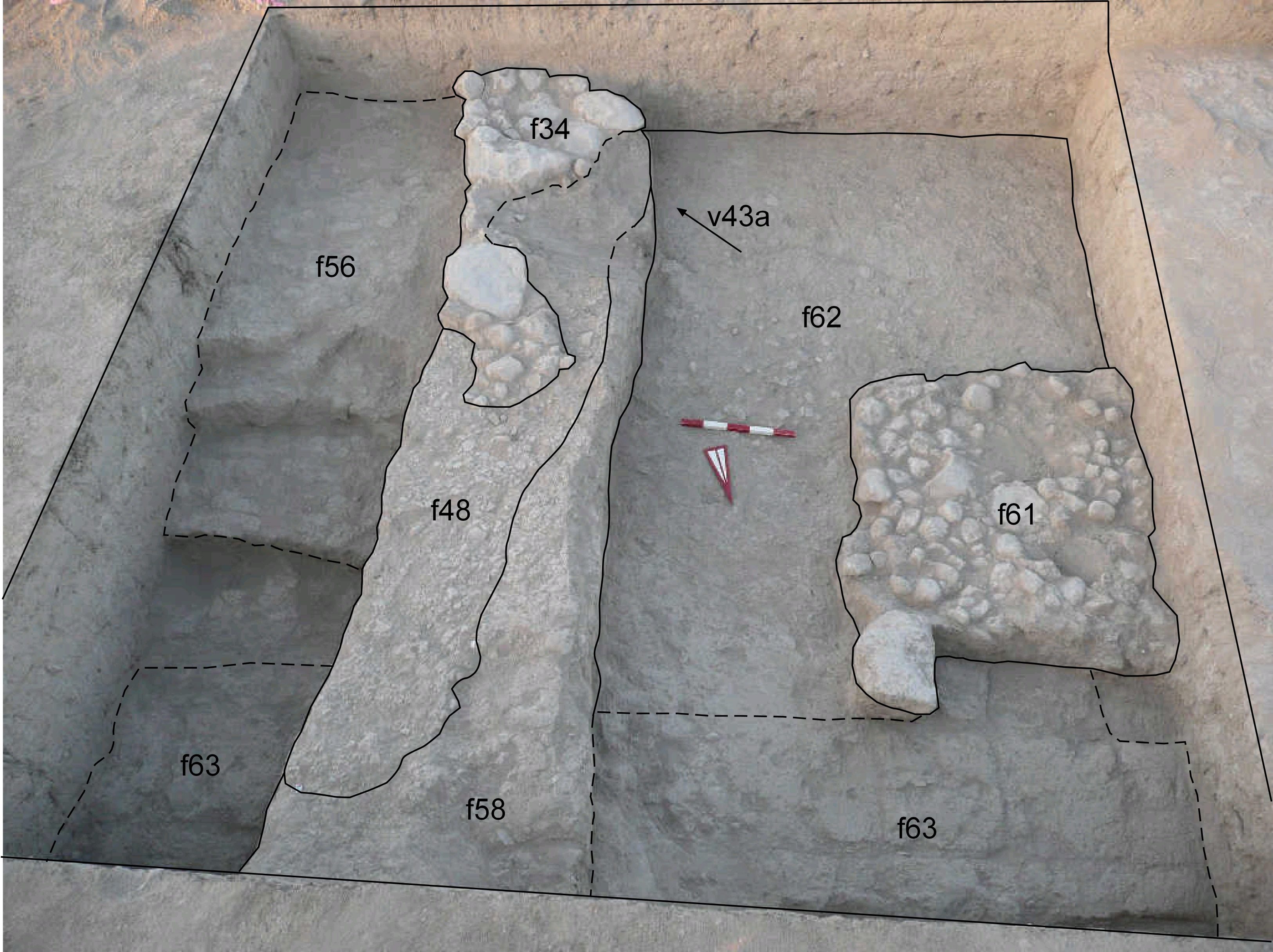
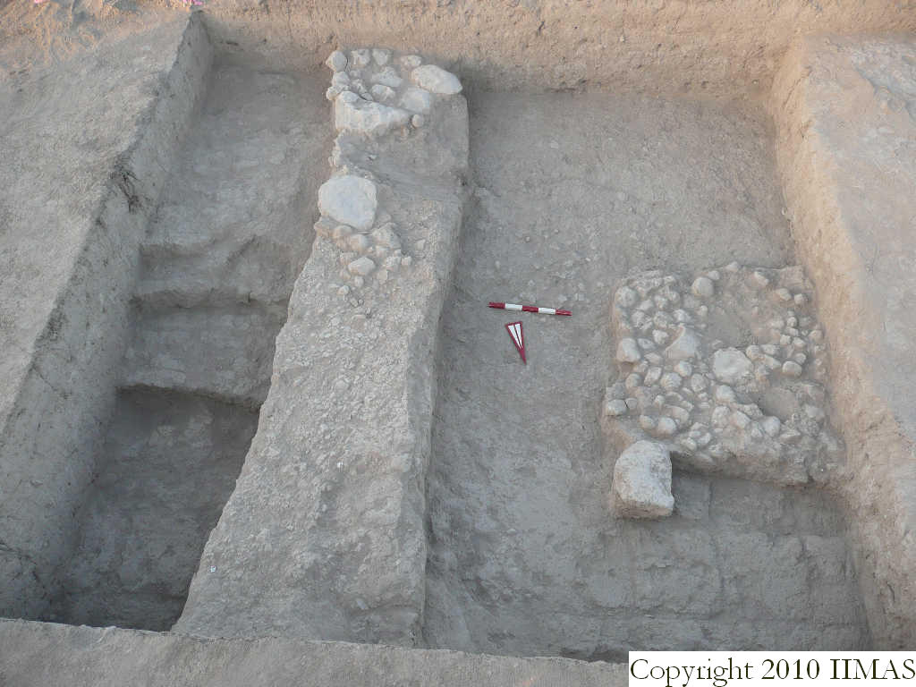
| view/drawing orientation | 2008-7-30 | lR | looking south | [Input File: S811lC.j] | ||||
| text description of view | 2008-7-30 | lR | View showing the stone installation f34 that overlays the sherd and pebble pavement f48. In the deepest area near the east section of k14 it is emerging the mudbrick structure with vertical bricks f56 and the mudbrick wall f63 that continues toward west along the north section. The shot also shows the pebble pavement f61 above the accumulation f62. | [Input File: S811lC.j] | ||||
| constituents within view/drawing | 2008-7-30 | lR | f34 f48 f56 f58 f61 f62 f63 k14 | [Input File: S811lC.j] | ||||