| photo of view (for views only) | 2008-8-03 | !!! | |
[Input File: A20VK9c.J] |
| photo web | 2008-8-03 | !!! | |
[Input File: A20VK9c.J] |
| templates |
| |||||||
| photo of context (v view) |
| |||||||
| view/drawing orientation | 2008-8-03 | lC | looking north | [Input File: S811lC.j] | ||||
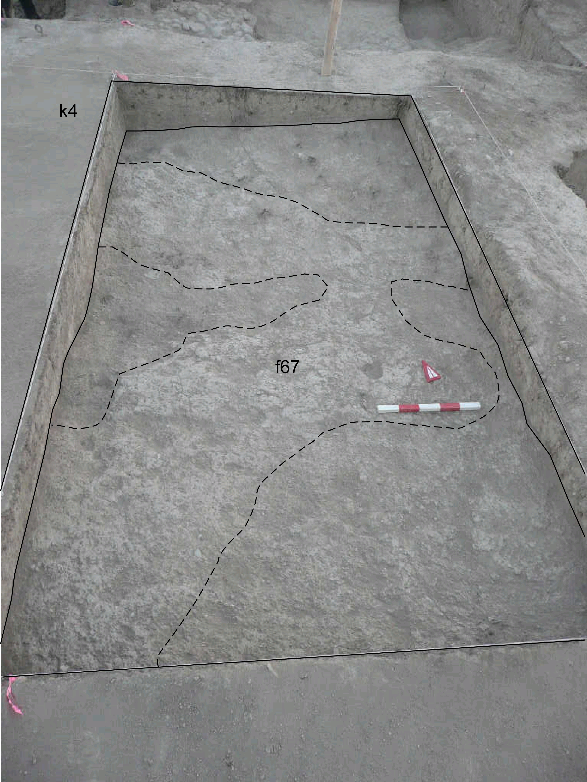
| text description of view | 2008-8-03 | lC | View showing k4 after removing of the topsoil f66 with the emerging of f67, a layer composed by patches of brickmelt and softer brown soil. This situation is like in k14 where the ancient tell surface f20 seems disappearing toward south. | [Input File: S811lC.j] | ||||
| constituents within view/drawing | 2008-8-03 | lC | f67 k4 | [Input File: S811lC.j] | ||||