
| photo of view (for views only) | 2008-8-06 | !!! | |
[Input File: A20VK9c.J] |
| photo web | 2008-8-06 | !!! | |
[Input File: A20VK9c.J] |
| 17-7-2020 | !!! | |
[Input File: A20_VWX.j] | |
| 17-7-2020 | !!! | |
[Input File: A20_VWX.j] | |
| 17-7-2020 | !!! | |
[Input File: A20_VWX.j] |
| photo of context (v view) |
| |||||||
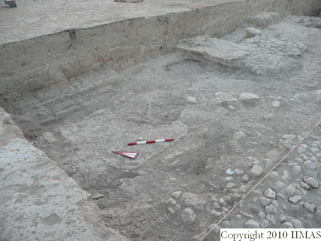
| view/drawing orientation | 2008-8-06 | yM | looking northeast | [Input File: S812lC.j] | ||||
| text description of view | 2008-8-06 | yM | View showing the mudbrick wall f41 in k13 and f63 in k14 and the probable wall N-S f77 exactly in the eastern baulk of k13. In the foreground it's visible the pebble pavement f50 not yet removed in the southern baulk of k13, and the accumulation f81 below it. | [Input File: S812lC.j] | ||||
| constituents within view/drawing | 2008-8-06 | yM | f30 f41 f50 f59 f60 f61 f62 f63 f77 f81 k13 k14 | [Input File: S812lC.j] | ||||