
| photo of view (for views only) | 2008-8-06 | !!! | |
[Input File: A20VK9c.J] |
| photo web | 2008-8-06 | !!! | |
[Input File: A20VK9c.J] |
| 17-7-2020 | !!! | |
[Input File: A20_VWX.j] | |
| 17-7-2020 | !!! | |
[Input File: A20_VWX.j] |
| templates |
| |||||||
| photo of context (v view) |
| |||||||
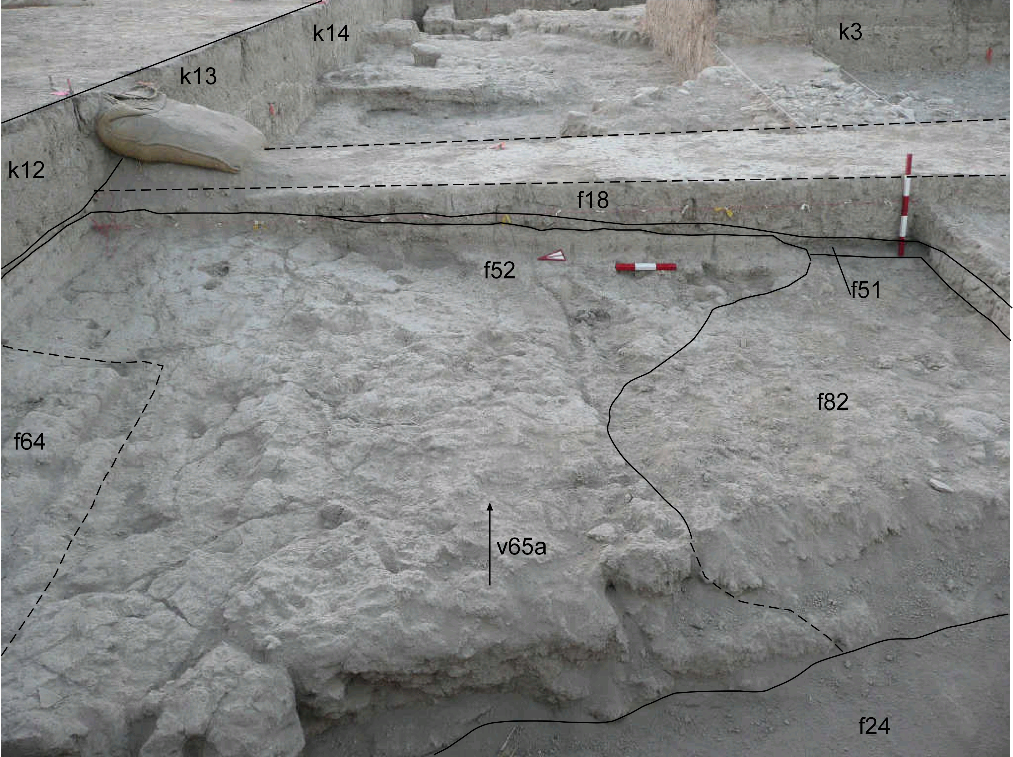
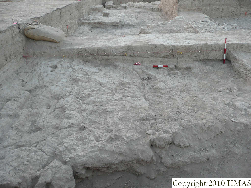
| view/drawing orientation | 2008-8-06 | yM | looking east | [Input File: S812lC.j] | ||||
| text description of view | 2008-8-06 | yM | View of the east section of k12 with the string. The view shows the ancient tell surface f18 separated by a thin soft ashy layer f51 from the compact brickmelt f52 in the north-western half of the square. The view also shows the mudbrick wall next to the north section of k12 f64 and the brickfall f82 above the brickmelt itself. In the lower part of the picture we can also see the deep ashy layer f24. | [Input File: S812lC.j] | ||||
| constituents within view/drawing | 2008-8-06 | yM | f18 f24 f51 f52 f64 f82 k12 k13 k14 | [Input File: S812lC.j] | ||||