
| photo of view (for views only) | 2008-8-07 | !!! | |
[Input File: A20VK9c.J] |
| photo web | 2008-8-07 | !!! | |
[Input File: A20VK9c.J] |
| 17-7-2020 | !!! | |
[Input File: A20_VWX.j] | |
| 17-7-2020 | !!! | |
[Input File: A20_VWX.j] |
| photo of context (v view) |
| |||||||
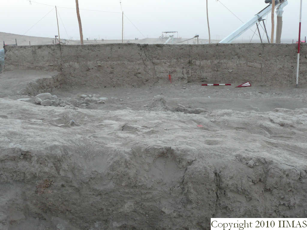
| view/drawing orientation | 2008-8-07 | sE | looking east | [Input File: S812lC.j] | ||||
| text description of view | 2008-8-07 | sE | View of the east section of k3 without the string, The view shows the topsoil f9 covering the soft accumulation f13 above f17 the ancient tell surface. In the section is also visible the f 31, the interface of the ashy layer f36 and the pebble and sherd pavement f35. | [Input File: S812lC.j] | ||||
| constituents within view/drawing | 2008-8-07 | sE | f9 f13 f17 f31 f35 f36 k3 | [Input File: S812lC.j] | ||||