
| photo of view (for views only) | 2008-8-10 | !!! | |
[Input File: A20VK9c.J] |
| photo web | 2008-8-10 | !!! | |
[Input File: A20VK9c.J] |
| templates |
| |||||||
| photo of context (v view) |
| |||||||
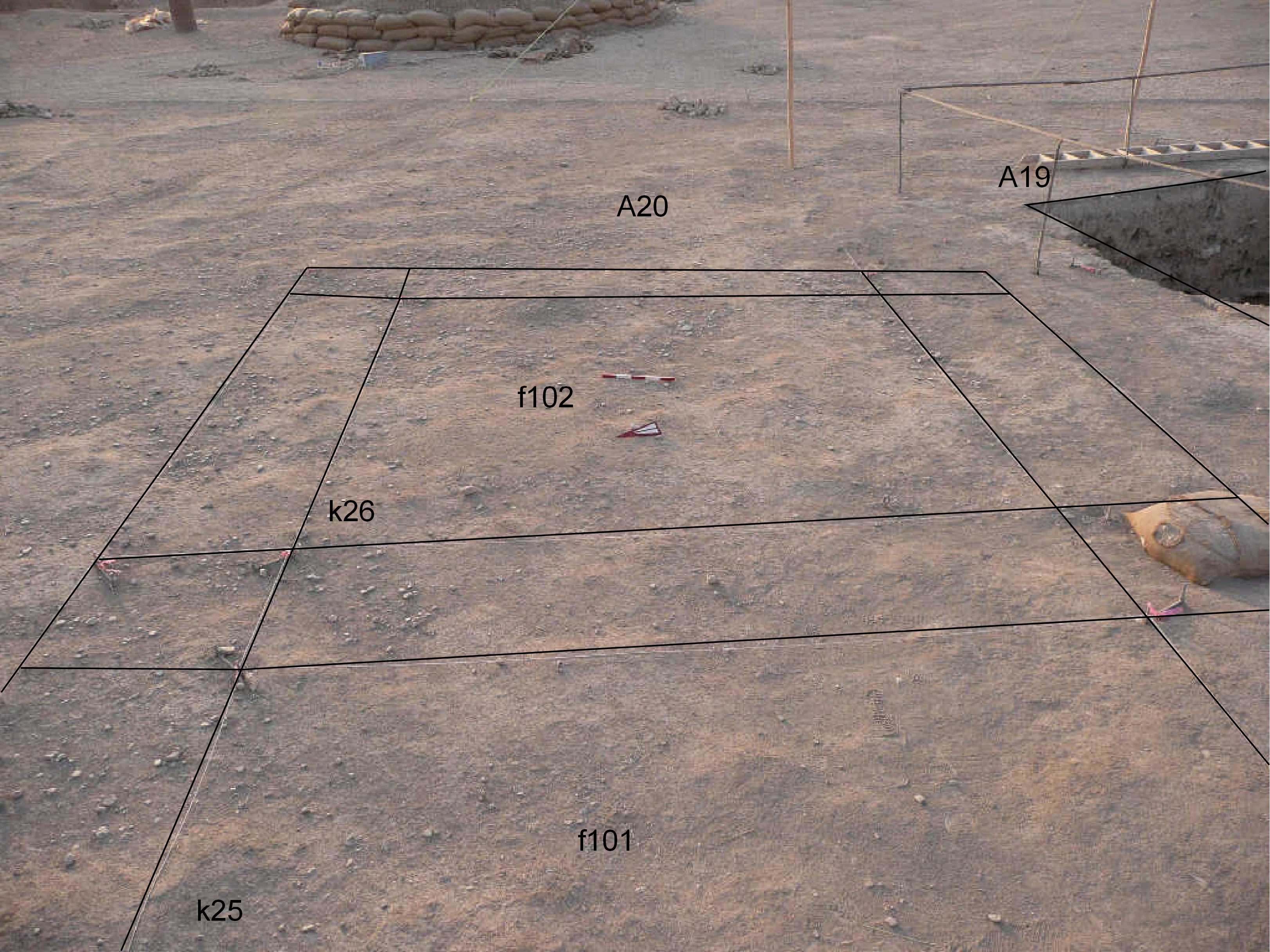
| view/drawing orientation | 2008-8-10 | lC | looking east | [Input File: S812lC.j] | ||||
| text description of view | 2008-8-10 | lC | View showing k26 before the beginning of the excavation with the topsoil f102 and a small part of k25 with the topsoil f101. In the right part of the picture is also visible a corner of the old A19 excavation area. | [Input File: S812lC.j] | ||||
| constituents within view/drawing | 2008-8-10 | lC | f101 f102 k25 k26 | [Input File: S812lC.j] | ||||