A20v130a

File: /MZ/A/A20/D/I//MZ/A/A20/D/V/0130a.HTM
Processed on 21-8-2020
The home for this page is A20

Labeling/Designation

Description/Count
photo of view (for views only) 2008-8-27 dm [Input File: A20VK9c.J]
photo web 2008-8-27 dm [Input File: A20VK9c.J]
17-7-2020 !!! [Input File: A20_VWX.j]

Analogical Record
photo of context (v view)
17-7-2020 / !!! / [Input File:A20_VWX.j]
view/drawing orientation 2008-8-27 yM looking north [Input File: S909lC.j]
text description of view 2008-8-27 yM 
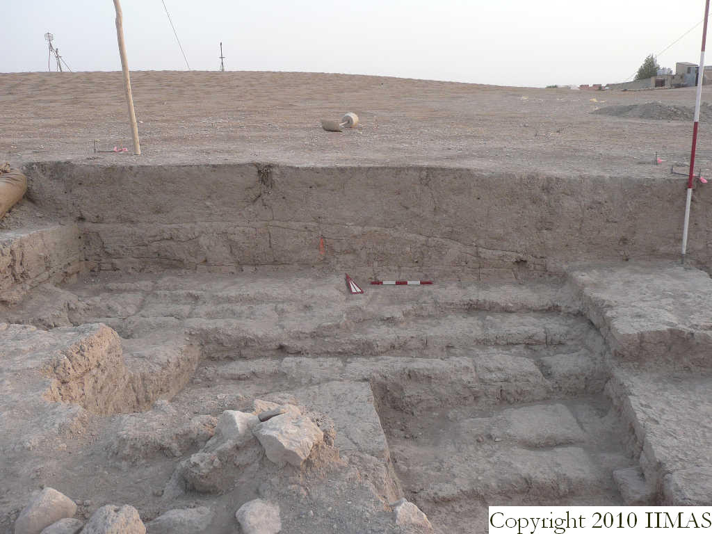
View of the north section of k13 without the string. The shot shows the topsoil f4 above the accumulation f7, interpreted as the ancient tell surface abandonment. Below is visible the brickfall f30 probably coming from the big mud brick wall f41 running east to west, just at the bottom of the section. To the south of this big wall there is another wall f105 abutting the wall f41 and linked with some stone structures not visible in this picture. [Input File: S909lC.j]
constituents within view/drawing 2008-8-27 yM f4 f7 f30 f41 f59 f105 k13 [Input File: S909lC.j]