A20v131

File: /MZ/A/A20/D/I//MZ/A/A20/D/V/0131.HTM
Processed on 21-8-2020
The home for this page is A20

Labeling/Designation

Description/Count
photo of view (for views only) 2008-8-27 dm [Input File: A20VK9c.J]
photo web 2008-8-27 dm [Input File: A20VK9c.J]
17-7-2020 !!! [Input File: A20_VWX.j]

Analogical Record
templates
17-7-2020 / !!! / [Input File:A20_VWX.j]
2008-9-18 / !! / [Input File:TMPL-S9i.J]
photo of context (v view)
17-7-2020 / !!! / [Input File:A20_VWX.j]
view/drawing orientation 2008-8-27 yM looking north [Input File: S909lC.j]
text description of view 2008-8-27 yM 
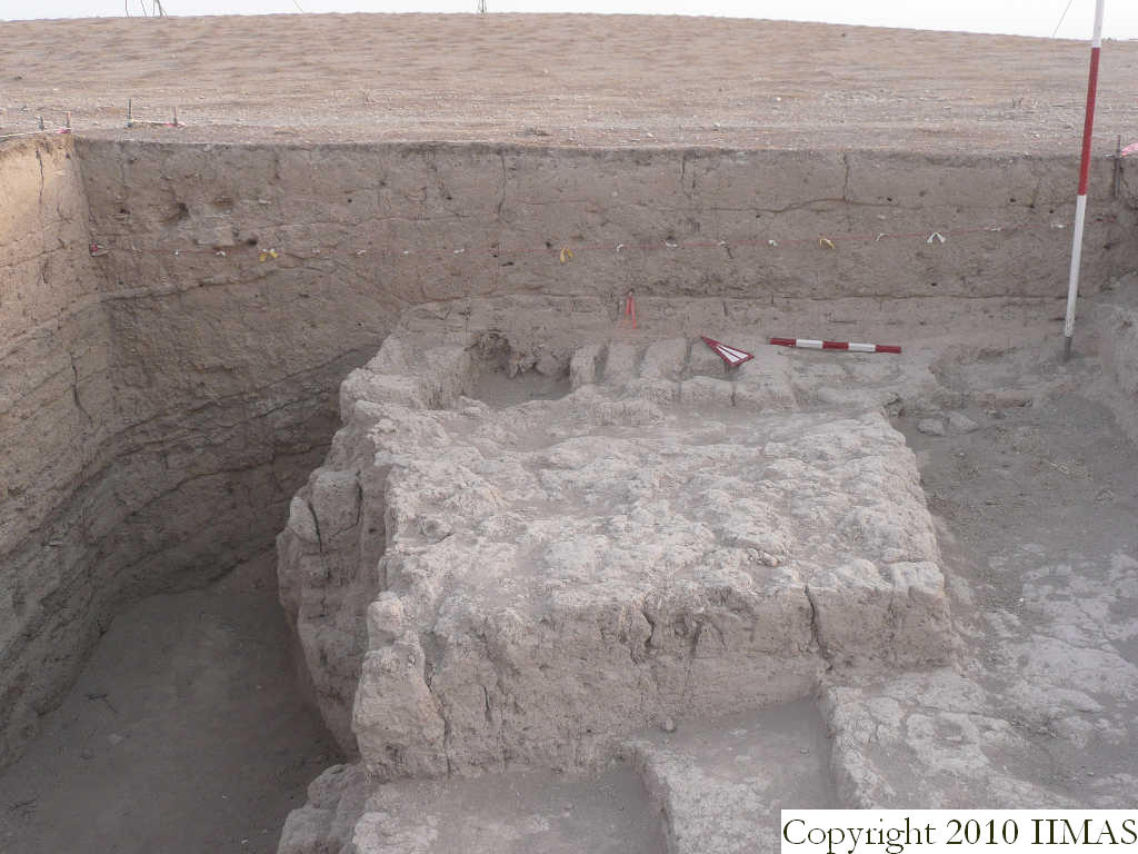
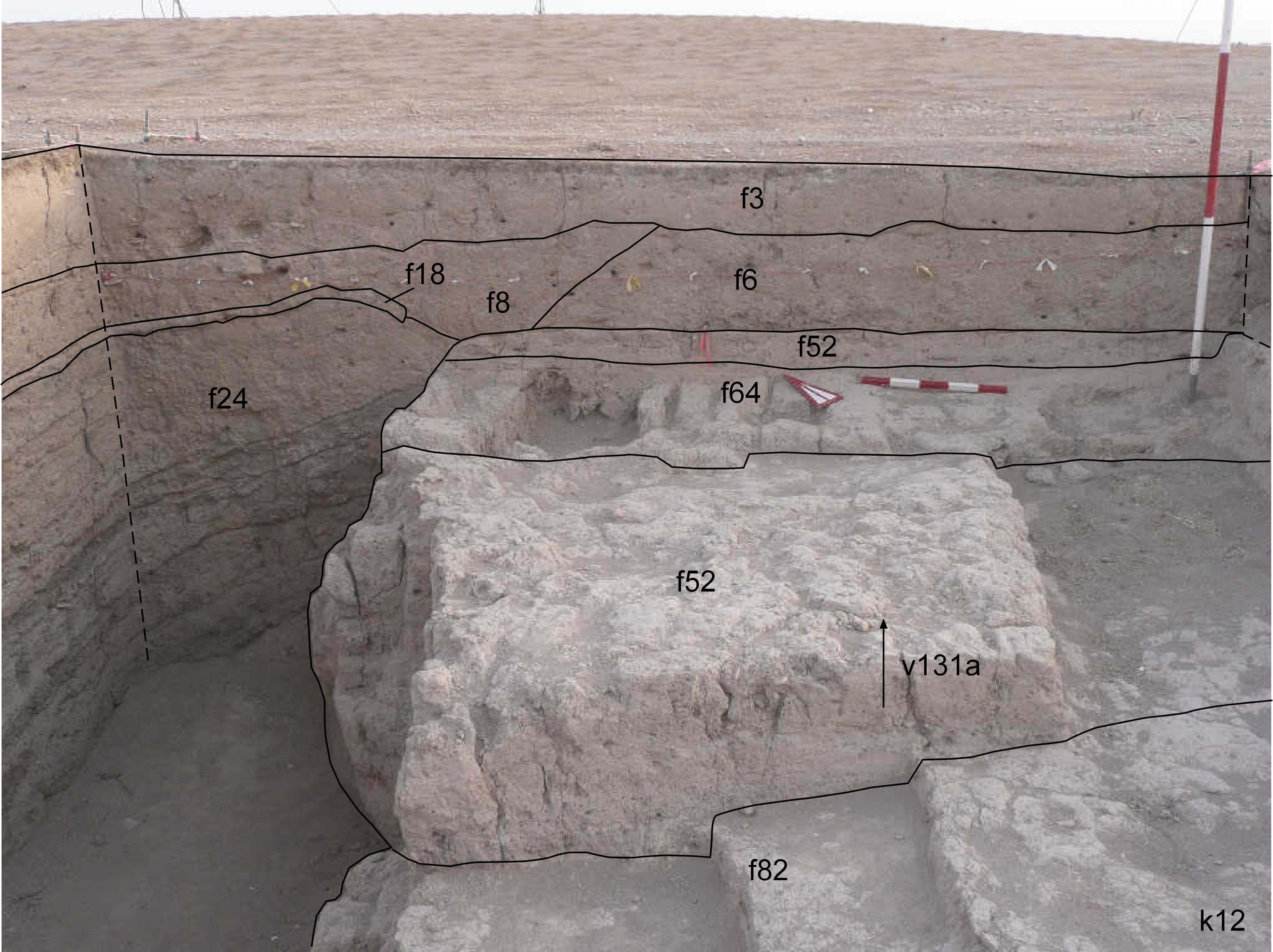
View of the north section of k12 with the string. The shot shows the topsoil f3 above the accumulations f6 and f8. In the western part of the section is also visible a thin layer, f18 interpreted as brick melt, also continuing in the western section. Below this layer there is the ashy layer f24, more than one meter thick. This ashy layer is abutting the bricky layer f52, where has been identified the wall f64 running east to west, just next to the northern baulk. [Input File: S909lC.j]
constituents within view/drawing 2008-8-27 yM f3 f6 f8 f18 f24 f52 f64 f82 k12 [Input File: S909lC.j]