A20v149a

File: /MZ/A/A20/D/I//MZ/A/A20/D/V/0149a.HTM
Processed on 21-8-2020
The home for this page is A20

Labeling/Designation

Description/Count
photo of view (for views only) 2008-8-28 dm [Input File: A20VK9c.J]
photo web 2008-8-28 dm [Input File: A20VK9c.J]
17-7-2020 !!! [Input File: A20_VWX.j]

Analogical Record
photo of context (v view)
17-7-2020 / !!! / [Input File:A20_VWX.j]
view/drawing orientation 2008-8-28 lC looking north [Input File: S910lC.j]
text description of view 2008-8-28 lC 
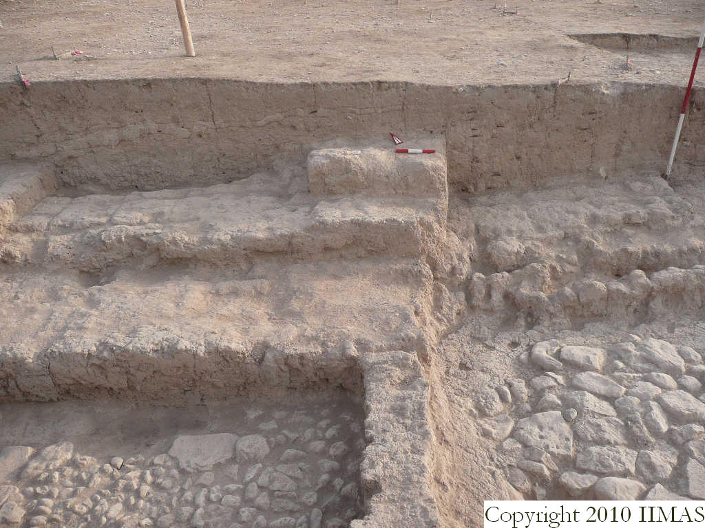
View showing the north section of k14 without the string. The section shows the topsoil f19 above the thin layer f20 and the accumulation f32 in the eastern part and the brickfall f37 toward west. Below the brickfall f37 there is a very compact layer f58 that was overlaying the big wall f63. To the south the walls f106 and f92 form a small room with the pavement f93. The mud brick wall f92 divides this room from another room, the a6, toward east, of which is visible the stone pavement f132. [Input File: S910lC.j]
constituents within view/drawing 2008-8-28 lC f19 f20 f32 f37 f63 f92 f93 f106 f132 f150 k14 [Input File: S910lC.j]