A20v156a

File: /MZ/A/A20/D/I//MZ/A/A20/D/V/0156a.HTM
Processed on 21-8-2020
The home for this page is A20

Labeling/Designation

Description/Count
photo of view (for views only) 2008-9-06 dm [Input File: A20VK9c.J]
photo web 2008-9-06 dm [Input File: A20VK9c.J]
17-7-2020 !!! [Input File: A20_VWX.j]

Analogical Record
photo of context (v view)
17-7-2020 / !!! / [Input File:A20_VWX.j]
view/drawing orientation 2008-9-06 lC looking north [Input File: S916lC.j]
text description of view 2008-9-06 lC 
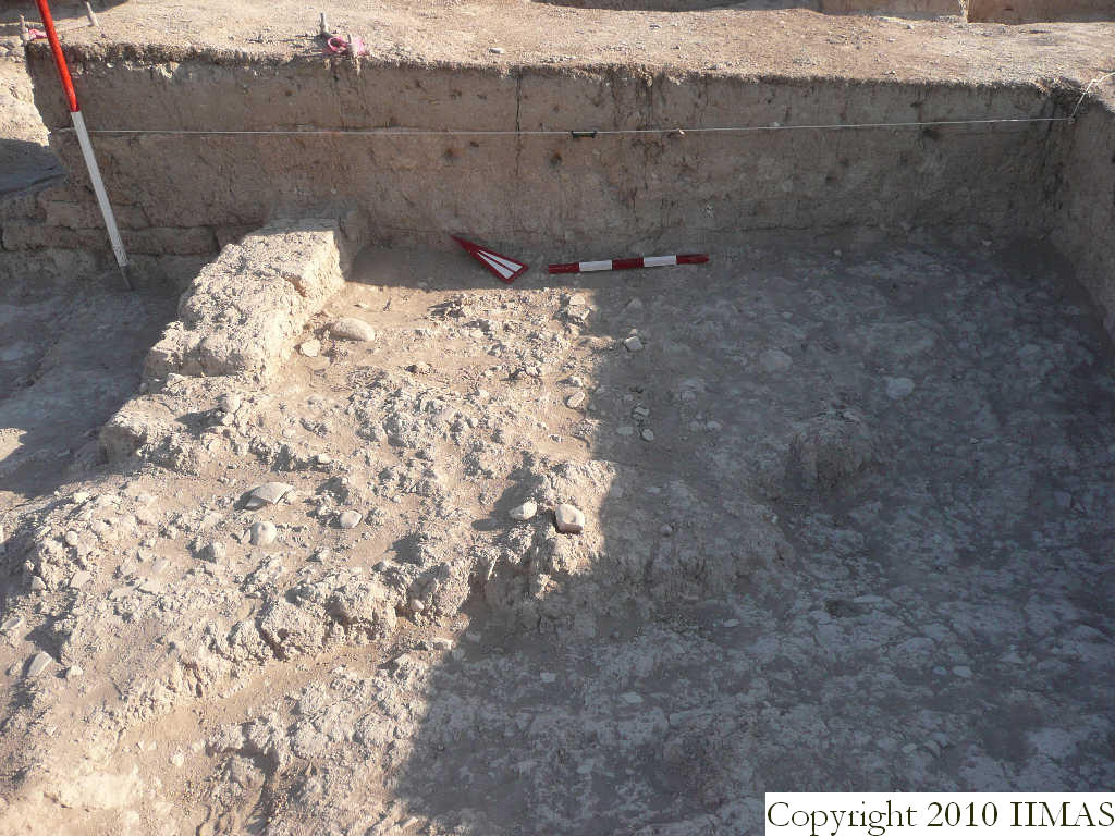
View of the section of the north baulk of k4 with the string. The view shows the topsoil f66 above the thin layer f67 constituted of patches of brickmelt and softer soil. Below this layer there is the accumulation f69 that we distinguished right on top of the pavement f73 in another feature, the accumulation aa f74. Toward west the section also shows some mud bricks belonging possibly to a wall f129, that is not still clear if it is running south to north or east to west. [Input File: S916lC.j]
constituents within view/drawing 2008-9-06 lC f66 f67 f69 f73 f74 f129 k4 [Input File: S916lC.j]