2. IDENTIFICATION
Designation
| Roster | Date | Author | Record |
|---|---|---|---|
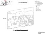
| Description (summary) | 2001-07-04 | dC | Section drawn by dC using a scaled photo then traced with freehand. The section was then checked with the real section for distortion and found to be accurate with section string strung at elevation 9007. The section shows the topsoil and brickmelt layers above the brickfall a4 in k2 north section. [Input: W314LC.j] |
6. REFERENCE
Analogical Record
| Roster | Date | Author | Record |
|---|---|---|---|
| Drawing of context (w 2-D) | |||
| View/drawing of aggregate | 2001-07-04 | dC | a4 (brickfall) [Input: W314LC.j] |
| View/drawing of features | 2001-07-04 | dC | f1 (topsoil) f15 (brickfall) f127 (layer) [Input: W314LC.j] |
| View/drawing of locus | 2001-07-04 | dC | k2 [Input: W314LC.j] |
| View/drawing orientation | 2001-07-04 | dC | n [Input: W314LC.j] |
| Notes on analogical record | 2001-07-04 | dC | Refer to composite drawing w41 [Input: W314LC.j] |
