6. REFERENCE
Analogical Record
| Roster | Date | Author | Record |
|---|---|---|---|
| Template | |||
| Photo of context (v view) | |||
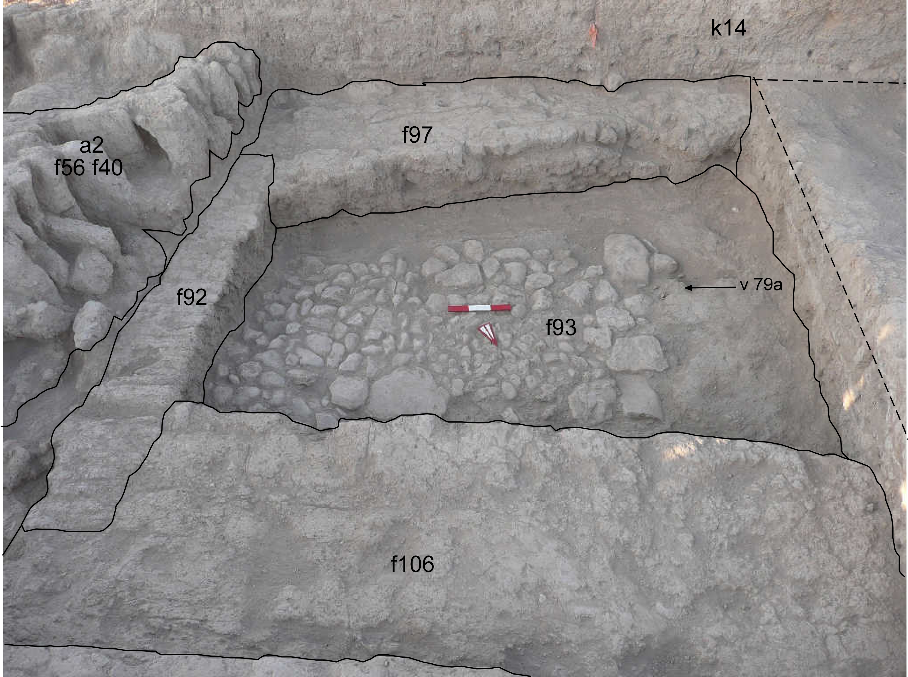
| View/drawing of aggregate | 2008-08-14 | lC | a2 (brick installation) a4 (room) [Input: S820LC.j] |
| View/drawing of features | 2008-08-14 | lC | f56 (brick pile) f92 (wall) f93 (pavement, type c) f97 (wall) f106 (wall) [Input: S820LC.j] |
| View/drawing of locus | 2008-08-14 | lC | k14 [Input: S820LC.j] |
| View/drawing orientation | 2008-08-14 | lC | looking south [Input: S820LC.j] |
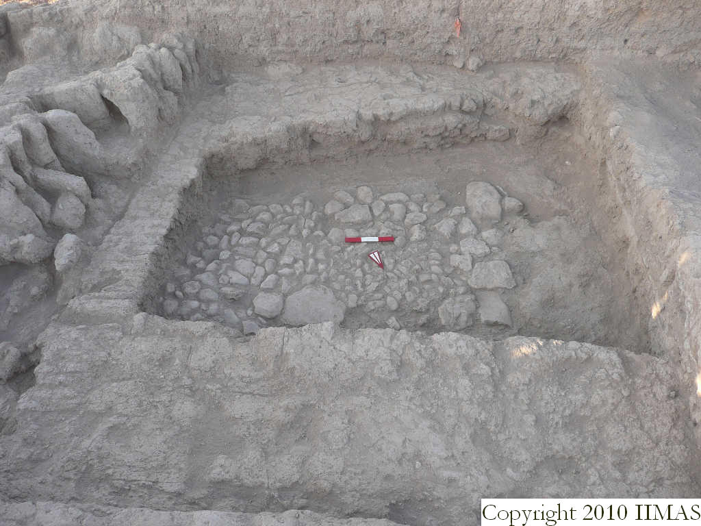
| Text description of view | 2008-08-14 | lC | View of a4, after removing the last accumulation f91 on top of the cobblestone pavement f93. The aggregate is formed by this pavement and by the three mudbrick walls until now recognized, f92, f97 and f106. The shot also shows the a2 just to the east of the small room, with the vertical bricks very close to the wall f92. Note that the stones do not appear to continue towards the west and south along with thepoor construction of the a4 walls which almost appear like jumbles of broken mudbricks clustered together making it difficult to articulate the wall with the possibility that one course of bricks in the southern wall were cut. [Input: S820LC.j] |
| Web view | |||
| Photo of view | |||


