
| photo of view (for views only) | 2008-8-26 | dm | |
[Input File: A20VK9c.J] |
| photo web | 2008-8-26 | dm | |
[Input File: A20VK9c.J] |
| 17-7-2020 | !!! | |
[Input File: A20_VWX.j] | |
| 17-7-2020 | !!! | |
[Input File: A20_VWX.j] |
| templates |
| |||||||
| photo of context (v view) |
| |||||||
| view/drawing orientation | 2008-8-26 | lC | looking south | [Input File: S909lC.j] | ||||
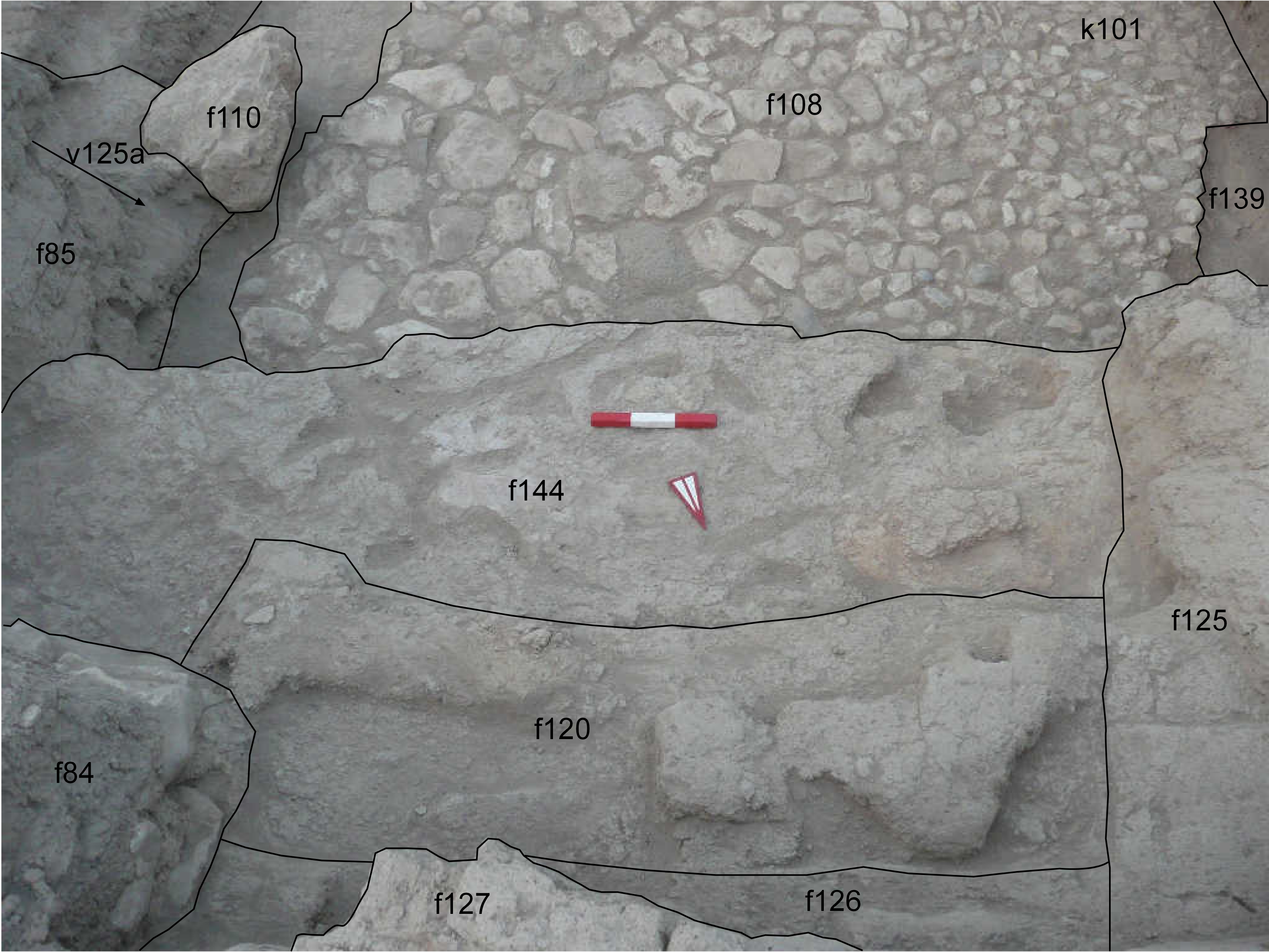
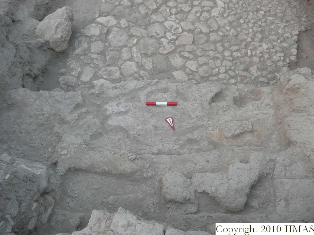
| text description of view | 2008-8-26 | lC | View showing the floor f144 uncovered below the accumulation f120. The floor presents traces of white soil, due to organic material in its middle portion, and red traces to the west due to crumbled red broken bricks. The floor is linked to the wall f125 and probably also to the wall f127 and it seems belonging to a reuse of this area above the stone pavement f108 visible to the south. | [Input File: S909lC.j] | ||||
| constituents within view/drawing | 2008-8-26 | lC | f84 f85 f108 f110 f120 f125 f126 f139 f144 k101 | [Input File: S909lC.j] | ||||