6. REFERENCE
Analogical Record
| Roster | Date | Author | Record |
|---|---|---|---|
| Template | |||
| Photo of context (v view) | |||
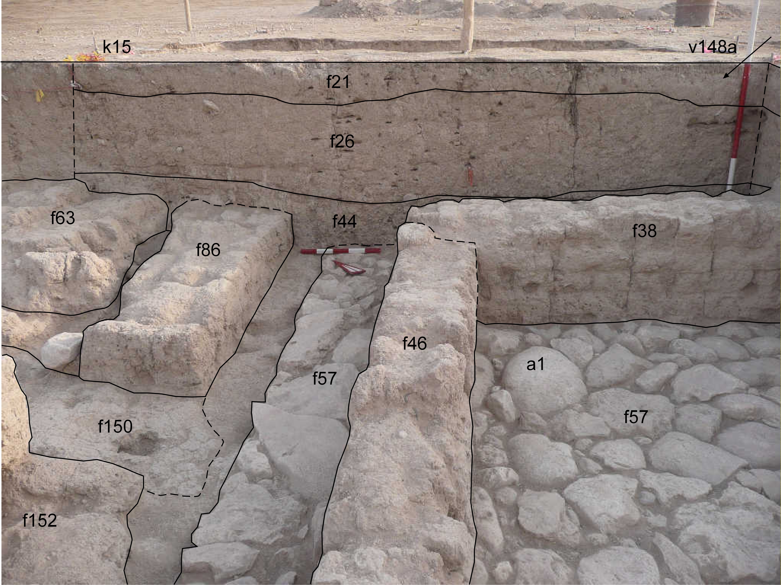
| View/drawing of aggregate | 2008-08-28 | lC | a1 (room) [Input: S909LC2.j] |
| View/drawing of features | 2008-08-28 | lC | f21 (topsoil) f26 (layer) f38 (wall) f44 (accumulation C) f46 (wall) f57 (pavement, type b) f63 (wall) f86 (wall) f150 (layer) f152 (wall) [Input: S909LC2.j] |
| View/drawing of locus | 2008-08-28 | lC | k15 [Input: S909LC2.j] |
| View/drawing orientation | 2008-08-28 | lC | looking north [Input: S909LC2.j] |
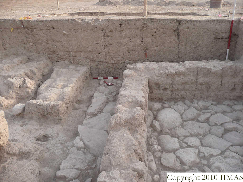
| Text description of view | 2008-08-28 | lC | View showing the north section of k15 without the string. The section shows the topsoil f21 above the accumulation f26 that is on top of the accumulation f44 outside the structure of a1 visible to the right and formed by the two bounded walls f38 and f46 and the stone pavement f57. Toward east are visible the wall f86 and part of the wall f63, probably contemporary, and the eastern edge of the clay layer f150, running inside this probable doorway, next to the wall f152. [Input: S909LC2.j] |
| Web view | |||
| Photo of view | |||


