6. REFERENCE
Analogical Record
| Roster | Date | Author | Record |
|---|---|---|---|
| Template | |||
| Photo of context (v view) | |||
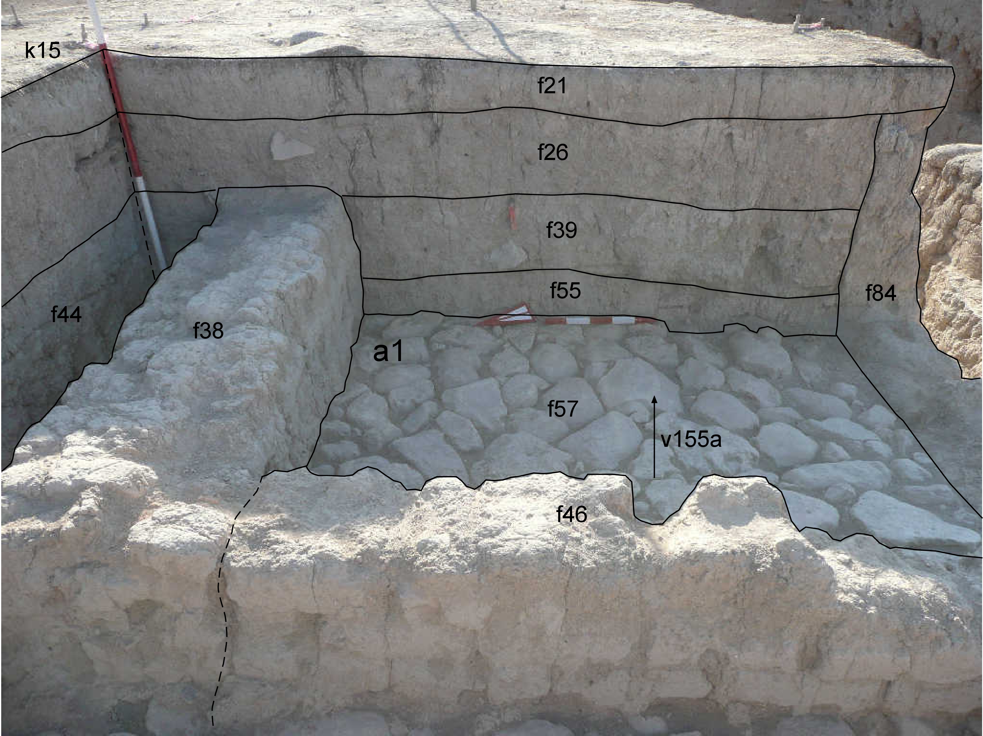
| View/drawing of aggregate | 2008-09-06 | lC | a1 (room) [Input: S916LC.j] |
| View/drawing of features | 2008-09-06 | lC | f21 (topsoil) f26 (layer) f38 (wall) f39 (accumulation B) f44 (accumulation C) f46 (wall) f55 (accumulation A) f57 (pavement, type b) f84 (wall) [Input: S916LC.j] |
| View/drawing of locus | 2008-09-06 | lC | k15 [Input: S916LC.j] |
| View/drawing orientation | 2008-09-06 | lC | looking east [Input: S916LC.j] |
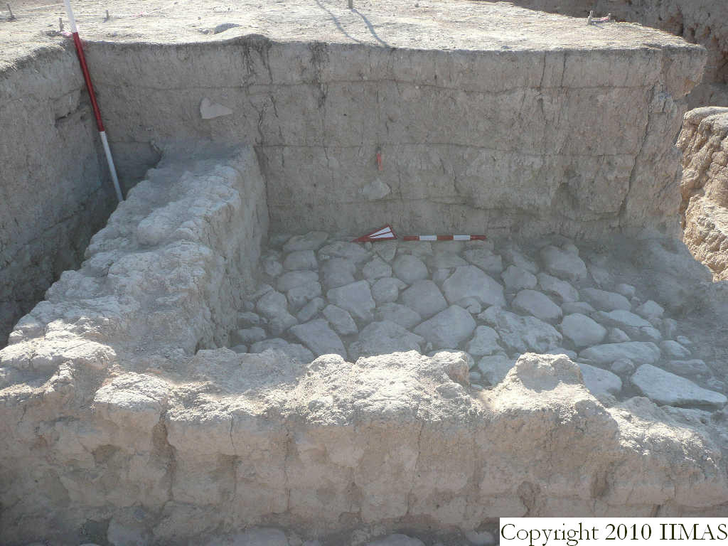
| Text description of view | 2008-09-06 | lC | View of the section of the east baulk of k15 without the string. The view shows the top soil f21 above the accumulation f26. Below we see the top part of the mud brick wall f38 running east to west trough the baulk. At this point we differentiated two accumulations, f44 the accumulation outside the structure and f39 the accumulation inside the structure, constructed also of the mud brick wall f46. Right on top of the stone pavement f57 there is the accumulation f55 created to distinguish the pottery on top of the pavement from the sherds above. On the right is visible, in section and at the level of the stone pavement, the wall f84 closing the room to the south. [Input: S916LC.j] |
| Web view | |||
| Photo of view | |||


