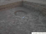
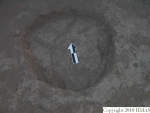
1. OVERVIEW
| Roster | Date | Author | Record |
|---|---|---|---|
| Category | !! | !! | installation |
| Best definition | 2004-09-11 | jw | pit [Input: O911JW.j] |
| Best image | 2004-06-22 | !! |  v118 [Input: O702JW.j] |
2. IDENTIFICATION
Designation
| Roster | Date | Author | Record |
|---|---|---|---|
| Definition | 2004-06-23 | jw | pit [Input: O624JW2.j] |
| Description (summary) | 2004-06-23 | jw | shallow pit consisting of cut, f180, and fill, f179. Its shallowness (less than 10cm) and its location close to the topsoil indicate that either the area was built up in antiquity and was washed away and covered by gully debris from higher on the tell or that it was dug in modern times through the deep topsoil, for which there was no indication. [Input: O624JW2.j] |
| 2004-09-11 | jw | Pit and its fill located in the NW corner of k14. Fill assumed to be more or less contemporary with the digging and its deposition to be the reason the pit was dug. [Input: O911JW.j] |
3. STRATIGRAPHY
Volumetric Localization
| Roster | Date | Author | Record |
|---|---|---|---|
| Locus | 2004-09-11 | jw | k14 [Input: O911JW.j] |
| Relays (applicable to elements) | 2004-06-23 | gm | r397 (40847 34177 - 8189 / Relay location: perimeter) [Input: O625JW1R.j] |
| 2004-06-23 | gm | r398 (40825 34132 - 8189 / Relay location: perimeter) [Input: O625JW1R.j] | |
| 2004-06-23 | gm | r399 (40872 34114 - 8189 / Relay location: perimeter) [Input: O625JW1R.j] |
Spatial Aggregation
| Roster | Date | Author | Record |
|---|---|---|---|
| Features within aggregate | 2004-09-11 | jw | f179 (fill) f180 (cut) [Input: O911JW.j] |
Time Sequencing
| Roster | Date | Author | Record |
|---|---|---|---|
| Stratum (to which element belongs) | 2004-08-24 | !! | s5JPA [Input: O824JW.j] |
| Phase (to which element belongs) | 2004-08-24 | !! | h7JPA [Input: O824JW.j] |
