2. IDENTIFICATION
Designation
| Roster | Date | Author | Record |
|---|---|---|---|
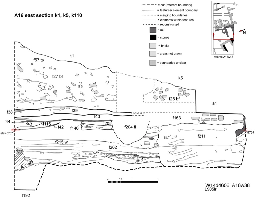
| Description (summary) | 2001-07-05 | lR | Composite drawing of East section k1, k5, k110. Includes w10,w27,w29,w35 and w63. Drawing shows the extent of the area excavated in MZ14 with the natural slope of the unit at the top followed with brickfall and layers below. [Input: W314LC.j] |
6. REFERENCE
Analogical Record
| Roster | Date | Author | Record |
|---|---|---|---|
| View/drawing of aggregate | 2001-07-05 | lR | a1 (^ structure) a4 (^ brickfall) [Input: W314LC.j] |
| View/drawing of features | 2001-07-05 | lR | f25 (^ brickfall) f27 (^ brickfall) f38 (^ layer) f39 (^ layer) f40 (^ layer) f42 (^ layer) f43 (^ layer) f44 (^ layer) f57 (^ topsoil) f115 (^ layer) f163 (accumulation C) f192 (^ pavement) f202 (^ layer) f204 (pit fill) f211 (^ fill) f215 (^ wall) [Input: W314LC.j] |
| View/drawing of locus | 2001-07-05 | lR | k1 k5 k110 [Input: W314LC.j] |
| View/drawing orientation | 2001-07-05 | lR | e [Input: W314LC.j] |
| Photo of view | |||
