6. REFERENCE
Analogical Record
| Roster | Date | Author | Record |
|---|---|---|---|
| Template | |||
| Photo of context (v view) | |||
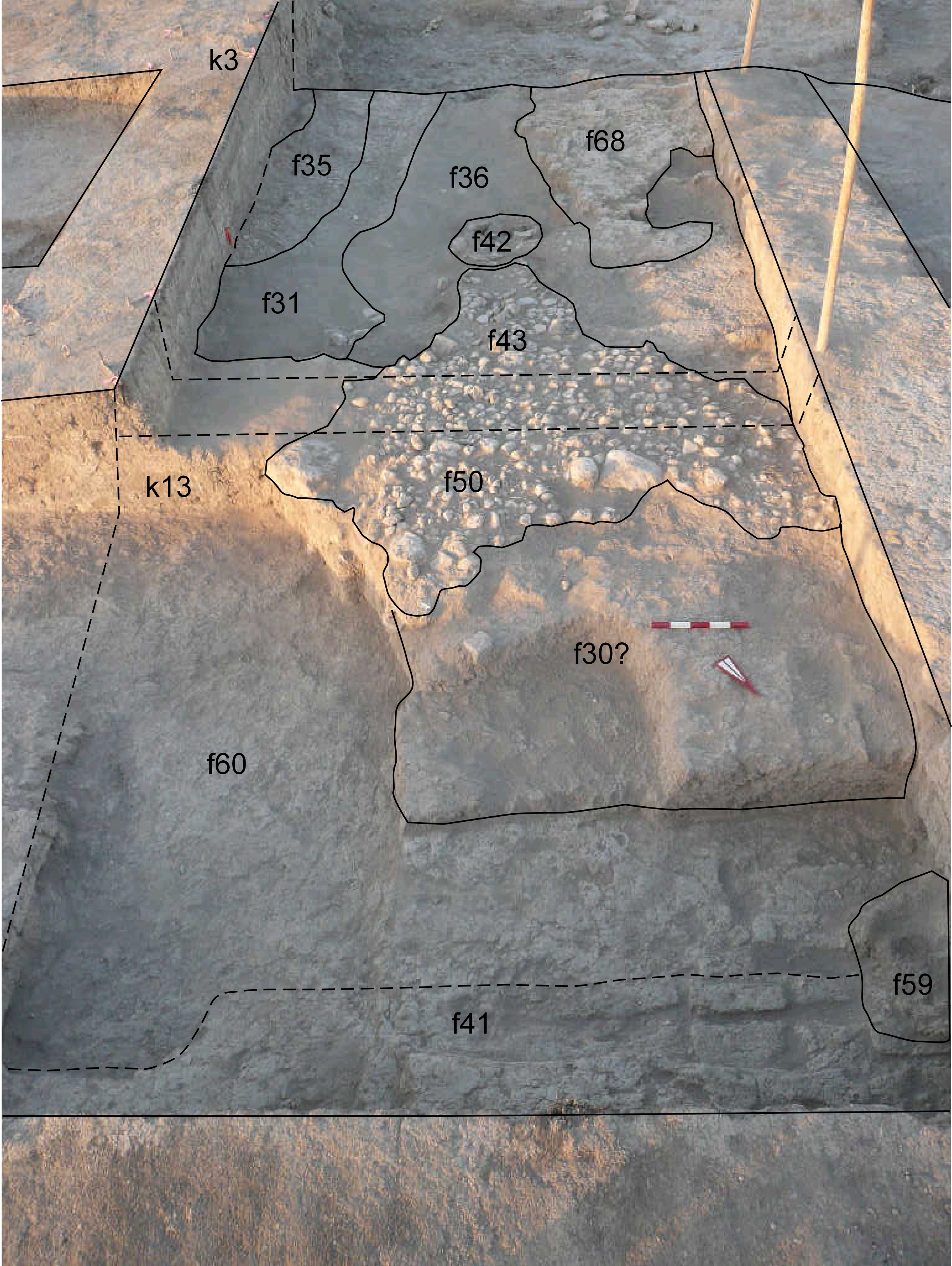
| View/drawing of features | 2008-08-04 | sE | f30 (brickfall) f31 (layer) f35 (pavement, type c) f36 (accumulation C) f41 (wall) f42 (tannur (feature)) f43 (pavement, type c) f50 (pavement, type c) f59 (hearth) f60 f68 (brick pile) [Input: S812LC.j] |
| View/drawing of locus | 2008-08-04 | sE | k3 k13 [Input: S812LC.j] |
| View/drawing orientation | 2008-08-04 | sE | looking south [Input: S812LC.j] |
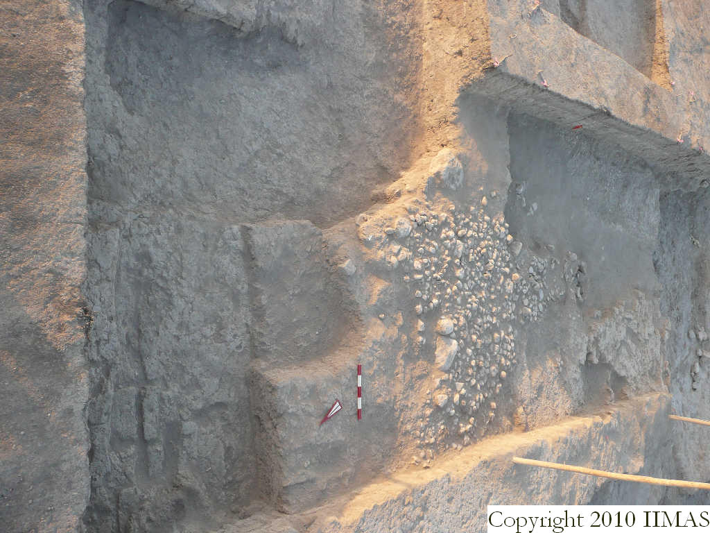
| Text description of view | 2008-08-04 | sE | General view of k3 and k13 in connection with A18. The shot shows the mudbrick wall f41 running E-W with the earth f59 and the brickfall f30 on top of the accumulation f60. The picture also shows the entire cobble stone pavement f43 and f50 between k13 and k3 and its relationship with the southern installations, toward A18, the pavement f35,the tannur f42 and the brickpile f68. [Input: S812LC.j] |
| Web view | |||
| Photo of view | |||


