J5f121
File: "/MZ/A/J05/D/F/0121.htm".Processed on 2022-09-11.
1. Overview
| Roster | Date | Author | Record |
|---|---|---|---|
| Best definition | 2008-08-09 | dL | accumulation D [Input file: S914LH.j] |
| Summary | 2012-12-16 | jW | Natural accumulation in k33 under accumulation f122 and abutting stone installation f126. [Input file: WZ16JW.j] |
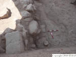
| Best image | 2008-09-22 | lH |  v71 [Input file: S922LH.j] |
2. Identification
Designation
| Roster | Date | Author | Record |
|---|---|---|---|
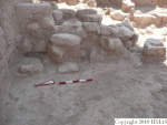
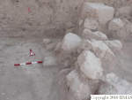
| Description (summary) | 2008-08-09 | jW | A relatively horizontal layer of mixed sand and silt with an extremely hard surface in the NE corner of k33. To the east, it abuts the dressed stones which form f126, and which are approximately aligned with wall, f41. Although higher than the glacis, f74, to wall, f41, the hard surface led jW to initially conclude that this feature was a glacis to stone installation, f126. However, a detailed investigation by fAB, rE, and jW led to the conclusion that, considering the stratigraphy of the west baulk of k22 and k23 and the somewhat sandy texture of f122 which covered it, that f121 was a glacis-like feature formed by the action of water on sedimentation. We conclude that f121 is equal to natural accumulation, f124. [Input file: S809JW.j] |
3. Stratigraphy
Volumetric Localization
| Roster | Date | Author | Record |
|---|---|---|---|
| Locus | 2008-08-09 | dL | k33 [Input file: S914LH.j] |
| Elevation | 2010-08-19 | mM1 | 9068 @ top (corrected) [Input file: U819MM1.j] |
| 2010-08-19 | mM1 | 9072 @ bottom (corrected) [Input file: U819MM1.j] | |
| M#/elev @top | 2008-08-09 | dL | m4906 [Input file: S914LH.j] |
| Height @top | 2008-08-09 | dL | 36 [Input file: S914LH.j] |
| H-eye @top | 2008-08-09 | dL | 161 [Input file: S914LH.j] |
| M#/elev @bottom | 2008-08-09 | dL | m4960 [Input file: S914LH.j] |
| Height @bottom | 2008-08-09 | dL | 89 [Input file: S914LH.j] |
| H-eye @bottom | 2008-08-09 | dL | 161 [Input file: S914LH.j] |
| Notes on volumetric localization | 2010-08-07 | mM1 | The measured bottom elevation (9072) exceeds the top (9068), which is impossible. The feature f122, which covers f121, has a bottom elevation of 9072. Threfore I conclude that the elevation of the top and the elevation of the bottom could have been reversed. That means that the bottom should have a meausrement of 9068, while the top should be 9072. [Input file: U807MM1.j] |
Contact Association
| Roster | Date | Author | Record |
|---|---|---|---|
| Type of contact: earliest events | 2008-09-12 | lH | f121 (accumulation D) abuts f126 (stone installation) [Input file: S915LH.j] |
| 2008-09-12 | lH | f122 (accumulation D) covers f121 (accumulation D) [Input file: S915LH.j] |
Time Sequencing
| Roster | Date | Author | Record |
|---|---|---|---|
| Stratum (to which element belongs) | 2012-10-16 | jW | s148J5B (Building of western temple entrance and court) [Input file: WX16JW.j] |
| Phase (to which element belongs) | 2012-10-16 | !! | h7mJ5B [Input file: WX16JW.j] |
4. Typology
Morphology
| Roster | Date | Author | Record |
|---|---|---|---|
| Ware or Material, species | 2008-08-09 | dL | so [Input file: S914LH.j] |
6. Reference
Analogical Record
| Roster | Date | Author | Record |
|---|---|---|---|
| View/drawing of features | |||
Disposition
| Roster | Date | Author | Record |
|---|---|---|---|
| Removed (feature), discarded/missing (item) | 2008-08-09 | dL | S809 [Input file: S914LH.j] |

