6. REFERENCE
Analogical Record
| Roster | Date | Author | Record |
|---|---|---|---|
| Template | |||
| Photo of context (v view) | |||
| View/drawing of aggregate | 2004-07-05 | jw | a15 (pit) a16 (pit) a17 (pit) [Input: O911JW2.j] |
| View/drawing of features | 2004-07-05 | jw | f216 (layer) [Input: O911JW2.j] |
| View/drawing of locus | 2004-07-05 | jw | k14 [Input: O911JW2.j] |
| View/drawing orientation | 2004-07-05 | jw | looking south [Input: O911JW2.j] |
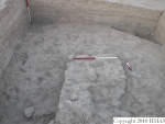
| Text description of view | 2004-07-05 | jw | Photograph of the first Phase 3 working surface below gully wash, f216, excavated in k14. Three pits, tentatively associated with Phase 4, a15, a16, and a17 were located at the corners of the locus. a17 can be seen to the right and a16 to the left in this view. a15, not seen in this view, was a large, deep pit which eventually encompassed parts of k4 and k5. [Input: O911JW2.j] |
| Web view | |||

