6. REFERENCE
Analogical Record
| Roster | Date | Author | Record |
|---|---|---|---|
| Template | |||
| Photo of context (v view) | |||
| View/drawing of features | 2004-07-05 | jw | f245 (accumulation) f253 (floor, type b) [Input: O911JW2.j] |
| View/drawing of locus | 2004-07-05 | jw | k14 [Input: O911JW2.j] |
| View/drawing orientation | 2004-07-05 | jw | looking east [Input: O911JW2.j] |
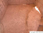
| Text description of view | 2004-07-05 | jw | View of the second in a series of stone and sherd pavements, f253, ascending from west to east toward the abi entrance. At the time of the photograph, we believed that the pavement was bounded by a mound of debris from the AK building renovation, f245, which can be seen to the right. (Subseuent excavation has shown that the pavement runs under the debris and was therefore laid before the renovation) Shown in the lower left corner is part of the deep Phase 4 pit, a15. Shown in the lower right corner is what we believed to be a pit, a17, and which now seems equally likely to have been a continuation of brown accumulation which overlaid the renovation debris in other parts of the locus. [Input: O911JW2.j] |
| Web view | |||

