6. REFERENCE
Analogical Record
| Roster | Date | Author | Record |
|---|---|---|---|
| Photo of context (v view) | |||
| View/drawing of features | 2004-07-05 | jw | f213 (floorsurface in general) f253 (floor, type b) f281 (pavement, type c) f286 (pavement, type c) [Input: O911JW2.j] |
| View/drawing of locus | 2004-07-05 | jw | k3 k4 k12 k13 k14 [Input: O911JW2.j] |
| View/drawing orientation | 2004-07-05 | jw | looking east [Input: O911JW2.j] |
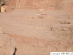
| Text description of view | 2004-07-05 | jw | Final photograph of the middle and northern loci excavated this season. In the course of excavation, a number of pavements and living accumulations above them were exposed. Generally the pavements were pebble and sherd, but also some were pise. Those shown on this photo include pise pavement, f213 in k4, an extensive pebble and sherd pavement, f253 in k14, a small pavement, f281 in k13, and a pebble surface, f286 in k12. Note that the main and auxiliary views as orignally conceived have been exchanged. This photograph, shot in morning light, more clearly illustrates the progression up the hill to the east of these surfaces, than the other photo which was shot in strong afternoon light that washed out important details. [Input: O911JW2.j] |
| Web view | |||
