| Text description of view |
2004-07-05 |
jw |
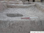
Final photograph of k12. This locus, like k22 to the south is in the transition zone between a series of paved, horizontal working surfaces to the west and the abi to the east, which is considerably higher. Higher priority work to the west only permitted time for a brief probe of k12 and we stopped when the first significant architectural feature, f286, was exposed. We hypothesized that there might be a retaining wall or similar structure with steps up to the abi entrance. It seemed that the pavement/surface, f286, may either have been a steep path from lower levels up to the entrance or debris deposited in a stairway by water rushing down a gully. Excavations in future seasons will test the hypothesis. This photograph shows f286 in the SE corner of the locus, just to the south of where a stone and sherd path led into a wall system just north of the abi, f45. [Input: O911JW2.j] |
