6. REFERENCE
Analogical Record
| Roster | Date | Author | Record |
|---|---|---|---|
| Template | |||
| Photo of context (v view) | |||
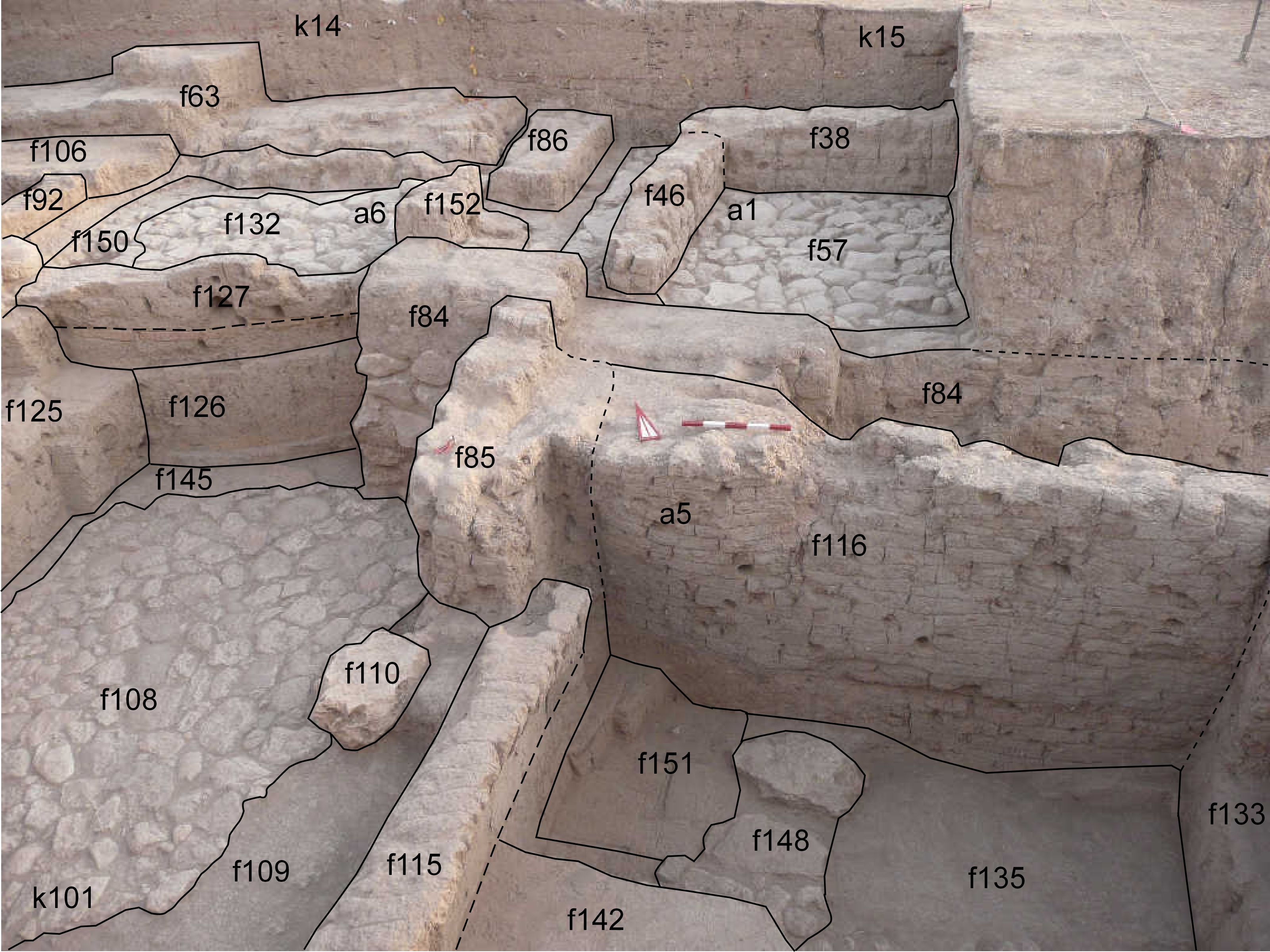
| View/drawing of aggregate | 2008-08-28 | lC | a1 (room) a5 (room) a6 (room) [Input: S909LC2.j] |
| View/drawing of features | 2008-08-28 | lC | f38 (wall) f46 (wall) f57 (pavement, type b) f63 (wall) f84 (wall) f85 (wall) f92 (wall) f106 (wall) f108 (pavement, type b) f109 (wall) f110 (stone installation) f115 (wall) f116 (wall) f125 (wall) f126 (wall) f127 (wall) f132 (pavement, type c) f133 (wall) f135 (floor, type b) f142 (floor, type a) f145 (accumulation B) f148 (stone installation) f150 (layer) f151 (wall) f152 (wall) [Input: S909LC2.j] |
| View/drawing of locus | 2008-08-28 | lC | k14 k15 k101 [Input: S909LC2.j] |
| View/drawing orientation | 2008-08-28 | lC | looking north [Input: S909LC2.j] |
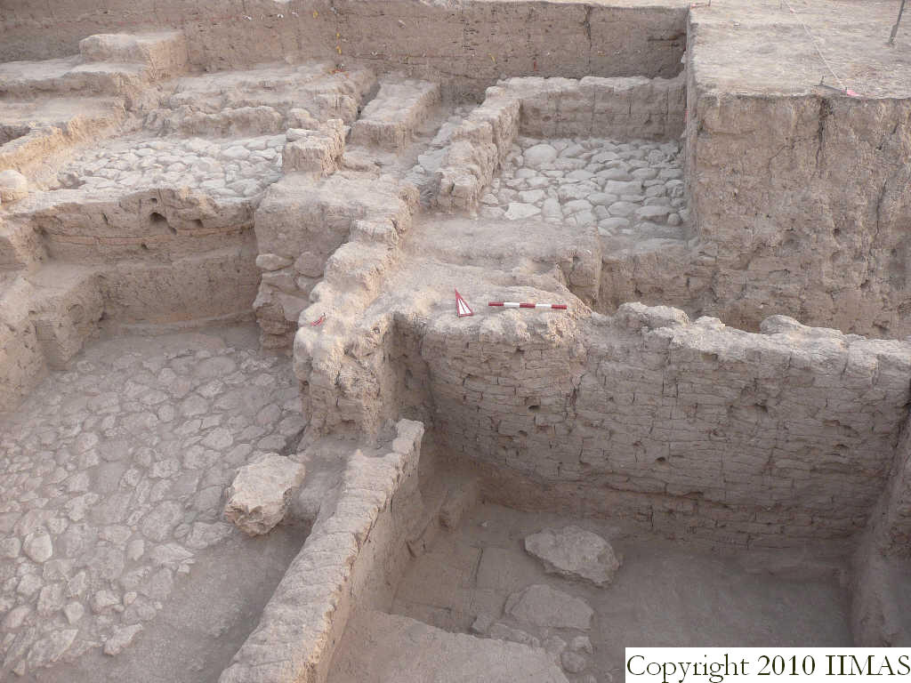
| Text description of view | 2008-08-28 | lC | View showing the different levels of Mitanni occupation. The lowest level is shown by the a5 with the two high preserved mud brick walls f116 and f133 and with the floor f134 and the later floor f142, probably related to a reuse of the structure. To the west we have the big stone pavement f108, probably related to the walls f125, f85 and f126, that represent the second level. In the northern area of A20, in k14 and k15 are visible the pavements f57 and f132 related to the a1 and a6. These two aggregates are constituted of small rooms with beautiful stone pavements. It seems that these three different levels belong to the same stratum that means they are contemporary. Anyway there are still some open questions that only further excavations will clarify. [Input: S909LC2.j] |
| Web view | |||
| Photo of view | |||


