A20v157

File: /MZ/A/A20/D/I//MZ/A/A20/D/V/0157.HTM
Processed on 21-8-2020
The home for this page is A20

Labeling/Designation

Description/Count
photo of view (for views only) 2008-9-06 dm [Input File: A20VK9c.J]
photo web 2008-9-06 dm [Input File: A20VK9c.J]

Analogical Record
templates
17-7-2020 / !!! / [Input File:A20_VWX.j]
2008-9-18 / !! / [Input File:TMPL-S9i.J]
photo of context (v view)
17-7-2020 / !!! / [Input File:A20_VWX.j]
view/drawing orientation 2008-9-06 lC looking east [Input File: S916lC.j]
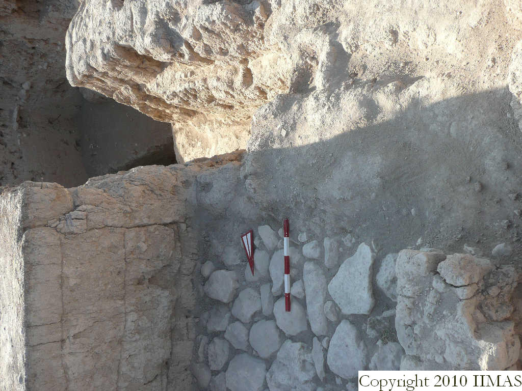
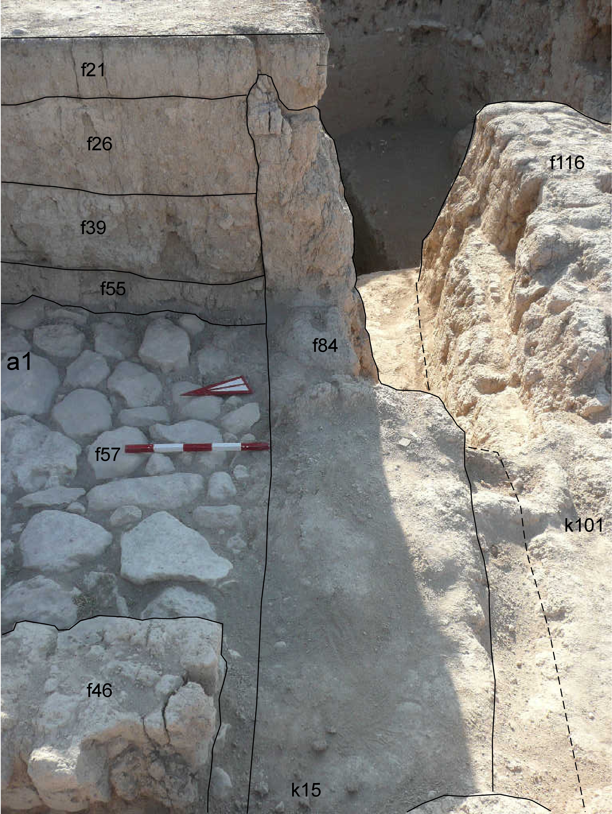
text description of view 2008-9-06 lC View showing part of the section of the east baulk of k15. The shot was taken to show the mud brick wall f84 preserved for a good elevation, until just below the top soil f21. Removing the accumulations f26, f39 and f55 we didn't recognize the wall, that was very badly preserved because it is just inside the north baulk of A19 excavation. We identified it only about 20 cm above the level of the pavement f57 but, looking for good preserved bricks, we removed it until the stone pavement [Input File: S916lC.j]
constituents within view/drawing 2008-9-06 lC f21 f26 f39 f46 f55 f57 f84 f116 k15 k101 [Input File: S916lC.j]