6. REFERENCE
Analogical Record
| Roster | Date | Author | Record |
|---|---|---|---|
| Template | |||
| Photo of context (v view) | |||
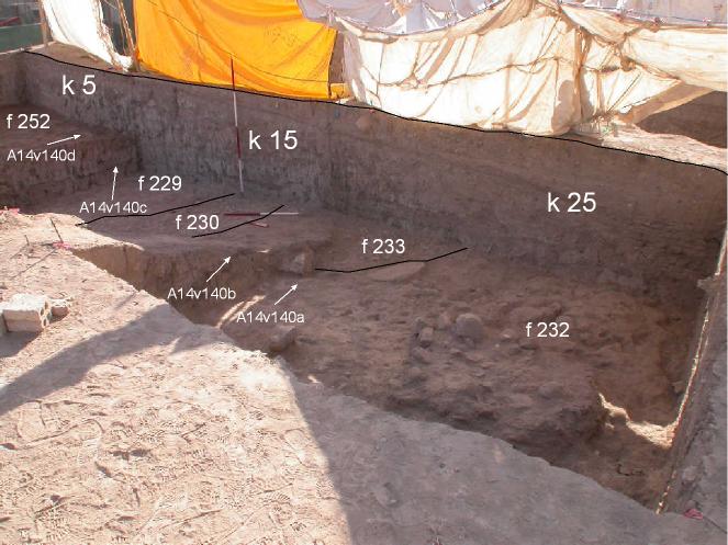
| View/drawing of locus | 2004-07-05 | jw | k5 k15 k25 [Input: O911JW2.j] |
| View/drawing orientation | 2004-07-05 | jw | looking east [Input: O911JW2.j] |
| Text description of view | 2004-07-05 | jw | Series of photographs that show the slope of the ancient and modern gullies, down from the north near the AK building (k5) to the south (k25). This was possible to see after the north baulks were removed from all 3 loci. In the process it also shows the extent of the red brick debris from the Phase 3 renovation of the AK building. The debris extends from the north edge of k5 adjacent to AK to the south edge of k15. [Input: O911JW2.j] |
| Web view | |||

