6. REFERENCE
Analogical Record
| Roster | Date | Author | Record |
|---|---|---|---|
| Photo of context (v view) | |||
| View/drawing of features | 2004-07-05 | jw | f270 (pavement, type c) f301 (stone installation) [Input: O911JW2.j] |
| View/drawing of locus | 2004-07-05 | jw | k24 [Input: O911JW2.j] |
| View/drawing orientation | 2004-07-05 | jw | looking east [Input: O911JW2.j] |
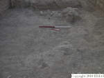
| Text description of view | 2004-07-05 | jw | Final photograph of k24. This locus marks the transition from the erosional effects of severe gully wash to the succession of horizontal Phase 3 pavement surfaces, some of pise and some of pebbles and sherds found to the west and north. Seen at the bottom of the photograph is a pebble and sherd pavement, f270, found in the E baulk of k25 but apparently missing from k24. Along the left side of the photo can be seen several horizontal bands above the lowest level excavated, which probably are continuations of pavements found in loci to the north. [Input: O911JW2.j] |
| Web view | |||
