6. REFERENCE
Analogical Record
| Roster | Date | Author | Record |
|---|---|---|---|
| Template | |||
| Photo of context (v view) | |||
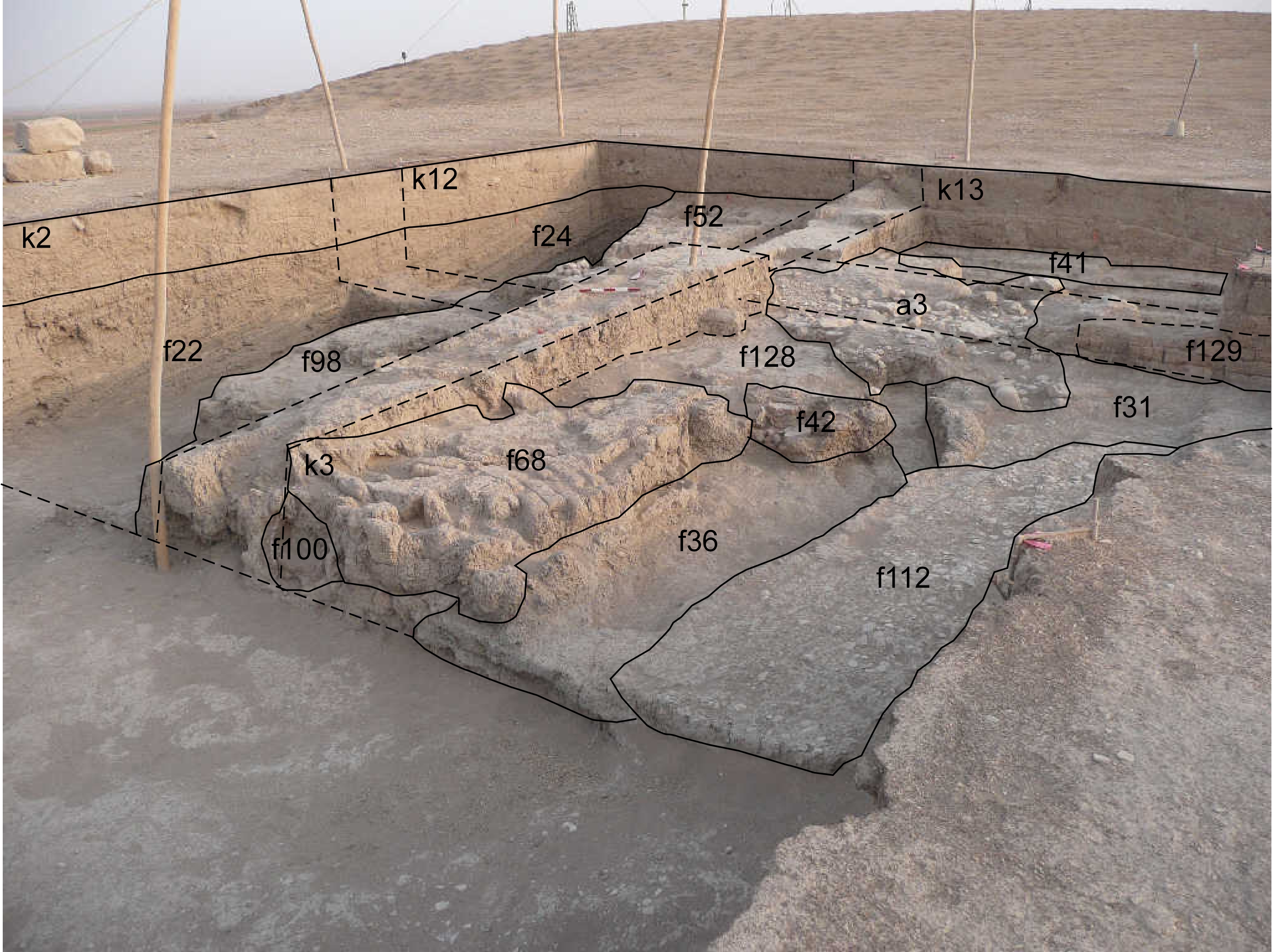
| View/drawing of aggregate | 2008-08-28 | lC | a3 (installation) [Input: S909LC2.j] |
| View/drawing of features | 2008-08-28 | lC | f22 (accumulation C) f24 (accumulation C) f31 (layer) f36 (accumulation C) f41 (wall) f42 (tannur (feature)) f52 (layer) f68 (brick pile) f98 (brickfall) f100 (tannur (feature)) f112 (pavement, type c) f128 (layer) f129 (wall) [Input: S909LC2.j] |
| View/drawing of locus | 2008-08-28 | lC | k2 k3 k12 k13 [Input: S909LC2.j] |
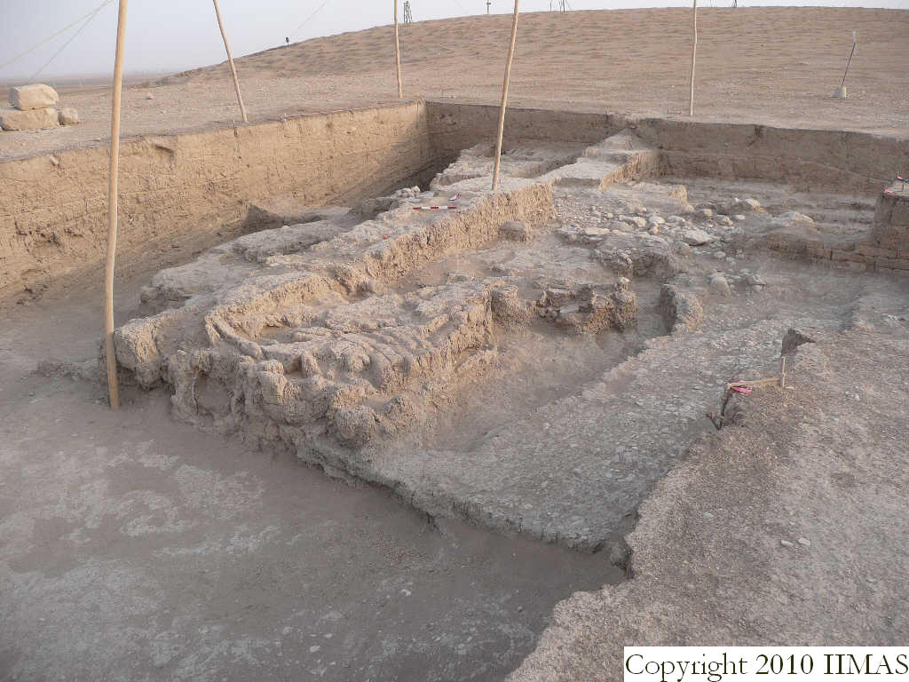
| View/drawing orientation | 2008-08-28 | lC | looking northwest [Input: S909LC2.j] |
| Text description of view | 2008-08-28 | lC | View showing the installations and the structures in the western loci of A20. These four loci are the closest to A18 and show a similar use of this open space. To the west is visible the big ashy layer f22 and f24, in part removed, that was abutting the brick mass f98 in k2 and f52 in k12. In k3 we can see the brick pile f68, next to the ashy layer f36 just in part removed, but in part still present in a sort of channel in the middle of k3. Right to the west of this sort of channel there is the pavement f112. In the background, between k3 and k13 is visible the pebble pavement f80 related to the drain f83, forming a3 and part of the big mud brick wall f41 running east to west. [Input: S909LC2.j] |
| Web view | |||
| Photo of view | |||


