6. REFERENCE
Analogical Record
| Roster | Date | Author | Record |
|---|---|---|---|
| Template | |||
| Photo of context (v view) | |||
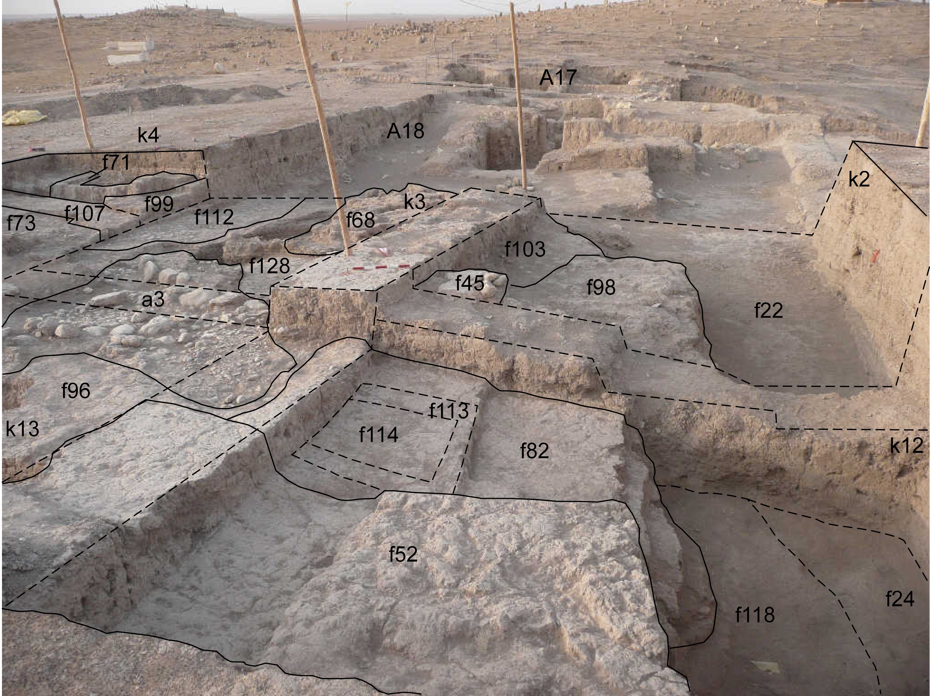
| View/drawing of aggregate | 2008-08-28 | lC | a3 (installation) [Input: S909LC2.j] |
| View/drawing of features | 2008-08-28 | lC | f22 (accumulation C) f24 (accumulation C) f45 (stone installation) f52 (layer) f68 (brick pile) f71 (wall) f73 (pavement, type c) f82 (brickfall) f96 (installation) f98 (brickfall) f99 (wall) f103 (layer) f107 (wall) f112 (pavement, type c) f113 (bin) f114 (fill) f118 (layer) f128 (layer) [Input: S909LC2.j] |
| View/drawing of locus | 2008-08-28 | lC | k2 k3 k4 k12 k13 [Input: S909LC2.j] |
| View/drawing orientation | 2008-08-28 | lC | looking south [Input: S909LC2.j] |
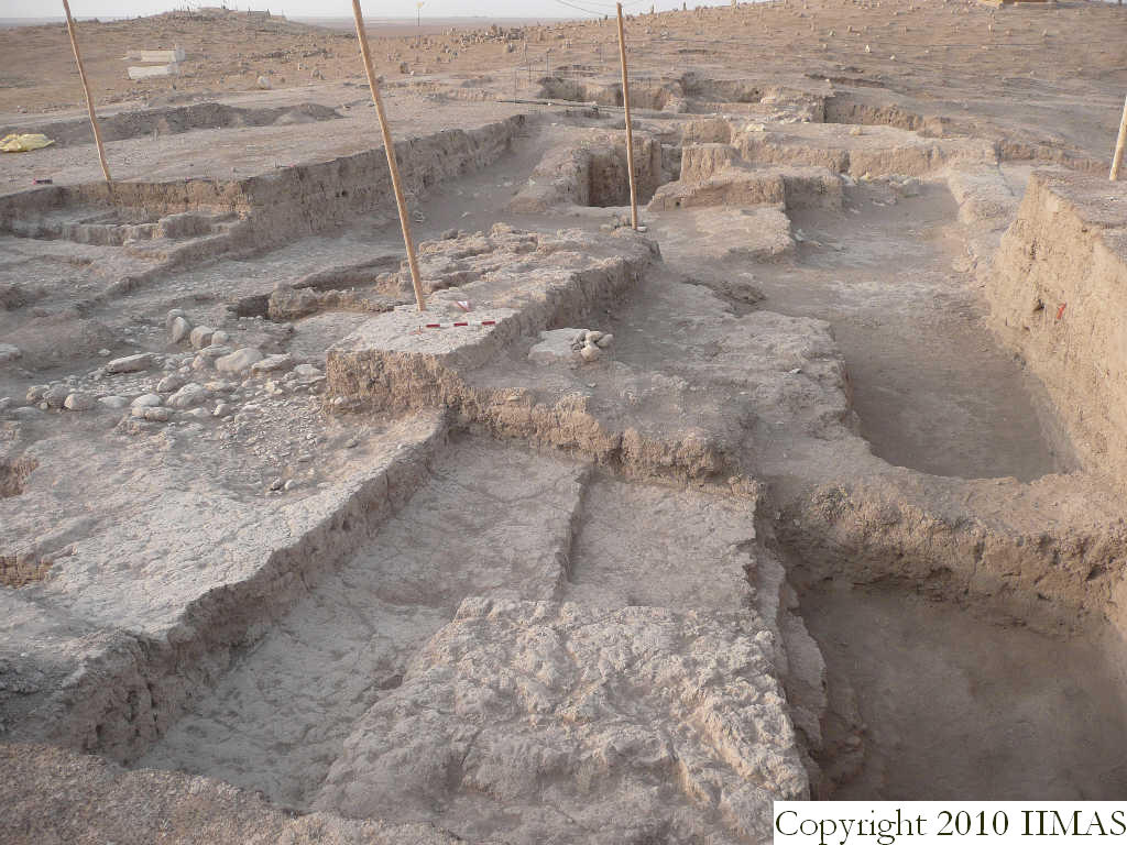
| Text description of view | 2008-08-28 | lC | View showing the relationship between the western part of A20 and the areas A18 and A17 in the background. In the western portion of k2 and k12 we can see the thick ashy layer abutting the brickmass f52 and f82 in k12 and f98 in k2. Above the brick mass f98 seems to be another layer of ash f103, different from the ash f22. To the east the drain and the related pebble pavement f80 forming a3, are clearly visible, just to the north of the pavement f112 and the clay layer f128 sloping toward south, below the brick pile f68. The pavement f112 is abutting the mud brick wall f99, running north to south and bounded with the wall f107 running east to west, next to the small bin f71, just in part uncovered. [Input: S909LC2.j] |
| Web view | |||
| Photo of view | |||


