6. REFERENCE
Analogical Record
| Roster | Date | Author | Record |
|---|---|---|---|
| Template | |||
| Photo of context (v view) | |||
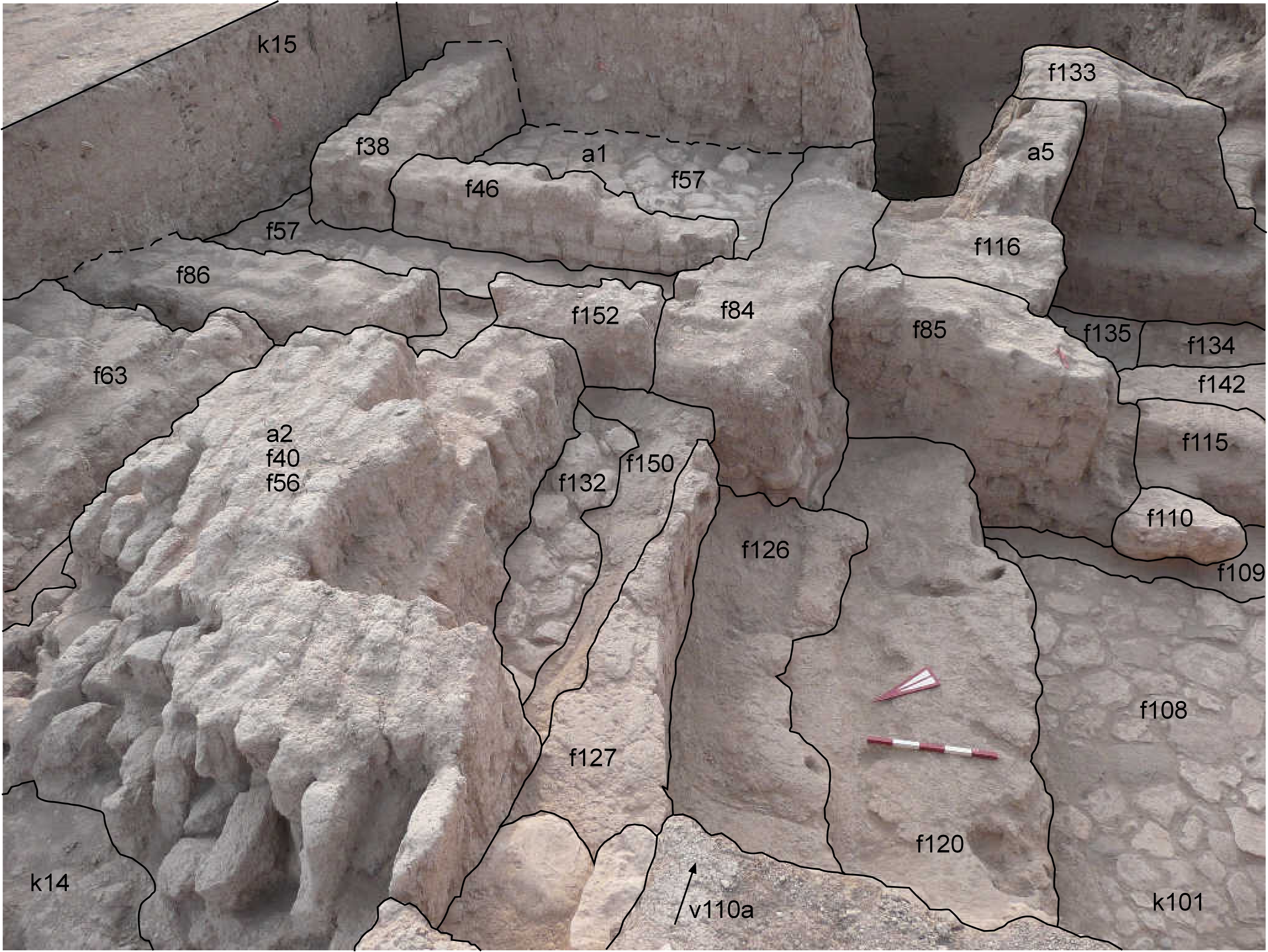
| View/drawing of aggregate | 2008-08-23 | lC | a1 (room) a2 (brick installation) a5 (room) [Input: S901LC2.j] |
| View/drawing of features | 2008-08-23 | lC | f38 (wall) f40 (wall) f46 (wall) f56 (brick pile) f57 (pavement, type b) f63 (wall) f84 (wall) f85 (wall) f86 (wall) f108 (pavement, type b) f109 (wall) f110 (stone installation) f115 (wall) f116 (wall) f120 (accumulation) f126 (wall) f127 (wall) f132 (pavement, type c) f133 (wall) f134 (pavement, type b) f135 (floor, type b) f142 (floor, type a) f150 (layer) f152 (wall) [Input: S901LC2.j] |
| View/drawing of locus | 2008-08-23 | lC | k14 k15 k101 [Input: S901LC2.j] |
| View/drawing orientation | 2008-08-23 | lC | looking east [Input: S901LC2.j] |
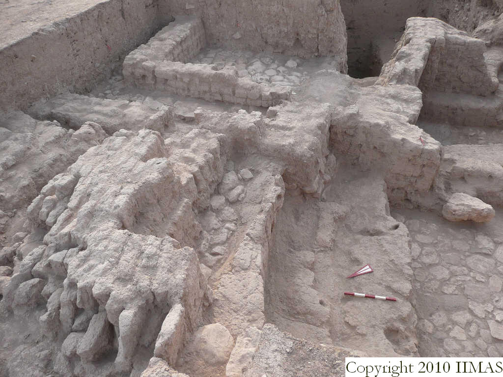
| Text description of view | 2008-08-23 | lC | View showing the a2 between k14 and k15 and its relationship with all the structures to the south and east of it. The view shows the a2 after the removal of some rows of vertical bricks, uncovering a narrow part of the pavement f132. The shot also shows the difference of level between the a2 and the pavement f132, and the stone pavement f108, on top of which is visible the accumulation f120 abutting the wall f126, underneath the level of a2. To the east are visible the a1, constituted of the stone pavement f57, and the mud brick walls f38, f46 and 84; and part of the a5, a room at a lower level, closed by two high walls f116 and f133, with the floors f134, f135 and the floor f142 higher in level, probably belonging to a reuse of the structure. [Input: S901LC2.j] |
| Web view | |||
| Photo of view | |||


