6. REFERENCE
Analogical Record
| Roster | Date | Author | Record |
|---|---|---|---|
| Photo of context (v view) | |||
| View/drawing of aggregate | 2008-08-28 | lC | a1 (room) a5 (room) a6 (room) [Input: S909LC2.j] |
| View/drawing of features | 2008-08-28 | lC | f38 (wall) f46 (wall) f57 (pavement, type b) f63 (wall) f84 (wall) f85 (wall) f86 (wall) f108 (pavement, type b) f110 (stone installation) f115 (wall) f116 (wall) f132 (pavement, type c) f135 (floor, type b) f148 (stone installation) f150 (layer) f151 (wall) f152 (wall) [Input: S909LC2.j] |
| View/drawing of locus | 2008-08-28 | lC | k15 k101 [Input: S909LC2.j] |
| View/drawing orientation | 2008-08-28 | lC | looking north [Input: S909LC2.j] |
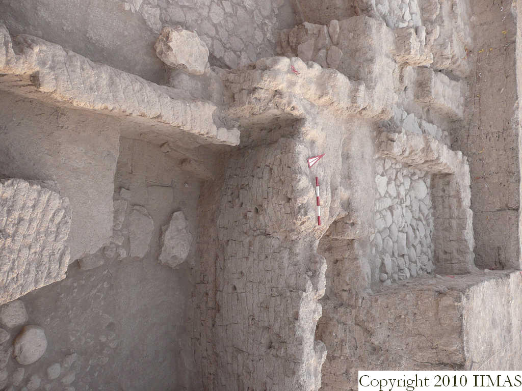
| Text description of view | 2008-08-28 | lC | Sub view showing the relationship and the different elevation between the a5 floor f135 with the high wall f116 and the stone pavement f57 of a1. We assume that this pavement f57 is earlier than the two mud brick walls f38 and f46 on top of it, for some structural differences. This pavement is also too well built for the small walls associated to it and probably it has been reused in a later period. To the west are in part visible the stone pavement f108 and the stone pavement f132 at a higher level. [Input: S909LC2.j] |
| Web view | |||
| Photo of view | |||


