6. REFERENCE
Analogical Record
| Roster | Date | Author | Record |
|---|---|---|---|
| Template | |||
| Photo of context (v view) | |||
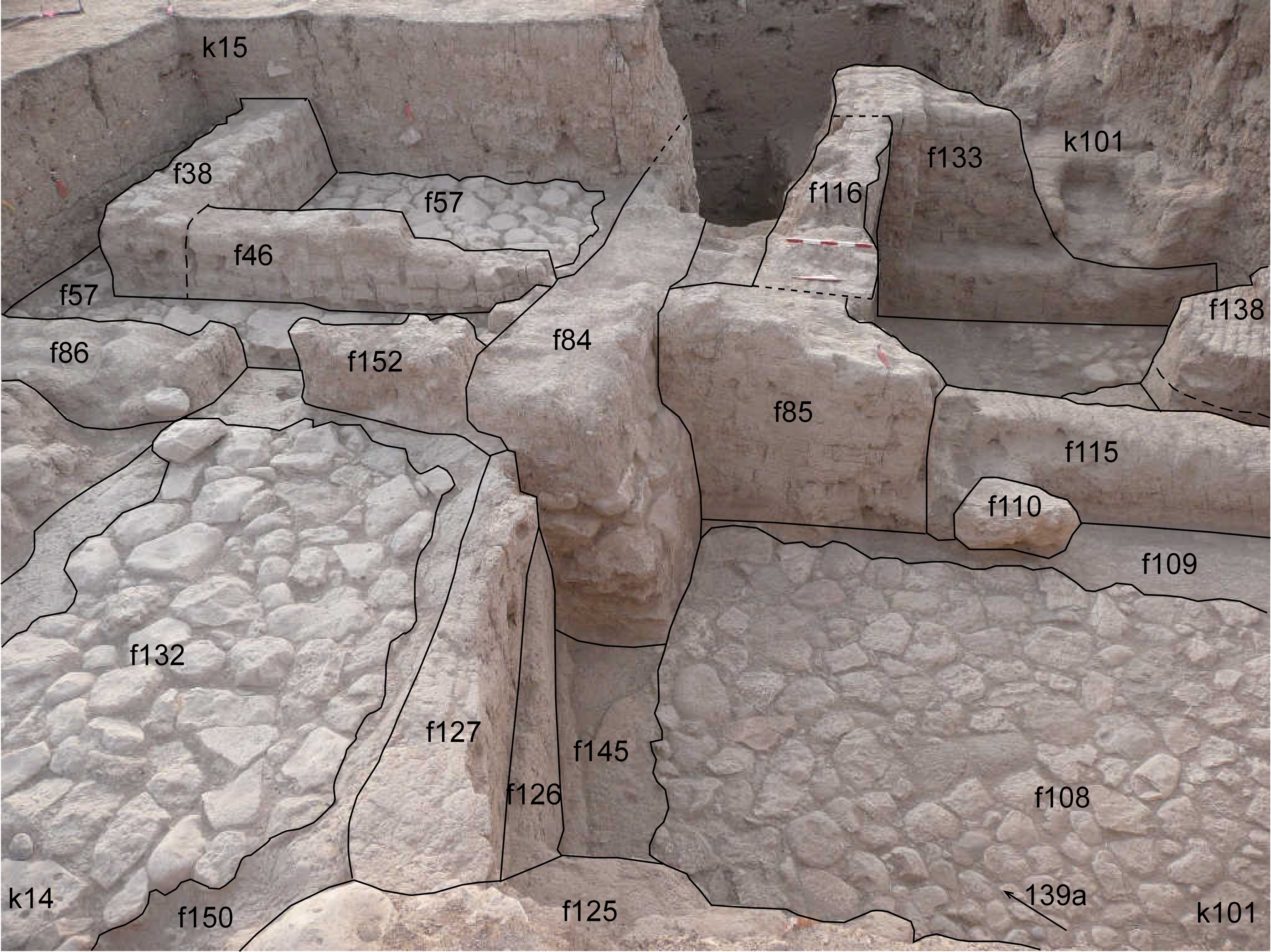
| View/drawing of aggregate | 2008-08-28 | lC | a1 (room) a5 (room) a6 (room) [Input: S909LC2.j] |
| View/drawing of features | 2008-08-28 | lC | f38 (wall) f46 (wall) f57 (pavement, type b) f84 (wall) f85 (wall) f86 (wall) f108 (pavement, type b) f109 (wall) f110 (stone installation) f115 (wall) f116 (wall) f125 (wall) f126 (wall) f127 (wall) f133 (wall) f134 (pavement, type b) f135 (floor, type b) f136 (stone installation) f138 (installation) f152 (wall) [Input: S909LC2.j] |
| View/drawing of locus | 2008-08-28 | lC | k14 k15 k101 [Input: S909LC2.j] |
| View/drawing orientation | 2008-08-28 | lC | looking east [Input: S909LC2.j] |
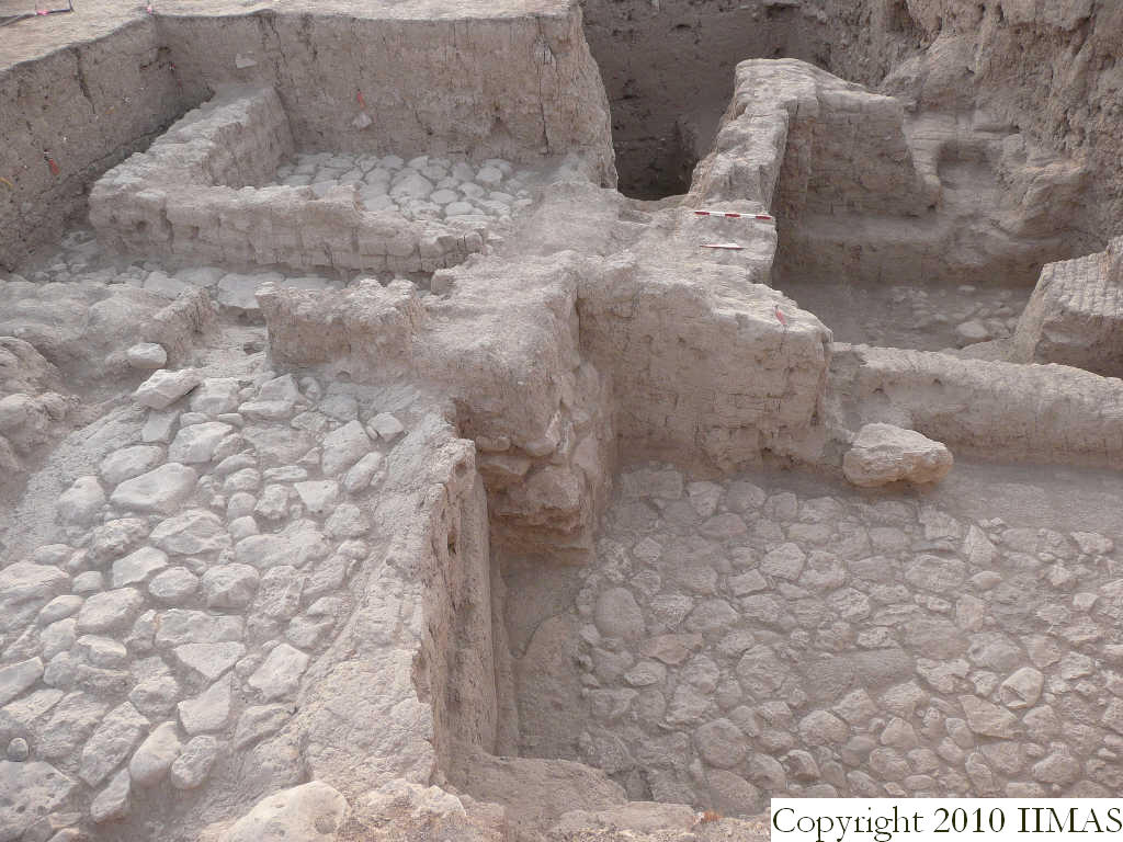
| Text description of view | 2008-08-28 | lC | View showing the different elevations of Mitanni structures. The view shows the a1, constituted of the stone pavement f57 and the walls f38 and f46, and separated with a narrow sidewalk by the a6 toward west. The a6 is constituted of the walls f152 and f127 associated with the pavement f132 and the clay layer f150. To the south we have the big stone pavement f 108 at a lower level and in the background is visible the a5 with its high walls and the floors f135 and f134. [Input: S909LC2.j] |
| Web view | |||
| Photo of view | |||


