6. REFERENCE
Analogical Record
| Roster | Date | Author | Record |
|---|---|---|---|
| Photo of context (v view) | |||
| View/drawing of aggregate | 2008-08-28 | lC | a1 (room) a5 (room) a6 (room) [Input: S909LC2.j] |
| View/drawing of features | 2008-08-28 | lC | f38 (wall) f46 (wall) f57 (pavement, type b) f63 (wall) f84 (wall) f85 (wall) f86 (wall) f108 (pavement, type b) f109 (wall) f110 (stone installation) f115 (wall) f116 (wall) f125 (wall) f126 (wall) f127 (wall) f132 (pavement, type c) f133 (wall) f135 (floor, type b) f138 (installation) f139 (layer) f142 (floor, type a) f145 (accumulation B) f150 (layer) f152 (wall) [Input: S909LC2.j] |
| View/drawing of locus | 2008-08-28 | lC | k14 k15 k101 [Input: S909LC2.j] |
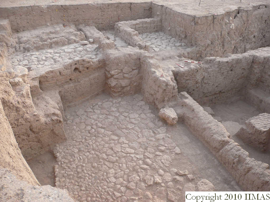
| View/drawing orientation | 2008-08-28 | lC | looking northeast [Input: S909LC2.j] |
| Text description of view | 2008-08-28 | lC | View showing the different levels of the Mitanni structures looking north. In the foreground we can see the big stone pavement f108, probably associated with the mud brick walls f109, f125 and f126. There is a little more than a meter between the level of the pavement f108 and the pavement f132 , but also f57. Assuming that these pavements are contemporary, the walls f84 and the wall f126 should have had the function of divide these different levels, but this question has still to be demonstrated. Toward east is also visible the a5, formed by the mud brick walls f116, f113 and probably f115. [Input: S909LC2.j] |
| Web view | |||
| Photo of view | |||


