6. REFERENCE
Analogical Record
| Roster | Date | Author | Record |
|---|---|---|---|
| Template | |||
| Photo of context (v view) | |||
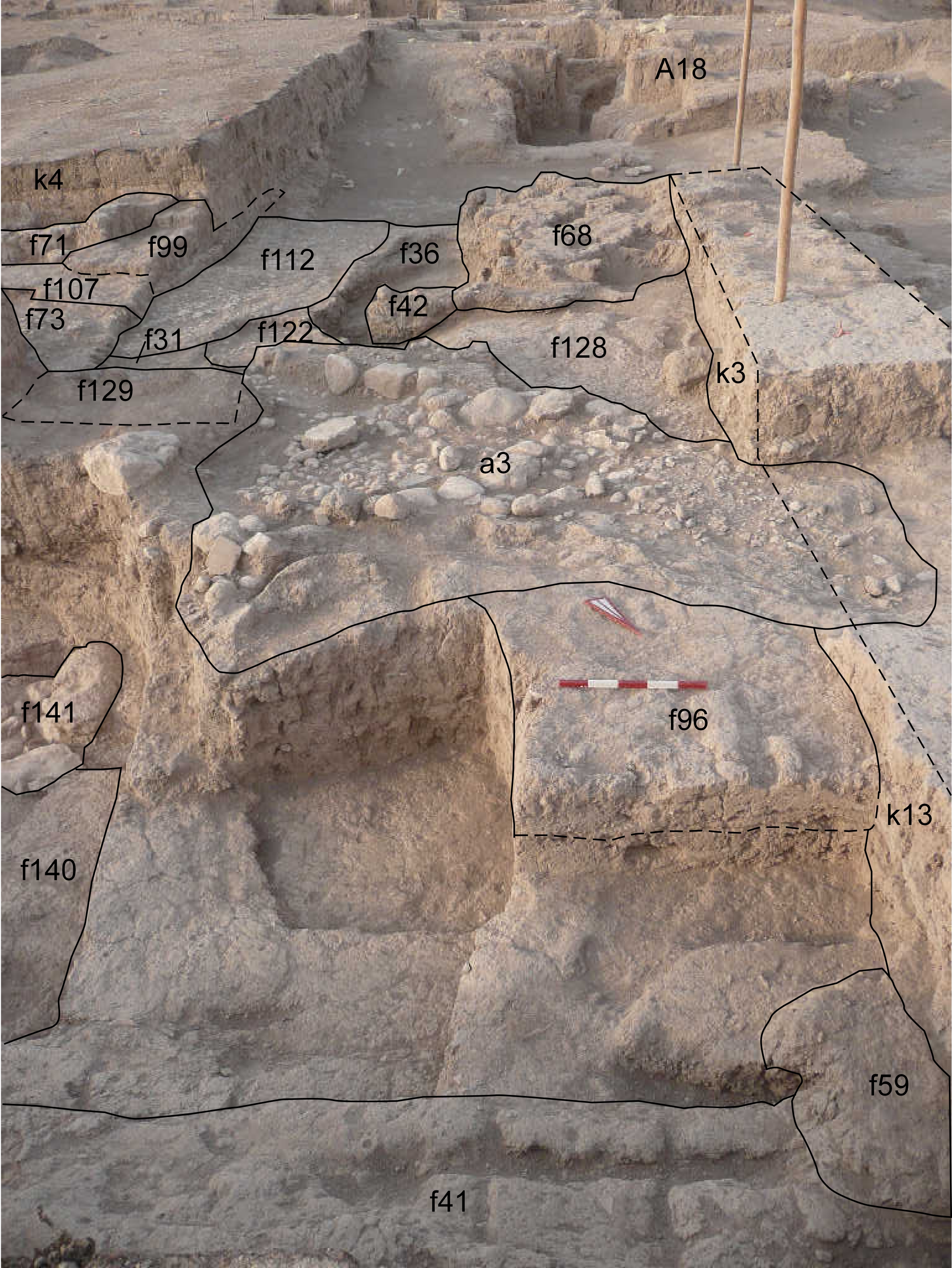
| View/drawing of aggregate | 2008-08-28 | lC | a3 (installation) [Input: S909LC2.j] |
| View/drawing of features | 2008-08-28 | lC | f31 (layer) f36 (accumulation C) f41 (wall) f42 (tannur (feature)) f59 (hearth) f68 (brick pile) f71 (wall) f73 (pavement, type c) f96 (installation) f99 (wall) f107 (wall) f112 (pavement, type c) f122 (pavement, type c) f128 (layer) f129 (wall) f140 (accumulation) f141 (stone installation) [Input: S909LC2.j] |
| View/drawing of locus | 2008-08-28 | lC | k3 k4 k13 [Input: S909LC2.j] |
| View/drawing orientation | 2008-08-28 | lC | looking south [Input: S909LC2.j] |
| Text description of view | 2008-08-28 | lC | View showing the installations of k3 and k13, and in the background the structures of A18. To the north there is the big wall f41 running east to west and south of it some hard compact clay layers, perhaps floors, sloping toward south, under the unexcavated step of a3. Next to the a3 are visible the pavement f112 and the pavement f122 underneath, showing an intense use of this area. On the right is also visible the clay layer f128 that in some points has small embedded pebbles and sherds and could has been used as floor. On top of this layer sloping toward south there is the ashy layer f36 and the brick pile f68. In k4 we have the bounded walls f99 and 107, the bin f71 and the pavement f73. [Input: S909LC2.j] |
| Web view | |||
| Photo of view | |||


