6. REFERENCE
Analogical Record
| Roster | Date | Author | Record |
|---|---|---|---|
| Template | |||
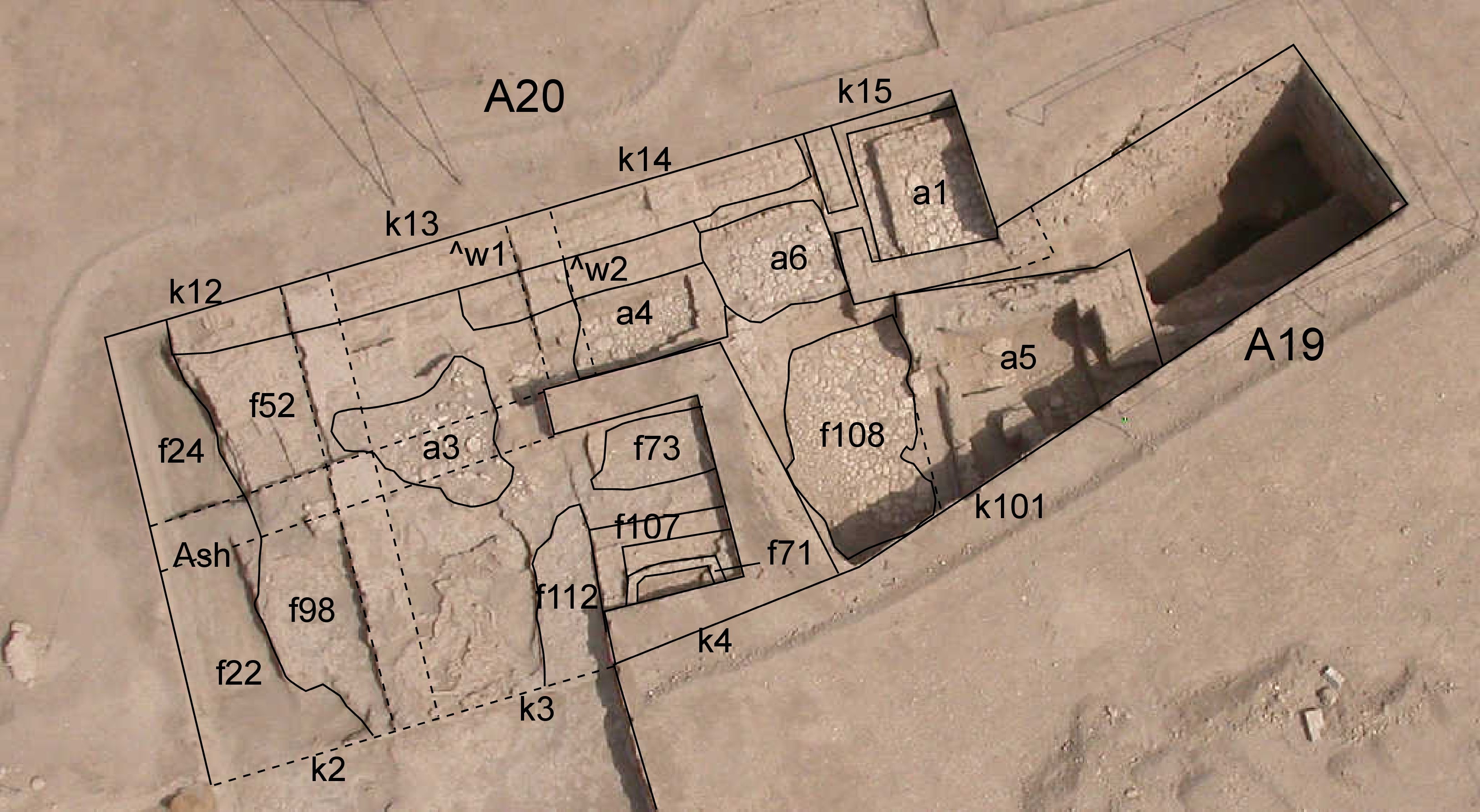
| View/drawing of aggregate | 2008-09-15 | lC | a1 (room) a3 (installation) a4 (room) a5 (room) a6 (room) [Input: S917LC4.j] |
| View/drawing of features | 2008-09-15 | lC | f22 (accumulation C) f24 (accumulation C) f52 (layer) f71 (wall) f73 (pavement, type c) f98 (brickfall) f107 (wall) f108 (pavement, type b) f112 (pavement, type c) [Input: S917LC4.j] |
| View/drawing of locus | 2008-09-15 | lC | k2 k3 k4 k12 k13 k14 k15 k101 [Input: S917LC4.j] |
| View/drawing orientation | 2008-09-15 | lC | looking overhead [Input: S917LC4.j] |
| Text description of view | 2008-09-15 | lC | Kite view showing the excavation of A20. In its eastern portion are visible a1, a6 and a4 constructed of stone pavements and mud brick walls forming small rooms. The view also shows the big stone pavement f108 and the bigger room a5. From this shot we can also see how the situation changes to the west, where we can see some small sherd and pebble pavements (f112 and f73) and the drainage a3. Next to the west baulk of A20 there is the big accumulation of ash f22 and 24, probably related to the activities taken place in this open area. Right next to the north baulk there is the big mud brick wall1 probably belonging to a big structure to the north. [Input: S917LC4.j] |
| Web view | |||
