6. REFERENCE
Analogical Record
| Roster | Date | Author | Record |
|---|---|---|---|
| Template | |||
| Photo of context (v view) | |||
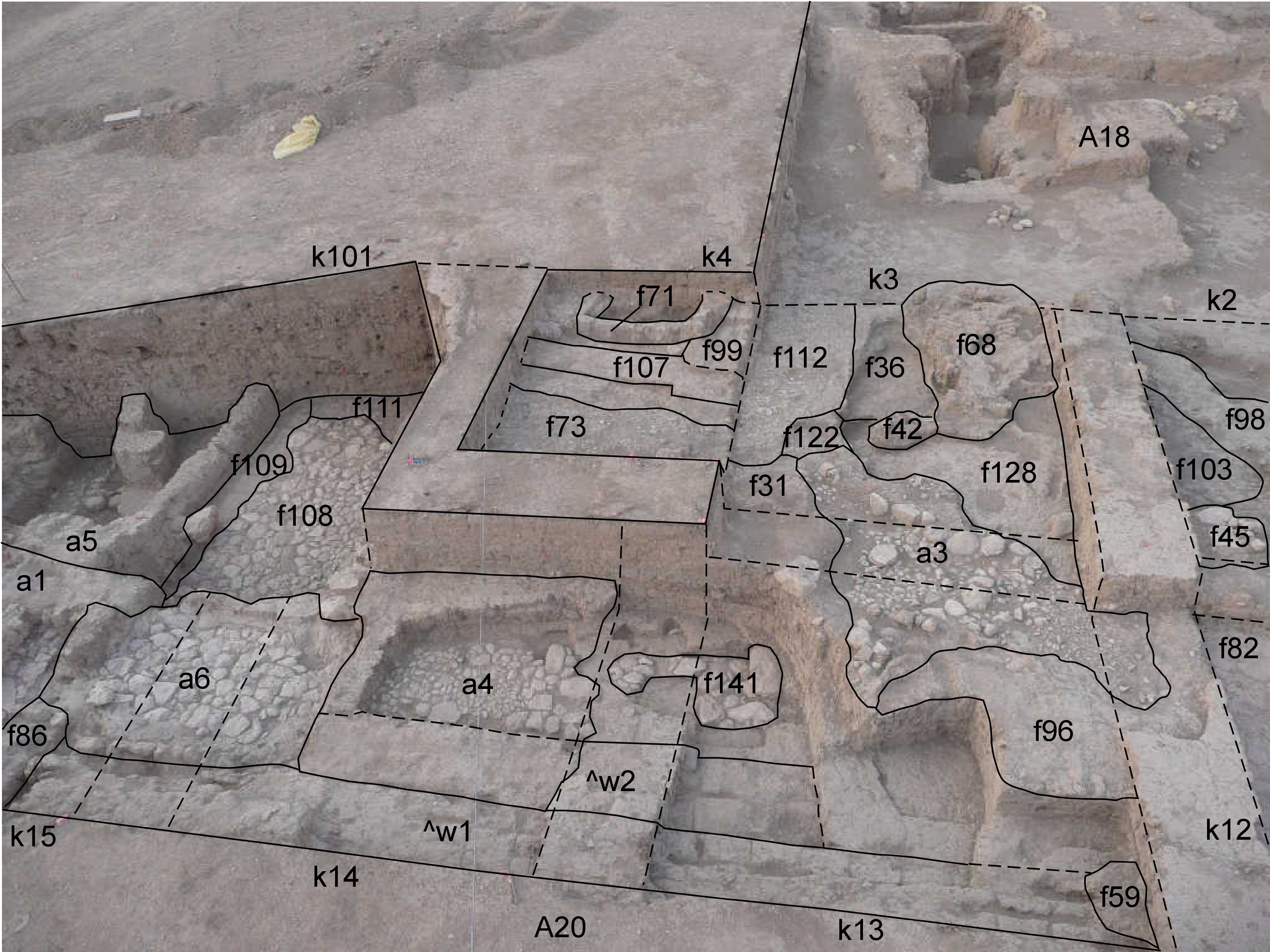
| View/drawing of aggregate | 2008-09-06 | lC | a1 (room) a3 (installation) a4 (room) a5 (room) a6 (room) [Input: S916LC.j] |
| View/drawing of features | 2008-09-06 | lC | f11 (stone installation) f31 (layer) f36 (accumulation C) f42 (tannur (feature)) f45 (stone installation) f68 (brick pile) f71 (wall) f73 (pavement, type c) f82 (brickfall) f86 (wall) f96 (installation) f98 (brickfall) f99 (wall) f103 (layer) f107 (wall) f108 (pavement, type b) f109 (wall) f112 (pavement, type c) f122 (pavement, type c) f128 (layer) f141 (stone installation) [Input: S916LC.j] |
| View/drawing of locus | 2008-09-06 | lC | k2 k3 k4 k12 k13 k14 k15 k101 [Input: S916LC.j] |
| View/drawing orientation | 2008-09-06 | lC | looking south [Input: S916LC.j] |
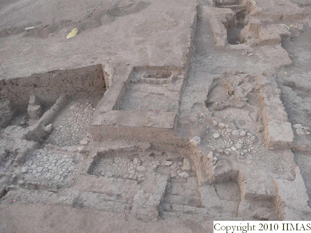
| Text description of view | 2008-09-06 | lC | View taken from the high ladder showing the middle and eastern portion of A20, with part of the northern structures of A18. The view shows all the installations of the late Mittani occupation to the north of A18 (stratum 12a), when this area was used as open space for some kinds of activities. There are pavements like f112 and f73, tannurs f42 and f100, a drainage system connected with a pebble pavement a3. Moreover are recognizable some ashy accumulation f36 and f103 probably coming from these activities taken place in the outdoor area. To the east we can see more big stone pavements belonging to the small rooms a4, a6, a5 and a1. These rooms, together with the big stone pavement f108, show the different elevations of the structures and it is not still clear if they belong to the same or to different strata. [Input: S916LC.j] |
| Web view | |||
| Photo of view | |||


