6. REFERENCE
Analogical Record
| Roster | Date | Author | Record |
|---|---|---|---|
| Template | |||
| Photo of context (v view) | |||
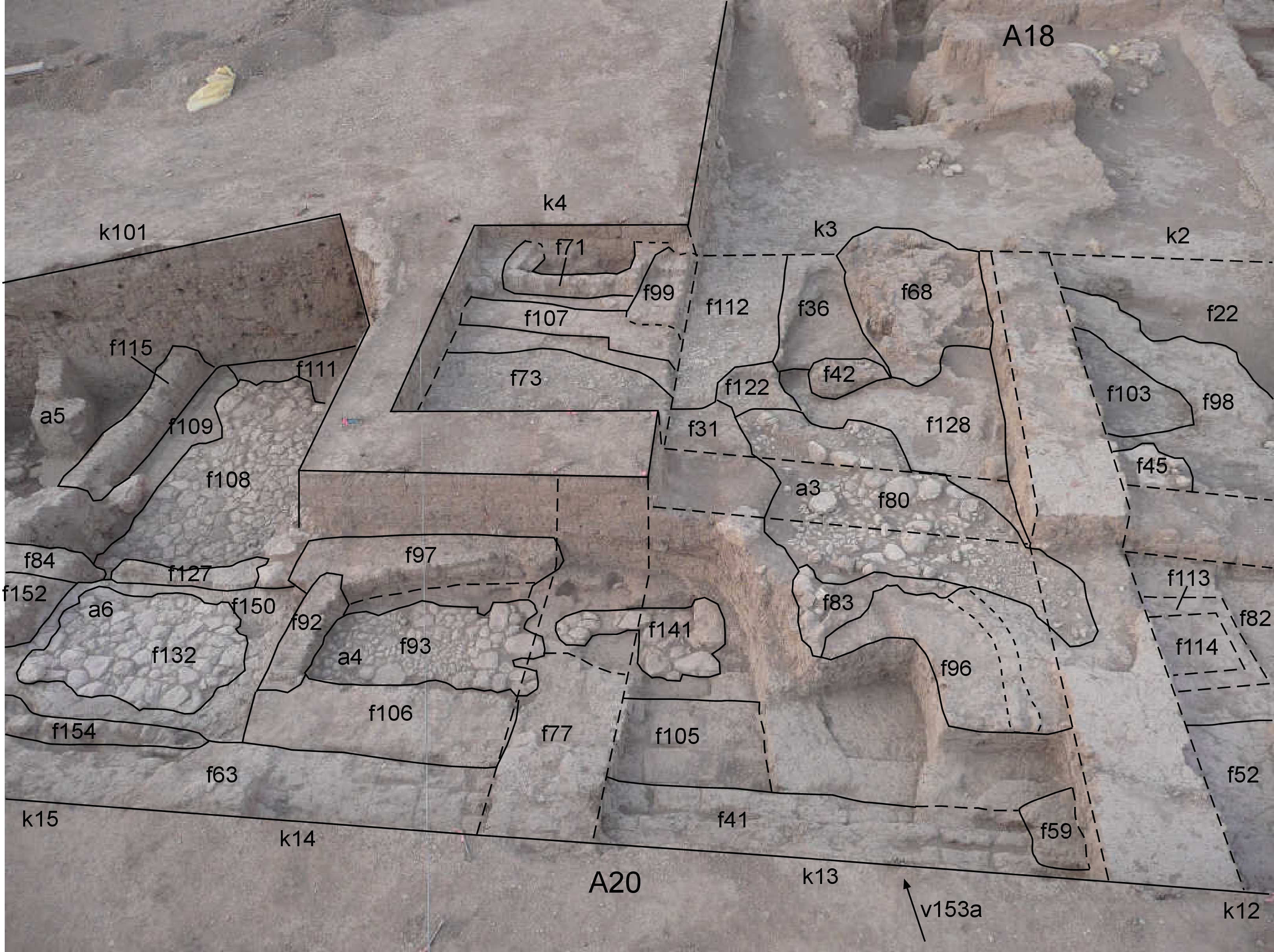
| View/drawing of aggregate | 2008-09-06 | lC | a3 (installation) a4 (room) a5 (room) a6 (room) [Input: S916LC.j] |
| View/drawing of features | 2008-09-06 | lC | f22 (accumulation C) f31 (layer) f36 (accumulation C) f41 (wall) f42 (tannur (feature)) f52 (layer) f59 (hearth) f63 (wall) f68 (brick pile) f71 (wall) f73 (pavement, type c) f77 (wall) f82 (brickfall) f84 (wall) f92 (wall) f93 (pavement, type c) f96 (installation) f97 (wall) f98 (brickfall) f99 (wall) f103 (layer) f105 (wall) f106 (wall) f107 (wall) f108 (pavement, type b) f109 (wall) f111 (layer) f112 (pavement, type c) f113 (bin) f114 (fill) f115 (wall) f122 (pavement, type c) f127 (wall) f128 (layer) f132 (pavement, type c) f141 (stone installation) f150 (layer) f152 (wall) f154 (wall) [Input: S916LC.j] |
| View/drawing of locus | 2008-09-06 | lC | k2 k3 k4 k12 k13 k14 k15 k101 [Input: S916LC.j] |
| View/drawing orientation | 2008-09-06 | lC | looking south [Input: S916LC.j] |
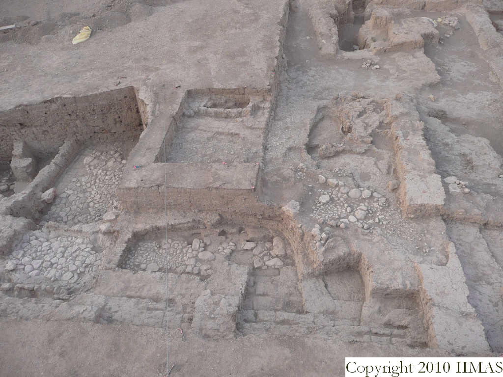
| Text description of view | 2008-09-06 | lC | View taken from the high ladder showing almost all the A20 area with a small portion of A18 in the background. This view shows all the loci at the end of the excavation. On the right we can see a5, a6 and a4 with their stone pavements forming small rooms one next to the other one, south of the wall f106. This wall runs next to another big wall, f63 and f41 running east to west and probably belonging to a structure toward north. To the west and to the south there are some installations, showing an open use of this area. There are structures like the bin f71, perhaps connected with the two bounded walls f107 and f99, the pavements f73 and f112, the drain f83 with the pebble pavement f80, the earth f59, and another possible bin f113. Moreover are recognizable three ashy accumulations f22, f103 and f36 result of some activities. [Input: S916LC.j] |
| Web view | |||
| Photo of view | |||


