Back to top: Volumetric data ("topography") for Unit J1
Introduction
For our approach to volumetry see the relevant section in the Grammar.
J1 is constituted of a very extended area, counting about 19 regular (5x5 m) squares (loci). 4 loci belong to the first season and have been inglobed in the new oriented grid (Chronicle). 5 loci have been included in J5 since 2008. The total surface is about 400 squared meters.
Back to top: Volumetric data ("topography") for Unit J1
Overall loci map
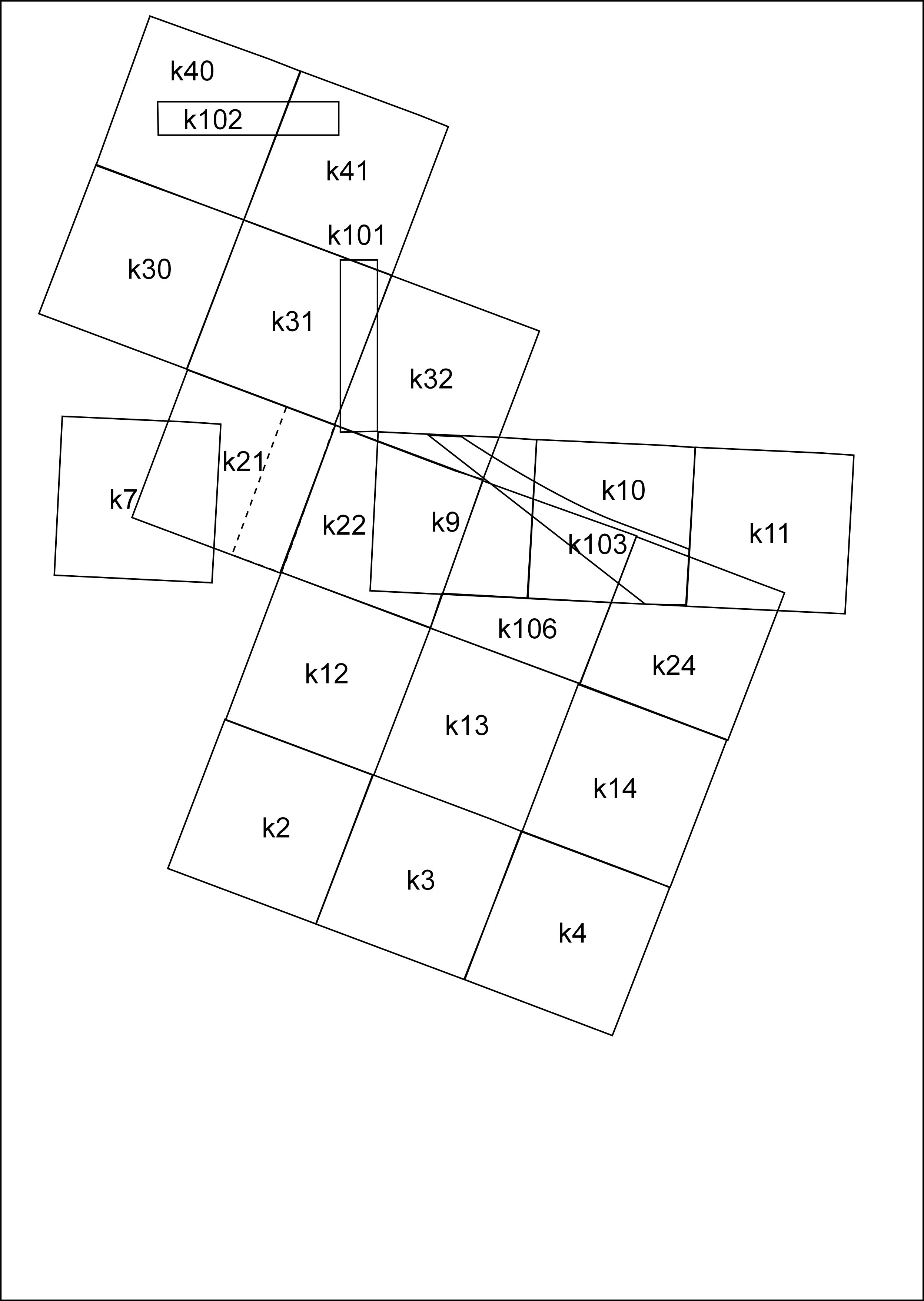
This map shows the regular loci (k7, k9, k10, k11) used during the first excavation season (2003) oriented following the North, and all the other loci following the orientation of the Temple Terrace.
The map also shows the first special loci k101, k102 small tranches excavated by the team of Peter Pfälner in 200??, and k103 made in order to follow the face of the revetment wall and to reach its bottom.
The sections below will show the loci used for each season. It is impossible to show all of them at the same time because they were over-shaped.
Back to top: Volumetric data ("topography") for Unit J1
Main loci (squares)
The regular loci have been used only during 2003-2006 excavation, then the deepness of the excavation required to re-modell the J1 area for safety reasons, in a theatre shape, where only new special loci were used. The regular loci (k7, k9, k10, k11) have been used in 2003, while loci k2-k41 between 2005 and 2006.
Back to top: Volumetric data ("topography") for Unit J1
Special loci
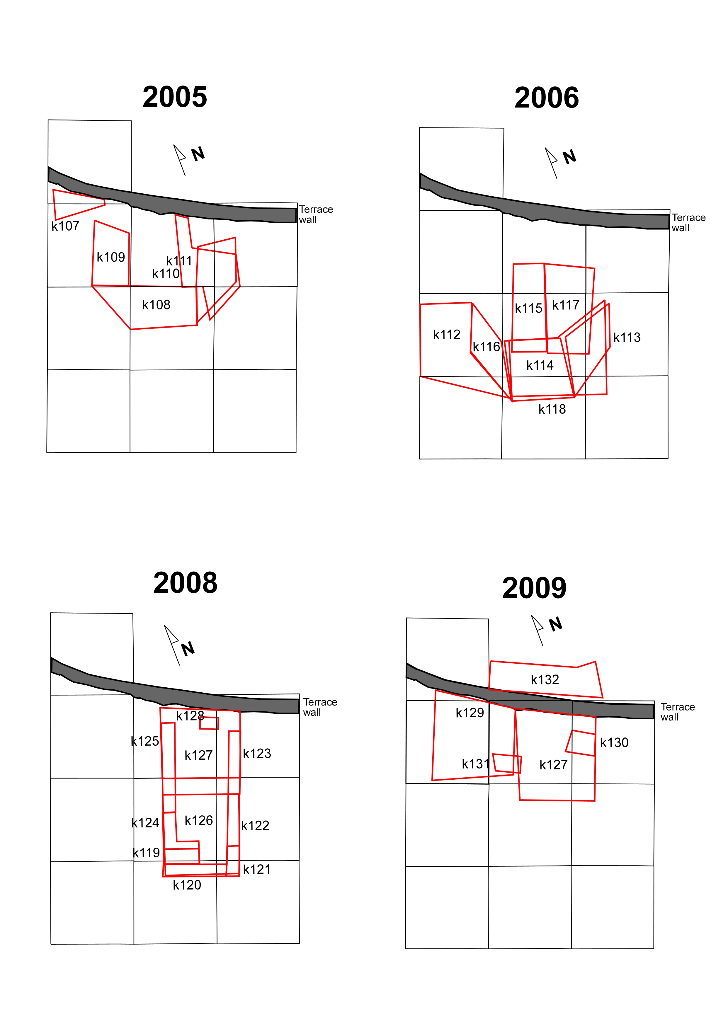
For the first time during 2005 season the theatre shape of the excavation unit started to be set up. At the beginning the squares were located next to the revetment wall because the goal was to reach the level of the Plaza close to it (k107-k111). From 2006 it was started to enlarge the area because we tried to give the ancient perception of the wall and the terrace from a slightly bigger distance (k112-k118). In 2008 the excavation was concentrated at the bottom of the wall to look for the construction of the escarpments and to check eventual earlier levels (k119-k128). After the recovery of the stucture in k128, the 2009 season looked for the earlier structure and the possible LC mound(k127-k132).
Back to top: Volumetric data ("topography") for Unit J1
Sections
Back to top: Volumetric data ("topography") for Unit J1
Introduction
The composite sections are not so numerous in J1 because the regular loci have been used for just a short period (two seasons). These sections refer to the uppermost levels. Everything worth note is visible in the grat eastern section showing the entire succession found in J1. Several single sections have been drawn because showing important stratigraphic relationships.
Back to top: Volumetric data ("topography") for Unit J1
Size and volume of excavations
The area excavated in J1 can be divided in two main areas: The area in front of the Revetment wall (k2-k24) for a surface of about 225 squared meters and the area on top of the revetment wall or just on front of it (6 squares k30-k41) for a surface of about 150 squared meters.
The entire measurments of the area is about 25 meters North to South and 25 meters East to West. Not all the squares have been excavated, for the excavated loci see supra. The maximum reached deepness is about 7.50 meters at the bottom of k130.
It seems plausible that the entire volume excavated in J1 counts approximatly 1100 cubuc meters. About 400 cubic meters have been included in J5 area from 2008 season.
Back to top: Volumetric data ("topography") for Unit J1