6. REFERENCE
Analogical Record
| Roster | Date | Author | Record |
|---|---|---|---|
| Template | |||
| Photo of context (v view) | |||
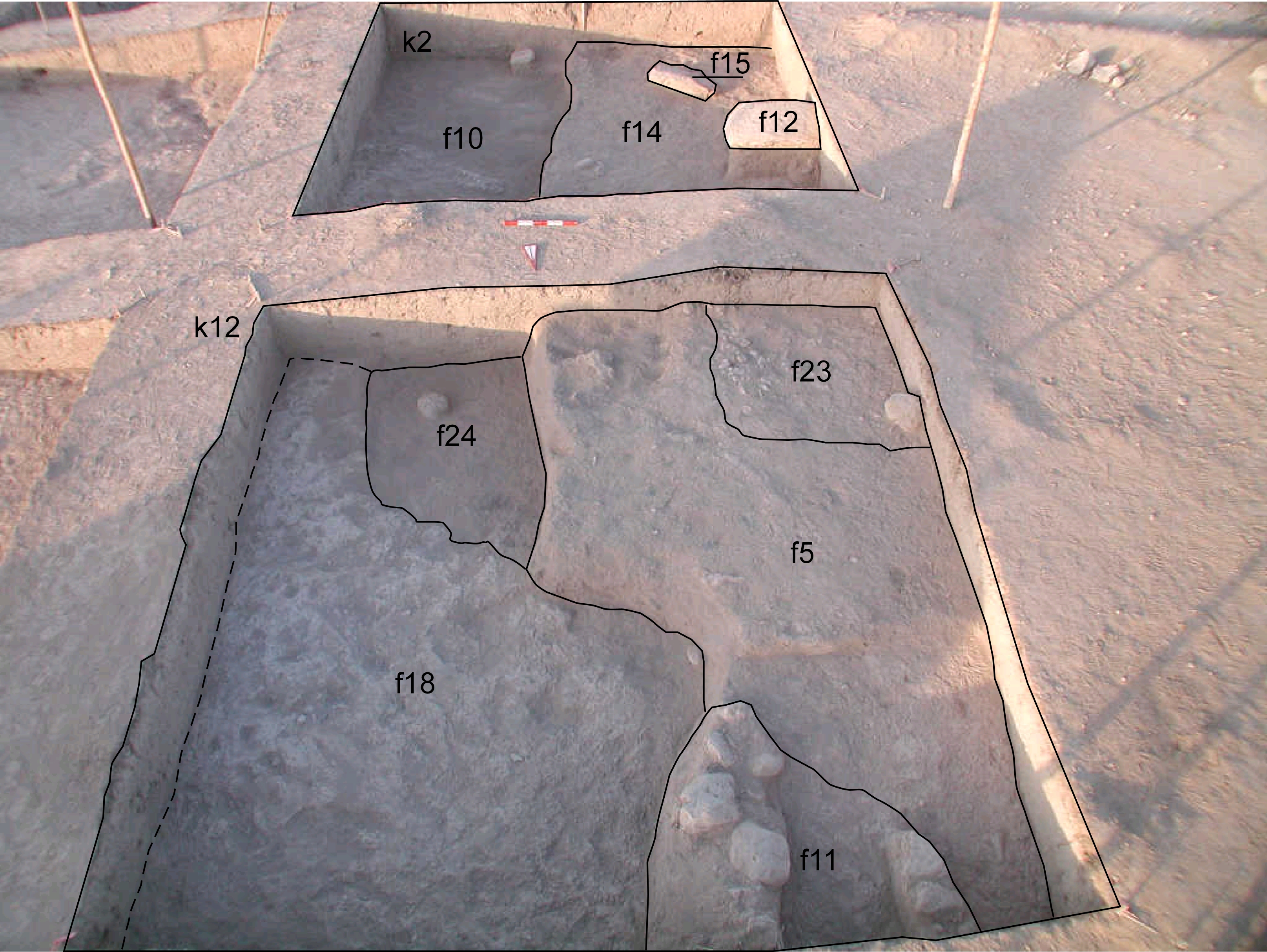
| View/drawing of features | 2008-07-17 | yM | f5 (accumulation C) f10 (accumulation D) f11 (stone installation) f12 (isolated stone) f14 (accumulation C) f15 (stone installation) f18 (layer) f24 (accumulation C) [Input: S803LR3.j] |
| View/drawing of locus | 2008-07-17 | yM | k2 k12 [Input: S803LR3.j] |
| View/drawing orientation | 2008-07-17 | yM | looking overhead [Input: S803LR3.j] |
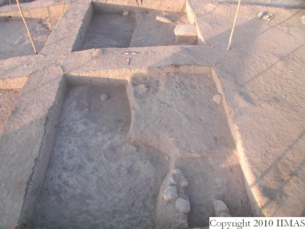
| Text description of view | 2008-07-17 | yM | Overhead view of k2 and k12 showing the continuation of features between these two loci at different levels with the eastern half an earlier level than the west. The compact bricky layer, f18 extends south into k2 visible in the northeast corner while an ashy surface is starting to emerge and at this point was unclear if it cut f18 or abuts it. The view also shows the later accumulations, f5 that continues into k2, overlays f18 with similar scattered occupation remains such as stone installations f11, f12, f15, and a sherd pavement f23. [Input: S803LR3.j] |
| Web view | |||
| Photo of view | |||


