6. REFERENCE
Analogical Record
| Roster | Date | Author | Record |
|---|---|---|---|
| Template | |||
| Photo of context (v view) | |||
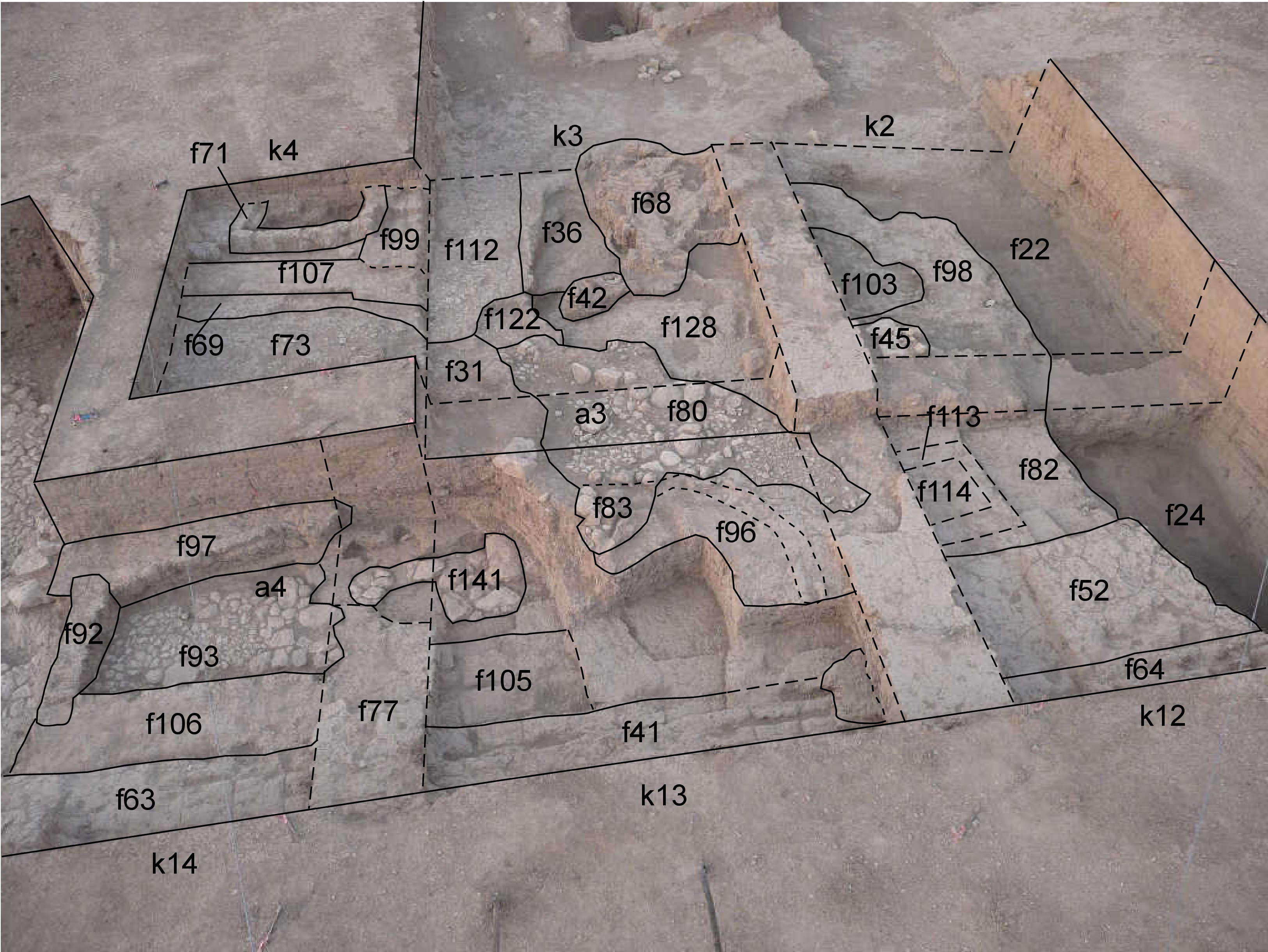
| View/drawing of aggregate | 2008-09-06 | lC | a3 (installation) a4 (room) [Input: S916LC.j] |
| View/drawing of features | 2008-09-06 | lC | f22 (accumulation C) f24 (accumulation C) f31 (layer) f36 (accumulation C) f41 (wall) f42 (tannur (feature)) f45 (stone installation) f52 (layer) f63 (wall) f64 (wall) f68 (brick pile) f69 (layer) f71 (wall) f73 (pavement, type c) f77 (wall) f80 (pavement, type b) f82 (brickfall) f83 (installation) f92 (wall) f93 (pavement, type c) f96 (installation) f97 (wall) f98 (brickfall) f99 (wall) f103 (layer) f105 (wall) f106 (wall) f107 (wall) f112 (pavement, type c) f113 (bin) f114 (fill) f122 (pavement, type c) f128 (layer) f141 (stone installation) [Input: S916LC.j] |
| View/drawing of locus | 2008-09-06 | lC | k2 k3 k4 k12 k13 k14 [Input: S916LC.j] |
| View/drawing orientation | 2008-09-06 | lC | looking south [Input: S916LC.j] |
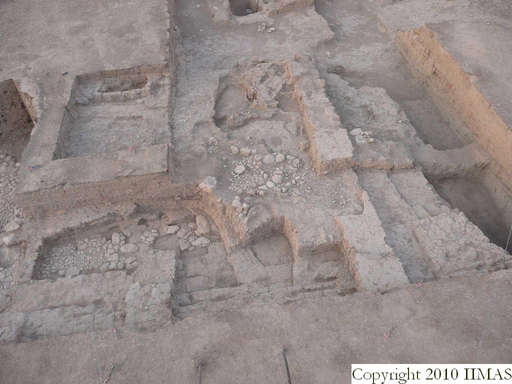
| Text description of view | 2008-09-06 | lC | View taken from the high ladder showing the western part of A20. To the west is visible the thick ashy accumulation f22 and f24 result of some kind of activities of this outdoor area, constituted of many different ashy layers sloping down toward south and west. This ash is abutting the brick mass f52, f82 and f98 on its sharp edge. To the east we found more installations like the tannurs f42, the brickpile f68, possibly an installation above the ash layer f36, the pavements f112, f122 and f73, next to the two bounded walls f107 and f99 with the bin f71. To the north between k3 and k13 there is the pebble pavement f80 and the drain f83. To the east other kinds of structures like stone pavements and big mud brick walls forming different rooms, show a different use of the space (outdoor-indoor). [Input: S916LC.j] |
| Web view | |||
| Photo of view | |||


