Back to top: Layering
Introduction
The overwhelming number of features excavated (61%) were layers. Listed in descending order of frequency, they were designated as accumulations, volumetric material, layers, topsoil, and laminations.
Back to top: Layering
Accumulations
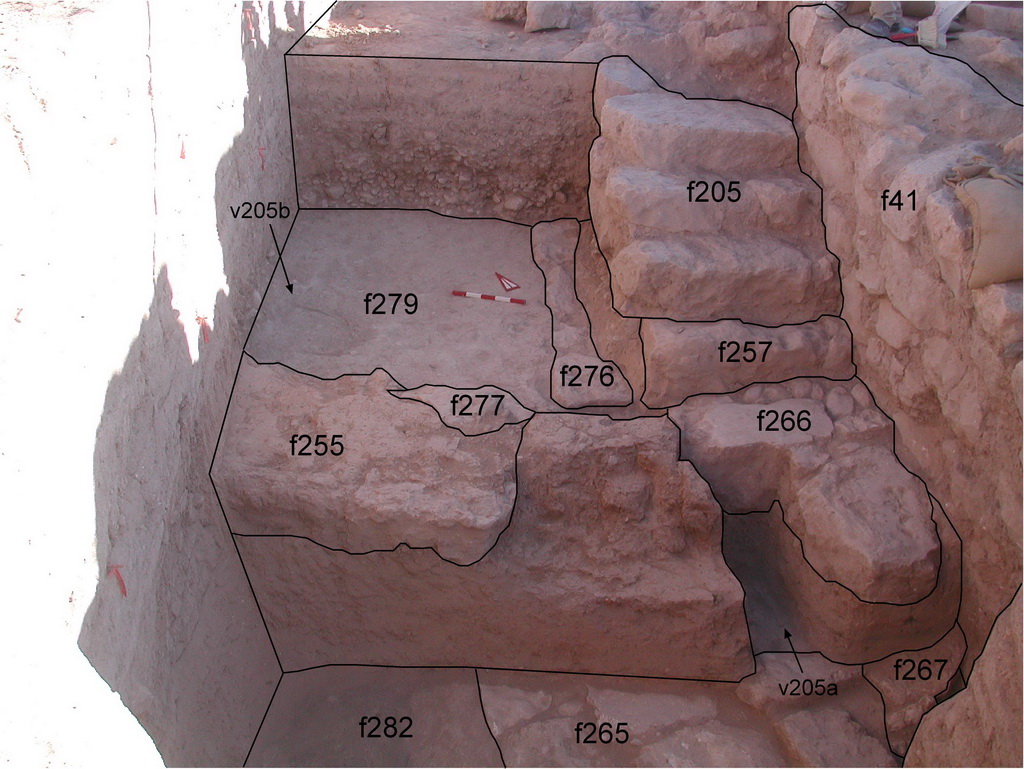
Accumulations, a gradual buildup of soil and other materials deposited either as the result of sedimentation or human activities, comprise two thirds of the layering excavated. Of them the majority were naturally deposited over structures when occupation ceased or was paused for significant periods of time. They begin from just beneath the topsoil and extend down for as much as two meters. An example is f9. Floor accumulations yield the most information about stratigraphy. An example is f282, which covered pebble floor f288.
There were 12 "living floors" accumulation type A, three accumulations directly above "living floors accumulation type B, 8 abandonment accumulations accumulation type C, and 90 sedimentation accumulations accumulation type D.
|
|
|
Back to top: Layering
Layers and Lenses
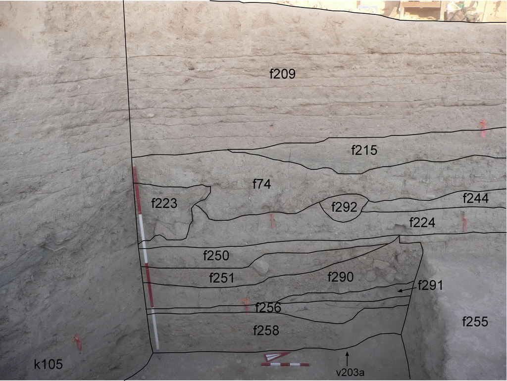
Layers are intermediate-sized deposits, either naturally occurring or as the result of human activity. As soil deposit in a water channel, f227, is an example of the former while an ash deposit, f215, is an example of the latter. These were the only two deposits designated as layers.
A lens is a small deposit that shares type categories with accumulations described above. The most common lens was formed by sedimentation. Lens, f292, is a typical example. There were several lenses containing cultural material either classified as resulting from abandonment or formed during occupation.
There were no lenses (lens type A) immediately above a floor surface. There were two occupational lenses lens type B, three abandonment lenses, lens type C , and 12 naturally formed lenses lens type D.
|
|
|
Back to top: Layering
Volumetric Material
A volumetric feature is one that has no stratigraphic meaning. Typically it is a block consisting of soil layers excavated as a unit. One example is a baulk between two excavated loci whose features match on either side. See f133 Another is a section of a locus with known and uniform accumulations having little expectation of yielding cultural data. See f110.
In all there were 28 such volumetric features.
|
|
|
Back to top: Layering
Topsoil
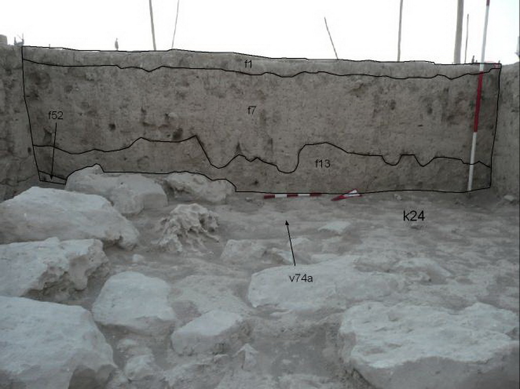
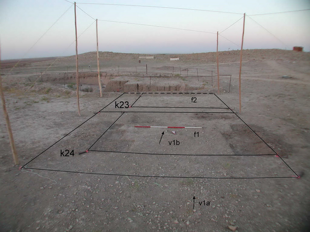
Topsoil is a special category of layering almost always seen at the surface. Plants have sunk their roots into the surface soil and decaying vegetation darkens the color. Feature f1 is a good example.
There were 12 topsoil features.
|
|
|
Back to top: Layering
Laminations
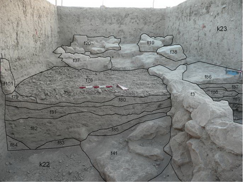
Laminations are caused by the action of water on deposits of soil. Typically, light rain falls on a thin layer of loess, evaporates, and leaves a hard crust. Here, partially excavated lamination, f78, was formed by action of water on a thicker layer of soil and pebbles.
There were 3 lamination features.
|
|
|
Back to top: Layering