| Best image | 2011-8-25 | cJC | 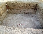 v4 |
| Label is included in another | 2011-8-17 | cJC | ^plow [Input file: V817CJC.J / V817CJC.-J] |
| Category | 1998-7-5 | !! | build-up [Input file: I714JL.J / I714JL.-J] |
| 1998-7-8 | !! | build-up [Input file: I708JLW.J / I708JLW.-J] | |
| Definition | 1998-7-5 | jL | topsoil [Input file: I714JL.J / I714JL.-J] |
| 1998-7-8 | jW | topsoil [Input file: I708JLW.J / I708JLW.-J] |
| Best image | 2011-8-25 | cJC | v4 |
| Description | 1998-7-8 | jW | surface soil layer approximately 10 cm deep. [Input file: I708JLW.J / I708JLW.-J] |
| Locus | 1998-7-5 | jL | k1 [Input file: I714JL.J / I714JL.-J] |
| Elevation | 2011-9-8 | cJC | 7847 @bottom [Input file: V908CJC.J / V908CJC.-J] |
| 2011-9-8 | cJC | 7857 @top [Input file: V908CJC.J / V908CJC.-J] | |
| D99.NVolmtrc | 2011-9-8 | cJC | The original elevations were measured from the surface down and appear in the record with these numbers. In 2011 cJC used the absolute elevation of m1869 which was located on the surface near OH2 to convert these measurements. [Input file: V908CJC.J / V908CJC.-J] |
| Type of contact: Earliest events | 1998-7-12 | gB | f1 covers f2 (soil) [Input file: I712JLW.J / I712JLW.-J] |
| Inclusions | 08-25-2016 | !! | frequencies of ceramic vessels and sherds included within feature |
| Stratum to which element belongs | 2011-8-27 | cJC | s20OH2 [Input file: V827CJC.J / V827CJC.-J] |
| Phase to which stratum belongs | 2011-8-27 | cJC | h9mOH2 [Input file: V827CJC.J / V827CJC.-J] |
| Color definition | 1998-7-8 | jW | pale brown [Input file: I708JLW.J / I708JLW.-J] |
| Color number | 1998-7-8 | jW | 10YR6/3 [Input file: I708JLW.J / I708JLW.-J] |
| Texture | 1998-7-8 | jW | fine and dusty with considerable vegetative matter. [Input file: I708JLW.J / I708JLW.-J] |
| Photo of view |  v1  v1a  v1b 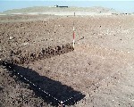 v2 | |||||||||
| Photo of view | 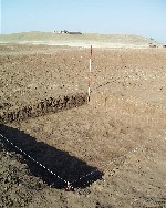 v2a v4  v8  v9  v10  v11  v12  v13 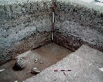 v14 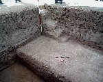 v15 | |||||||||
| Drawing of view | w3 |
w4 |
w5 |
w6 |