1. OVERVIEW
| Roster | Date | Author | Record |
|---|---|---|---|
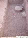
| Best image | 2014-10-24 | cJC |  [Input: YX24CJC.j] [Input: YX24CJC.j] |
2. IDENTIFICATION
Designation
| Roster | Date | Author | Record |
|---|---|---|---|
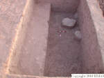
| Description (summary) | 2005-08-17 | aL | West of k14, south of k23. Opened in order to make east-facing stepped sections west of k14. [Input: P913MH3.j] |
| 2008-03-07 | pC | k24 is not a regular locus and it is only 260x400cm. Is defined by markers m3609, m3600, m3599, m4068, m4069, m4070, m4071 [Input: S206PC.j] |
3. STRATIGRAPHY
Recovery/Assignment
| Roster | Date | Author | Record |
|---|---|---|---|
| Daily notes about recovery of elements | 2005-08-27 | mH | We continued with the top soil feature (f243) and excavated one q-lot (q615). We found one metal item (i14), possibly a coin, from this q-lot. [Input: P827MH.j] |
| 2005-08-28 | mH | We finished removing the top soil (f243 q637) and continued with the layer below topsoil (f252 q640). Abutting the southern edge of the unit was a semi-globular ashy lense. I relayed the southern edge of it (r756). It was approximately 63 cm east-west at the widest and approximately 27 cm high north-south. Within that area we found what seem to be a modern pottery handle. [Input: P828MH.j] | |
| 2005-08-29 | mH | The elevation was m4071 +21-155 = 91.43 m when made the excavation area smaller. At this level there was also a single, rather small, floating stone, which we relayed and removed. This stone (f262) is defined by relays r924, r925, r926, and r927. After removing the stone and decreasing the excavation area we changed the feature number, although the soil texture did not change, and continued excavating down (q669). [Input: P830MH.j] | |
| 2005-08-29 | mH | We continued with the removal of f252, layer below topsoil (q658). The target here was to reach the 92 m elevation and then reduce the excavation area by 1 m and only excavate there. The work, however, had progressed here so swiftly that we actually went quite a bit below 92 m before we reduced the excavation area. [Input: P830MH.j] | |
| 2005-09-05 | sC | We continued to dig f263 (q679). [Input: P831SC.j] | |
| 2005-09-05 | sC | Today we continued to dig f263 in all the area (q707). Here, we remove a floating limestone (f274, r947) and few pottery sherds has been recovered in the pedestal of this stone (f275, q706). [Input: P901SC.j] |
Volumetric Localization
| Roster | Date | Author | Record |
|---|---|---|---|
| Elements within locus | 2005-08-23 | aL | f243 (topsoil) [Input: P913MH.j] |
| 2005-08-27 | sC | f252 (accumulation D) [Input: P913MH.j] | |
| 2005-08-29 | mH | f262 (isolated stone) f263 (lens type d) [Input: P913MH.j] |
|
| 2005-09-01 | sC | f274 (isolated stone) f275 (accumulation D) [Input: P913MH.j] |
|
| 2005-09-05 | sC | f313 (mix feature) [Input: P913MH5.j] | |
| 2005-09-05 | mH | f314 (lens type d) [Input: P913MH5.j] | |
| 2005-08-27 | sC | i14 (coin) [Input: P913MH4.j] | |
| 2005-08-25 | aL | q615 (items, pottery) [Input: P908MH2.j] | |
| 2005-08-28 | aL | q637 (pottery) [Input: P908MH2.j] | |
| 2005-08-28 | aA | q640 (pottery) q646 (pottery) q658 (bones, pottery) [Input: P908MH2.j] |
|
| 2005-08-29 | aL | q669 (pottery) [Input: P910MH.j] | |
| 2005-08-31 | aL | q679 (pottery) [Input: P910MH.j] | |
| 2005-09-01 | sC | q706 (pottery) q707 (bones, pottery) [Input: P910MH.j] |
|
| 2005-09-05 | sC | q783 (pottery) [Input: P910MH3.j] | |
| 2005-09-05 | mH | q786 (pottery) [Input: P910MH3.j] | |
| 2005-09-05 | aL | q798 (pottery) [Input: P910MH3.j] | |
| 2005-09-06 | sC | q805 (pottery) q814 (pottery) [Input: P910MH3.j] |
|
| Elevation | 2005-09-12 | mH | 9043 [Input: P913MH7.j] |
| 2005-09-12 | mH | 9170 [Input: P913MH7.j] | |
| Extension of locus or q-lot | 2005-08-17 | aL | m4070 [Input: P913MH3.j] |
| Length of two sides | 2005-08-17 | aL | 260w [Input: P913MH3.j] |
| 2005-08-17 | aL | 400s [Input: P913MH3.j] |


