1. OVERVIEW
| Roster | Date | Author | Record |
|---|---|---|---|
| Included in other label | 2010-12-03 | cJC | ^use1 (use area) [Input: T914CJC.j] |
| Category | !! | !! | buildup |
| Best definition | 2005-08-03 | vVE | accumulation D [Input: P912MH.j] |
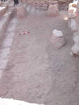
| Summary | 2008-03-06 | pC | natural accumulation North of wall f144, containing charcoal, melted bricks, little pebbles, pottery sherds, softer in texture than the surrounding area. [Input: S206PC.j] |
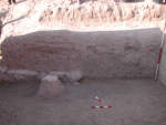
| Best image | 2007-07-13 | pC |  v78 [Input: S205PC.j] |
2. IDENTIFICATION
Designation
| Roster | Date | Author | Record |
|---|---|---|---|
| Description (summary) | 2005-08-03 | vVE | Pit in the SW corner of k4 [Input: P911MH.j] |
3. STRATIGRAPHY
Recovery/Assignment
| Roster | Date | Author | Record |
|---|---|---|---|
| Argument | 2007-07-13 | mH | It is possible that wall f144 and apron f131 at a certain time retained soil accumulated here, and hence the process of accumulation was different to the north and south of f144. It seems that to the north the accumulation was faster and hence a slope formed to the south and south-west of stone features f144 and f151. I suspect that f143, which we at first thought might have been a pit, also formed as a result of these stones. f143 was located higher up in this corner than the stones, but their presence affected the accumulation process also higher up [Input: S205PC.j] |
| 2008-03-06 | pC | f143 contains melted bricks, like f188, f189 [Input: S206PC.j] | |
| Harmonization | 2005-08-03 | sC | At first sight we thought that the SW corner of the area excavated in k4 (close to m3956) could be a pit because it contained charcoal, little pebbles, pottery sherds, and it had a softer texture than the surrounding area. During excavation we realized however that f143 is just natural accumulation. [Input: P911MH.j] |
| Problems in recording | 2005-08-21 | mH | Top and bottom elevations recorded in the feature log are inaccurate (The feature log gives 89.73 m as the top elevation m3956 + 84 - 114 and 89.54 m as the bottom elevation m3957 +92 - 124). f143 abuts f141 and thus it should start approximately at the same elevation as f141 (89.35 m). Indeed, the only qlot q385 excavated in this feature gives 89.32 m (m3956 +50 -121) as the top elevation of the feature. The correct bottom elevation remains unknown, but since f145 goes under f143, the bottom elevation of f143 should be higher than the bottom elevation of f145, which is 89.06 m. [Input: P821MH.j] |
Volumetric Localization
| Roster | Date | Author | Record |
|---|---|---|---|
| Locus | 2005-08-03 | vVE | k4 [Input: P912MH.j] |
| M#/elev @top | 2005-08-03 | vVE | 8973 [Input: P912MH.j] |
| M#/elev @bottom | 2005-08-03 | vVE | 8954 [Input: P912MH.j] |
| Notes on volumetric localization | 2005-08-03 | vVE | r445 220e 112n [Input: P911MH.j] |
Contact Association
| Roster | Date | Author | Record |
|---|---|---|---|
| Type of contact: latest events | 2005-08-03 | mH | f139 (accumulation D) covers f143 (accumulation D) [Input: S211PC2.j] |
| Type of contact: contemporary events/movable items | 2005-08-04 | !! | q385.1 (stamp seal) sits in f143 (accumulation D) [Input: U808YM3.j] |
| 2005-08-04 | !! | q385.2 (figurine) sits in f143 (accumulation D) [Input: U808YM3.j] | |
| 2005-08-04 | aL | q385 (bones, pottery) sits in f143 (accumulation D) [Input: U808YM3.j] | |
| Type of contact: earliest events | 2005-08-03 | mH | f143 (accumulation D) abuts f141 (lens type d) [Input: S211PC2.j] |
| 2005-08-03 | mH | f143 (accumulation D) abuts f144 (wall) [Input: S211PC2.j] |
Time Sequencing
| Roster | Date | Author | Record |
|---|---|---|---|
| Stratum (to which element belongs) | 2011-11-11 | cJC | s159J2B [Input: VY11CJC.j] |
| Phase (to which element belongs) | 2009-09-14 | !! | ^ctwl2 (wall) [Input: T914CJC.j] |
| 2010-11-15 | !! | ^ctwl3 (wall) [Input: T914CJC.j] | |
| 2010-12-03 | !! | ^use1 (use area) [Input: T914CJC.j] | |
| 2011-11-11 | !! | h7jJ2B [Input: VY11CJC.j] | |
| Stratigraphic reasons of assignment | 2008-03-05 | pC | same elevation as f141 and lower in elevation than the brickfall [Input: S305PC.j] |
| Other reasons, reservations, qualifications | 2005-09-14 | mH | The wall feature f144 and the deposits contained between it, f151, and the apron resulted in a terrain where this corner of k4 collected more material (pottery and pebbles) than the rest of k4 at this same elevation. This, however, no longer shows active use of the area. Top of f144 still visible [Input: S215PC.j] |
| 2011-05-16 | cJC | Associated with the use of wall f144 [Input: V516CJC.j] | |
| 2011-11-21 | cJC | Use area during brickfall, between construction of f232 and f144. see v78 [Input: VY21CJC.j] |
4. TYPOLOGY
Morphology
| Roster | Date | Author | Record |
|---|---|---|---|
| Color | 2005-08-03 | vVE | light grey and red [Input: P912MH.j] |
6. REFERENCE
Analogical Record
| Roster | Date | Author | Record |
|---|---|---|---|
| View/drawing of features | |||
Disposition
| Roster | Date | Author | Record |
|---|---|---|---|
| Removed (feature), discarded/missing (item) | 2005-08-03 | vVE | yes [Input: P912MH.j] |
