1. OVERVIEW
| Roster | Date | Author | Record |
|---|---|---|---|
| Best image | 2014-10-24 | cJC |  [Input: YX24CJC.j] [Input: YX24CJC.j] |
2. IDENTIFICATION
Designation
| Roster | Date | Author | Record |
|---|---|---|---|
| Description (summary) | 2004-07-08 | mh | west of k13 by one unit. delimited by markers m3615, m3609, m3619, m3620, m3694, m3695 [Input: O712MH2.j] |
| 2008-03-07 | pC | k33 was opened to follow the second apron to the west, but it was decided to stop excavating here. this locus was then excavated as a J3 locus [Input: S206PC.j] |
3. STRATIGRAPHY
Recovery/Assignment
| Roster | Date | Author | Record |
|---|---|---|---|
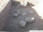
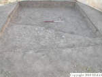
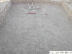
| Daily notes about recovery of elements | 2004-07-08 | ap | we opened this new square removing the top soil (f42, q87). About 15 cm under the top soil we noticed a difference between the south-western corner and the rest of the square. The soil in the corner (f46) is quite compact with stones of small-medium size and irregular shape and a single pottery shard. For the moment we took just the elevation (m3619 +132-142). Since at a first sight it seems a floor is more probable that it's a natural accumulation (sedimentation) on the surface of the tell. We decided to define it a lens of type d (ld) since there are not walls which abut the feature. For today we decide to go on just in the eastern part of the northern part of the square (f42, q99). [Input: O708AP.j] |
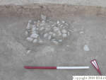
| 2004-07-11 | aP | we started excavating the north-western (f42, q102) and after we continued with the whole surface of the square (f49, q108) except f46. After we decided to remove f46 (f46, q106) which was interpreted as part of the tell of the surface, quite hard and with stones of small-medium size. Scraping, cleaning and removing the material (f46, q112) we noticed the stones go down but the surface occupied by them is smaller going deeper. So for the moment we can suppose that it could be a kind of pit filled by stones and fragments of basalt grinding stones (q112.1; q112.2; q112.3; q112.4; q112.5). At the end of the morning we asked to gB about the possible nature of the stone accumulation and he made the hypothesis of a tomb. [Input: O711AP.j] | |
| 2004-07-12 | ap | Yesterday we removed f46 defined as a lb since it appeared as an accumulation clearly different from the rest of the soil. However scraping the surface we noticed that the stones are going down also in they are concentrated all in the middle on the southern baulk of the square. We supposed it could be a pit (f54) filled by f55. We interpreted it as a pit, choosing to change feature, since the matrix seems quite different (stones and not basalt) and the materials are more concentrated. On the other hand we went down with the excavation of the other part of the square (f49, q118 and q125). [Input: O712AP.j] | |
| 2004-07-13 | aP | we are going down living a space of about 1X1 for f54 in all the square (f61, q130). In the northern part of the square, very close to the northern baulk we found a concentration (aggregate) of stones of big sizes collapsed form the north. Between the stones we noticed the presence of pottery sherds. We collected them as a q-item (q136.1) since we would like to try to fit them. We are going on with excavations dividing the square in two parts: western half (f61, q136) and eastern half (f61, q141). [Input: O713AP.j] | |
| 2004-07-14 | ap | we are going down removing soil between the stones (f61, q145) around and north of f54. We did not remove much dirt since the team was moved in k2. [Input: O714AP2.j] |
Volumetric Localization
| Roster | Date | Author | Record |
|---|---|---|---|
| Elements within locus | 2007-07-18 | pC | a1 (pit) [Input: S206PC2.j] |
| 2010-12-22 | cJC | f42 (topsoil) [Input: U809YM.j] | |
| 2008-01-31 | pC | f46 (lens type b) [Input: S131PC3.j] | |
| 2007-07-20 | sC | f49 (layer) f54 (pit) f55 (fill) [Input: S131PC2.j] |
|
| 2008-01-31 | pC | f61 (layer) [Input: S131PC3.j] | |
| 2004-07-08 | ap | q87 (bones, items, pottery) q99 (items, pottery) [Input: O710MH.j] |
|
| 2004-07-11 | ap | q102 (pottery) q106 (items, pottery) q108 (items, pottery) q112 (items, pottery) [Input: O711MH.j] |
|
| 2004-07-12 | ap | q118 (pottery) q125 (items, pottery) [Input: O712MH.j] |
|
| 2004-07-13 | mh | q130 (pottery) q136 (items, pottery) q141 (items, pottery) [Input: O713MH.j] |
|
| 2004-07-14 | ap | q145 (pottery) [Input: O717MH.j] | |
| Extension of locus or q-lot | 2004-07-08 | mh | m3619 [Input: O712MH2.j] |
| Length of two sides | 2004-07-08 | mh | 400e [Input: O712MH2.j] |
| 2004-07-08 | mh | 400n [Input: O712MH2.j] |
