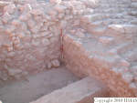
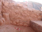
1. OVERVIEW
| Roster | Date | Author | Record |
|---|---|---|---|
| Best image | 2014-10-24 | cJC |  [Input: YX24CJC.j] [Input: YX24CJC.j] |
2. IDENTIFICATION
Designation
| Roster | Date | Author | Record |
|---|---|---|---|
| Description (summary) | 2005-08-17 | aL | Combining k101 and k103 into a single loci. [Input: P913MH3.j] |
3. STRATIGRAPHY
Recovery/Assignment
| Roster | Date | Author | Record |
|---|---|---|---|
| Daily notes about recovery of elements | 2005-08-28 | mH | We started following the gray layer and thus removing f246 in the whole unit (q638). We found what might be roofing pieces in q638, although nobody seems to be quite certain of the function of these things. Underneath we discovered a new brown soil layer (f253), which is shown in v110, v110a, and v110b. The feature slopes heavily towards south/southwest. The starting elevation at the highest point in the northwest was m4170 +84-154 = 88.03 and in the northeast it was m4170 +85-154 = 88.04. In the southeast corner, which is the lowest point, it was m4170 +75-154 = 87.94 m. While removing it (q642), we discovered two sealings (i16 and i17). After removing f253 the only feature left was f248 (=f247) and the difference between the northern edge of k104 and the southern end had increased significantly. In the north the elevation is m4169 +71-133 = 88.09 and in the south it is m4169 +41-133 = 87.79 m. For a couple of days now the pottery that has come from this area (previously k101 and k103) has been third millennium. Although the amounts of diagnostic sherds has been low, no later material has been found in these lots. Thus, gB and mKB thought it would be best to stop the excavation here for the time being and continue in k14 to the south of k104. We did than during the last hour of the day. [Input: P828MH.j] |
| 2005-09-06 | mH | we relay the stones f320.1, f320.2, f320.3 [Input: S307PC.j] | |
| Argument | 2005-08-28 | mH | Yesterday gB suggested that rather than being a use-area, this area might actually be a dump area formed by the corner of f127 and f128. He suggested that perhaps refuse from the activities associated with the apron (f131) and perhaps located in front of it were dumped here behind f127. fAB paid attention to the apparent downward (south) slope of f127 and suggested that we took photos of f127 with a line and a line-level in place showing the slope. This we took. They are v110, v110a and v110b. [Input: P828MH.j] |
Volumetric Localization
| Roster | Date | Author | Record |
|---|---|---|---|
| Elements within locus | 2007-07-18 | pC | a11 (floor) [Input: S206PC2.j] |
| 2005-08-27 | sC | f253 (accumulation D) [Input: P913MH.j] | |
| 2005-09-05 | sC | f320 (isolated stone) f321 (accumulation D) [Input: P913MH5.j] |
|
| 2005-08-25 | mH | i16 (sealing) [Input: P913MH4.j] | |
| 2005-08-25 | sC | i17 (seal impression) [Input: P913MH4.j] | |
| 2005-08-28 | sC | q638 (pottery) [Input: P908MH2.j] | |
| 2005-08-28 | aA | q642 (pottery) [Input: P908MH2.j] | |
| 2005-09-06 | sC | q811 (pottery) q812 (pottery) q815 (pottery) [Input: P910MH3.j] |
|
| Extension of locus or q-lot | 2005-08-17 | aL | m4169 [Input: P913MH3.j] |
| Length of two sides | 2005-08-17 | aL | 200n [Input: P913MH3.j] |
| 2005-08-17 | aL | 400e [Input: P913MH3.j] |
