Back to top: Volumetric data ("topography") for Unit J7 Loci
Introduction
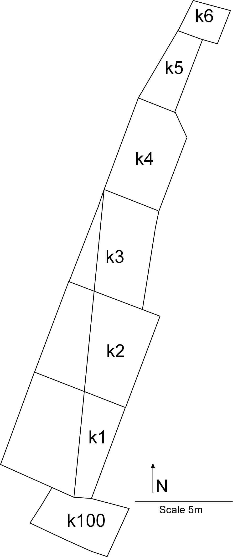
The loci in J7 were arranged to take advantage of the preexisting conditions. None of the J7 loci adhere to the 5x5 meter excavation squares that are usually used in the excavation.
Back to top: Volumetric data ("topography") for Unit J7 Loci
Main loci (squares)
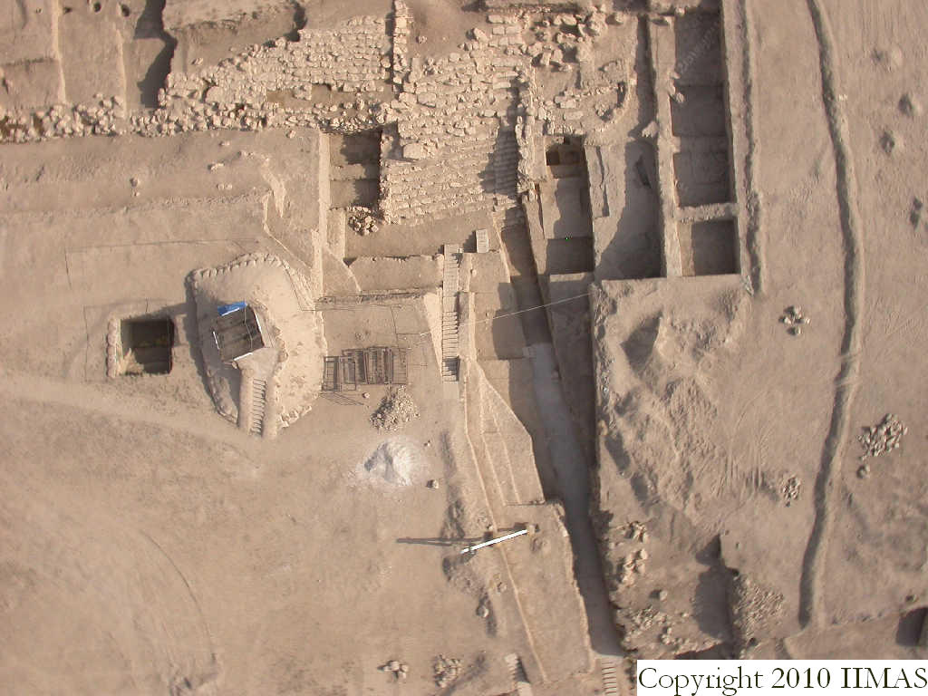
The loci were laid out according to the site grid using corner markers to delineate the western edge of the squares (m4838, m4858, m4837, m4860, m4836, m4874, m4839, m4876, m4845) and using the trench, k200, as the eastern edge (see p1). This line formed the western edge of k4, however, in k1, k2, and k3 the western edge was cut on an oblique line connecting m4856 (in the south east corner of k1) to m4839 (in the northwest corner of k3). The oblique cut was done to reduce the size of J7 and create an increasingly wide viewing area of the J2 staircase as one approaches from the south.
k5 was restricted in size by the cement staircase to the west and the cut (k200) to the east so it is irregularly shaped and much smaller than a traditional locus.
k6 was previously part of J2 and had limited excavations as part of J7. It was restricted to the area just north of k5, bordering the cement staircase.
Back to top: Volumetric data ("topography") for Unit J7 Loci
Special loci: Trench k200
k200 was a preexisting trench that was originally part of the excavations conducted by P. Pfälzner called area C2. The sides of the trench had eroded by the time excavations were begun in J7. No excavations were conducted in k200 during 2008 but it was necessary to have a way to refer to the area in the Global Record therefore it was assigned k200. It is also known as k200 in J6.
Back to top: Volumetric data ("topography") for Unit J7 Loci
Special loci: Backfilling area k100
k100 was a leveling operation in south J7. It was not relayed but simply consisted of backfilling a small area of C2 in order to create a level viewing platform for site presentation (see v51 or v26).
Back to top: Volumetric data ("topography") for Unit J7 Loci