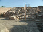
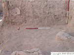
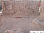
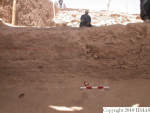
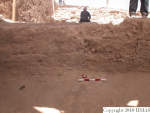
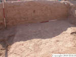
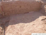
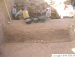
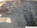
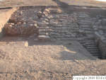
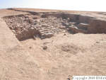
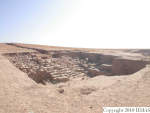
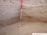
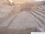
1. OVERVIEW
| Roster | Date | Author | Record |
|---|---|---|---|
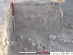
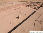
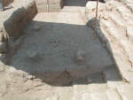
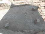
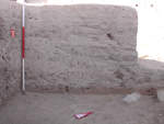
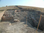
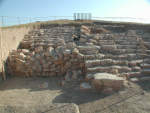
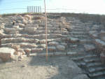
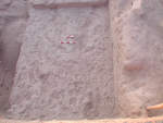
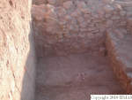
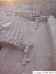
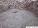
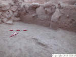
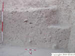
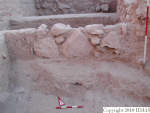
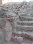
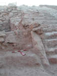
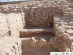
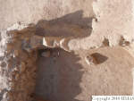
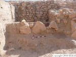
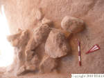
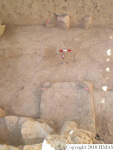
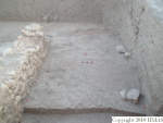
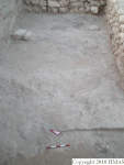
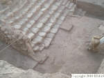
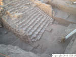
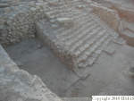
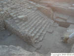
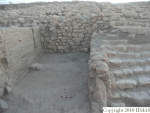
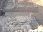
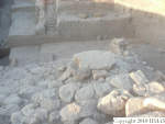
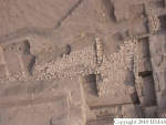
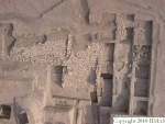
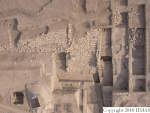
| Best image | 2014-10-24 | cJC |  [Input: YX24CJC.j] [Input: YX24CJC.j] |
2. IDENTIFICATION
Designation
| Roster | Date | Author | Record |
|---|---|---|---|
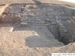
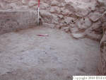
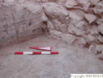
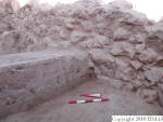
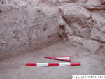
| Description (summary) | 2004-06-29 | mh | west of k4, western half of the unit falls into the German trench 20. Defined by markers m3600, m3616, m3599, r31, r30 [Input: O629MH2.j] |
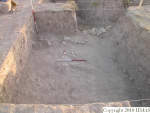
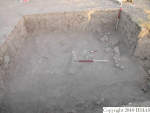
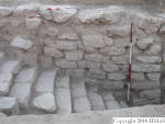
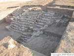
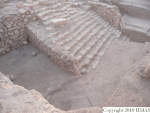
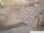
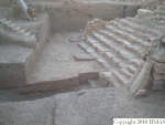
| 2008-03-07 | pC | k14 was opened to have a better view from the south of the second apron f132 and revetment wall f128 [Input: S206PC.j] |
3. STRATIGRAPHY
Recovery/Assignment
| Roster | Date | Author | Record |
|---|---|---|---|
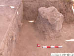
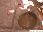
| Daily notes about recovery of elements | 2004-06-29 | mH | We opened this locus today. The western half of k14 is the German trench 20. The current bottom of that trench (including collapse) is approximately 1.5 m below the tell surface. Near the northern baulk of k14 we ran into a large stone near the surface. It seems to be there alone and has probably rolled to its current location from the temple terrace to the north. It is located much higher than we would expect for the apron we think extends into this unit from the north. We also found a tannur, f9, close to the middle of the southern baulk. [Input: O629MH3.j] |
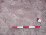
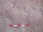
| 2004-06-30 | mH | Since we discovered a tannur feature f9 yesterday in the southern half of the unit, I divided the unit into two q-lots, q25 and q26, at the start of the day. In the southern half we dug with a small pick looking for a possible floor associated with the tannur f9. In the northern half we went once with a big pick and the same material f7 continued there. During these two q-lots I kept the feature f7 the same since the soil matrix had not changed from what we had earlier. It was still a combination of harder and softer patches and is clearly natural. After ca. 7 cm we found a hard, compacted layer west of the tannur and extending about 150 cm north. This layer did not contain any sherds embedded in it, nor did it include any other kinds of larger inclusions. In compactness it definitely differed from what was above it (f7) and next to it in the north (f7). I made this layer into f12. At this time we excavated the inside of the tannur to get an impression of where a floor level should be. Since the top of f12 was clearly much higher than the bottom of the tannur and since it did not seem to be a deliberate floor, I decided to go through it in search for a better floor. At the bottom of f12 we ran into sherds that had been embedded into it. Since these sherds were not horizontal but tilted, it became more obvious that f12 was not a real floor (intentional and constructed) but perhaps a "working floor", which had formed due to higher foot traffic around the tannur when it was used. We took pictures of this part of f12 and the tannur f9. This are v2 and v2a. After taking the pictures we cleared the remains of the working floor in order to see whether another floor would be under it. Under it, however, was the same kind of soil as had been above and around it in the whole unit. Starting from below f12 I made this layer in to f15. It covers the whole unit and is essentially the same type of material as f7. The working floor f12 was thus quite ephemeral; it does not even show up in the section. [Input: O630MH.j] | |
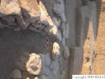
| 2004-07-01 | mh | We removed features f13 (large stone) and f9 (tannur) after i had drawn them. Under the large stone we discovered several smaller stones. In the northwest corner, underneath the large stone was also an area of very hard, brick-like material. In the south it was delineated by stones. This is f17. The stones in k14 are mostly aligned in east-west direction. Along the northern baulk, at the border with the German trench the stones form a half circle. The stones here are about 10 cm higher than in k5. This difference in elevation can be explained by the tell slope. As in k5, they do not seem to form a permanent, clear structure but appear more like the remains of a temporary structure. [Input: O703MH3.j] | |
| 2004-07-04 | mh | We did not excavate in this unit today. GB looked at f17 in northwest corner of the unit and suggested that the hard deposit was formed there because the surrounding stones had prevented the soil from eroding and disintegrating as it did beyond the stones. We relayed the stones today. I assigned them as f26 and defined that as lens type c. [Input: O704MH.j] | |
| 2004-07-05 | mh | We took two photos of the unit with the stone feature f26 as the target. I also sketches them in on the plots I ran yesterday. We did not excavated here today. [Input: O705MH4.j] | |
| 2004-07-06 | mH | Sylvana drew the N baulk. We did not draw the east baulk; GB did not think it was necessary. [Input: O706MH.j] | |
| 2004-07-07 | aP | we started to remove the western baulk of k14 (f35, q78) to have a more useful passage for the wheelbarrow. [Input: O707AP.j] | |
| 2004-07-12 | ap | we finished to remove the northern baulk of k14 (f52, q117) and we continued to remove the eastern baulk of k14 (f35, q126). [Input: O712AP.j] | |
| 2004-07-13 | aP | we removed part of the eastern section (f35 , q133 and q137) making a ramp to facilitate the passage of the wheelbarrow. Tomorrow we'll level all the surface to reach a uniform height in all the squares of the area to take a picture of a presumably horizontal plan with the eroded stones. [Input: O713AP.j] | |
| 2004-07-14 | ap | we finished to clean the southern part of k14 ( f15, q146), levelling the surfaces of the square and living all the stone of small size. On the other hand we cleaned the southern part of the German trench. [Input: O714AP2.j] | |
| 2004-07-20 | aP | after cleaning the surface for the picture we took away the pebbles and stones of small-medium size and we went going with a new feature (f76, q14). The consistency of the soil of this feature is quite the same of the feature above ( f15) but since there are no more stones we decided to change the feature. [Input: O721AP.j] | |
| 2004-07-25 | ap | we are going down in all the square continuing to remove the layer below the "Mittanic floor" (f76, q247 and q257). [Input: O726AP.j] | |
| 2004-07-26 | aP | we continued to go down with the previous feature (f76, q265) until we noticed two different situations. In the eastern part of the unit part of one of the German trenches (f104, q287) was clearly recognizable, while in the western part we noticed a mixture of softer (powder-like) soil and laminations (f109, q281 and q284). [Input: O728AP.j] | |
| 2004-07-27 | aP | after removing the German trench and the mixed soil in the eastern part of the unit we reached a new layer, harder and softer according to different lenses, in all the surface of the unit with few pottery. It's f111: we dug q291 and q301. We also removed the north baulk of the square (f115, q309). [Input: O730AP.j] | |
| 2004-07-28 | aP | we are going down with the excavation of the first meter from the northern baulk (f111, q319) and removing the eastern baulk (f115, q338). [Input: O730AP1.j] | |
| 2005-08-08 | mH | Based on a strategy meeting with gB, fAB, and members of J02, we decided to start digging here and bring it to the same level k13 is currently. The hard surface we ran into within f156 is the same as feature f103 in k13. This hard layer consists of laminations, brown sand, and very fine, dust-like material that has hardened into a cement-like consistency. [Input: P808MH.j] | |
| 2005-08-08 | sC | Today we started digging in k14. We assigned a new feature number (f156) to the top 10 cm and tomorrow we will change it when starting digging. We think that the square has been contaminated by the dirt moved here during the past days (due to the presence of the elevator in k13). f156, a natural accumulation characterized by a compact surface in all the area, was particulary hard to remove in the SW area where it present a very very compact surface. mH explained us that this accumlation was found very often in this area during last season. One qlot was collected during the exavation of f156 (q407). [Input: P808SC2.j] | |
| 2005-08-09 | mH | We continued excavating f159, the extremely hard and compact layer, which also contains a fair amount of pottery sherds. The workmen had hard time penetrating the layer even with big picks and therefore the work progressed slowly. We were, however, able to collect three qlots: q414, q415, and q419. At fAB's request we took three soil samples (q411.1, q412.1 and q413.1) from various places at the elevation of approximately 90.08 m. Of these vVE and aL sieved q413.1. The location from which this sample is taken is shown in v82b. We also collected two painted pottery sherds as q-items q415.1.1 and q415.1.2. These sherds were located at the elevation of 90.12 m. The baulk markers bP put in today made it clear that some part of the unit we have been calling k13 is actually the north baulk of k14 and some of that area even falls into the last 1 m of the 4x4 of k14. [Input: P809MH.j] | |
| 2005-08-10 | mH | We continued excavating in the hard feature f159 for one q-lot (q420). Since we had been using the same feature for quite some time and since the same material seemed to continue, we decided to change the feature into f161 and excavated two q-lots with this feature (q423 and q425). We found one decorative painted sherd, which we made into q-items (q423.1). The hard layer ended after this pick run and thus we changed the feature into f162. The work in this unit did not proceed as fast as normally today since the workmen had to wait for us to decide on the strategy of the ledges and their placement. [Input: P810MH.j] | |
| 2005-08-11 | mH | We started by removing soil from the western half of the unit (f162 q428), which was left higher up at the end of the day yesterday. After that we continued going down in the whole unit (q433) and brought it level with k13 (q435). In the last unit we found decoratively painted pottery sherds, which we made into q-items (435.4 and q435.5). [Input: P813MH.j] | |
| 2005-08-13 | mH | The unit had been brought approximately level with k13 on Thursday (q435). At the start of the morning we cleaned the unit well and took a picture of it (v83). We then placed plastic on the surface and moved the elevator from k13 into k14. We will not pause the excavations here for a while. [Input: P813MH2.j] | |
| 2005-08-16 | mH | After stopping the excavations in k101 and k13 we moved the team here in order to reach the level of features f150 in k4, f171 (f183) in k13, and f174 (f182) in k101. We continued with the feature we had stopped in earlier, feature f162, which is a sandy water deposit. We are only excavating in an area 400 cm east and 250 cm south of m4031 since the elevator is in the south part of the unit. The first and second q-lots were contaminated. These two q-lots also had labelling problems. Back at the house Diadin noticed that two bags had the same label q502 when one of them should have been q504. We now do not know, which one is which thus pottery data from these two q-lots are unreliable.The last q-lot of the day (q506) was located in the eastern part of the unit 100 cm east and 250 south of m4034. This q-lot already started approximately from the starting elevation of f150 in k4 (f150 started from 89.18 m whereas q506 started from 89.14 m), it remained as the sandy water deposit of f162. From the southern section of k13 and k101 we can see that we have still a couple of pickruns to go before we reach the use-area deposit if it is to be found here. [Input: P816MH.j] | |
| 2005-08-17 | mH | We started by excavating one q-lot (q511) in the western half of the unit. This was left higher at the end of the day yesterday. Yesterday afternoon vVE and aL drew the eastern section of k14, thus we were able to take it down today (f190 q515 and q516). At the end of the day we excavated the eastern half of the area (q520). [Input: P817MH.j] | |
| 2005-08-18 | mH | We started by going down in the western part (q524). In the northeastern corner of the unit I noticed an ash lense right next to the east baulk. The aerial extent of this ash lense was quite small and the sandy pockets continued everywhere else in the excavated area. Thus I did not make the ash lense into a separate feature. This ash layer is 13 cm higher than the ash deposit visible between the apron f131 and stone feature f151 in the western section of k4. We then continued down in the whole area we are currently excavating (q526). The soil was still very sandy, but in the east the sandy parts were more localized whereas in the west sandy areas were larger. The northeast corner, underneath the ash deposit, did not contain any sand, but it had pinkish parts. We thus made it into a separate feature (f198), and made the rest of the unit into feature f197. The ash and the pink material did not show in the northern baulk. I was concerned that we had missed the connection between f150 in k4 and f171 in k13, but after examining the sections and the top of feature f198, jO ensure me that we had not and that our strategy seemed correct. We then removed one pickrun of f197 (q528). This pick run reavealed that sand and pebbles seemed to continue under f197. This finding encouraged us to excavate f197 (q529). After removing that corner, we continued with one more pick run in the whole excavated area (q530). [Input: P820MH.j] | |
| 2005-08-19 | mH | sC and I drew the northern half of the east section of k14. While we were drawing it, we decided to label the ash deposit so clearly visible in the NE corner, as f199. [Input: P820MH.j] | |
| 2005-08-20 | mH | At the start of the morning I checked the surface and noted that the ash lenses are now spead wider west. We thus changed the feature number to f200, which now corresponds to f150 (k4), f171 (k13), and f174 (k101). After one pickrun of this feature, we reached the current level of k13 and k101. We then decided to take down the northern half of the eastern baulk of k14 (m4031 120 cm east and 200 cm south). [Input: P820MH.j] | |
| 2005-08-20 | vVE | Excavation was continued in the northern half of k14. Also the northern part of the east baulk of k14 was removed which showed the continuation of wall f127. At the end the elevator, which was standing in the southern half of k14, was moved to k15 and the top part of the southern half of k14 was removed. The finds from this area might be contaminated with material that was excavated from the other loci. However, it is not very likely to be actually contaminated because we had put a plastic sheet on the surface before we started to remove dirt with this elevator. [Input: P820VVE1.j] | |
| 2005-08-23 | sC | Today we finished to remove the dirty produced from yesterday excavation of f210. Lots of dirty in fact was still in the area, since yesterday the elevator was not working properly. The consistence of the soil is plastic and this is the reason why it sticks on the walls of the elevator, making difficult for it to remove the dirty. Then we started to remove f219 (the N baulk of k14). f219 presents the same structure and the same consistence of f174 in k101 and f171 in k13 (and of f210 and f211, both in k14): a medium compact soil with a very fine texture, clay and sandy, and ash areas. Once reached the bottom of the baulk (=88.37) the workmen moved on th E area of k14 and finished to remove f202 (the E baulk of k14); in fact a a little area was left (200m N and 100m E from m4097) since we started to dig this feature two days ago. In this area, f202 presents the same characteristics of f208 (above it) and f217 (on the eastern area of k4), and of f189 above f217): it is a bricky debris. We assigned also a feature number (f224) to the wall running E-W in k14, that seems to be connected on the north to the wall f127 (running N-S on the E baulk of k14). The elevation at the top is m4097 +82 -120 (=89.15) and at the bottom is m4097 +30 -120 (=88.63). [Input: P823SC.j] | |
| 2005-08-28 | mH | After reaching third millennium levels in k104 we moved Kamiran and Massum back to k14. We were only able to do a small q-lot today (f200 q652) with an additional q-lot (q653) recovered at the sifter. We continued with the use-area feature f200 we finished with here a while back. [Input: P828MH.j] | |
| 2005-08-29 | mH | We continued excavating in an area delimited by the northern baulk in the north, f224 in the south, and f127 in the east. We only excavated two qlots (q668 and q673). At the start of lot q673 we noted two ash lenses, one located in the northwest corner and one in the southwest corner of the excavation area. Otherwise the soil was characterized by different phases of brick decay. [Input: P830MH.j] | |
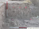
| 2005-08-29 | mH | We took two pictures of the west section wall. These are v114 and v114a. [Input: P830MH.j] | |
| 2005-09-04 | sC | Before start excavating in k14 I assigned a feature number to the wall running E-W (f288) exposed yesterday (after we removed the wall f224) and Kamiran define better the section of this wall (f289, q289). At the same time Masum dug f290 (q737), a little area characterized by the presence of ash in the corner between the wall f288 (N of it) and f127 (the wall running N-S). Then we scraped all the area and we noticed different accomulations: all of them slope toward the south area of the unit (therefore there is a difference in high between the south and the north area of the unit, between 5 to 20cm); Kamiran and Masums started by removing the first of these ones, f293 (q744). f293 is a layer located aproximately 1m N of wall f288, characterized by a very fine and compact accomulation, plastic in consistence (when wet but also when dry) and brown in colour. Then they removed f295 (q747), a layer located in the SW corner of k14 (160m W from r980, and 120m N to r980), that does not present a big difference in elevation even if it slopes a bit toward the south area of k14. In this layer have been found a seal impression that mKB dates to the late Akkadian period. We stop dig here for today: in the afternoon we take some photos of k14 (with feature f297, v124, v124a, v124b) and some paticular views of the N baluk of k14 and of the section of the wall f127 (v125, v125a, v125b, v125c). [Input: P903SC.j] | |
| 2005-09-05 | mH | in k14 ash layers are alternating with brown layers, sloping very sharply untill the second millennium wall f288. In k14 South to the wall ther is a different type of accumulation (f210). We found an akkadian seal impression in f295, but we found it together with 4 Khabur sherds. North of wall f288 we found a small area were there is a glacis f319 [Input: S307PC.j] | |
| 2005-09-05 | sC | Today we remove the wall f232 (it was composed by 9 stones) in k4. We assigned a feature number for the accomulation between and under the stones, f269, that was characterized by a crumble texture and by a soft-loose consistence (the same we had for the accomulation under the wall f144, f226, in k4). At the same time we removed three collapsed stones belonging to the wall f127. A feature number has been assigned to the pedestal under the three stones (f127.1, f127.2, f127.3) f270 (q690), and the pottery recovered in this accomulation have been collected in the qlot q689. Then we dig f200 in the N area of k14 (the area delimited by the N baulk of k14 and the wall f288): several qlots of pottery have been collected whit the digging and with the swifting of f200: q677 (of which q680 is the swift), q964 (swift q695) q696 and q699. In the SW area of k14 a ledge have been left higer because two big stone (belonging to the wall f224) have been located here. We are waiting for a craine in order to remove them. [Input: P831SC.j] | |
| 2005-09-05 | sC | Today we dig in the southern area of k14, S to the wall f224. We assigned a feature number to the briky melted and crumble accomulation N to the wall f288, f293. f293 is a accomulation located N of wall f288, and that is aproximately 1m N and 140 W. Then we dug f210 (aproximately 2m N and 3m W from r945) in the southern area of k14 (S to wall f288): the area is characterized by the presence of melted brick spread uniformly in all the exacavated area, and the surface individuated are completely flat, in the sense that they are not characterized by any kind of slope, as insted we had just on the other side of the wall f288. Lots of pottery sherds have been collected: q703, q710, q713, q717, q718 (q718 is the swift of q713, q717), q722 and q725. [Input: P901SC.j] | |
| 2009-07-25 | cJC | Today we began to remove the remaining baulk stub in the western part of k14. We are calling this f341. It is composed primarily of brickfall. We will excavate it from the top down in 50cm increments until it is level with the current bottom of k14. [Input: T725CJC.j] | |
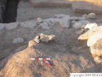
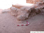
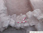
| 2009-07-26 | cJC | Today we continued removing f341. In the northern portion of f341 we uncovered a grouping of stones. It appears that they are a continuation of f334, the curtain wall of k14 (also assigned to k54 at the beginning of the excavations during cleaning). Tomorrow we will photograph the stones and assign a new feature and component numbers for the stones. We also found several medium-sized stones floating in the brickfall of f341. We didn't finish removing f341 today because the shaffat had to be shut down while Adeeb established the points. [Input: T726CJC.j] | |
| 2009-07-27 | cJC | Today we continued removing f341, the brickfall. We are almost to the bottom. The wall in the south part of f341, called f346, is almost completely exposed. Tomorrow we will relay the stones and remove it. We also began removing the accumulation under the wall, f334, that we removed last week. [Input: T727CJC.j] | |
| Strategy (projected or implemented) | 2004-06-29 | mH | My initial idea was to go with the big pick until we reach the level of the German excavation and then continue down in the whole unit. I did not expect to run into any major features until reaching the possible apron. Now that we located the tannur f9 at the southern end of the locus, we will continue excavating around it with small picks looking for a floor possibly associated with this installation. We will also excavate inside the tannur trying to find its bottom. The tannur will be cleaned and photographed. This will significantly slow down the excavation in this unit. For now we will leave the stone pedestalled. [Input: O629MH3.j] |
| 2004-06-30 | mH | Tomorrow, after I have drawn the large stone in the northern half of the unit (f13) and the tannur (f9) in the southern half of the unit, we will remove them and continue down with a big pick. We should reach the level of the German trench tomorrow. [Input: O630MH.j] | |
| 2004-07-01 | mh | As in k5 we stopped the excavations here for now. When we start we need to proceed carefully since there still could be a floor associated with these stones. They are not yet completely exposed and thus there is still a faint possibly for such a floor. [Input: O703MH3.j] | |
| 2004-07-06 | mH | Tomorrow we should be able to take down the north and the east baulks of the unit. [Input: O706MH.j] | |
| 2005-08-09 | mH | We should go down another 70 cm, move 90 cm south (i.e. leave a ledge), and cut back on the southern edge (N baulk of k15) to form the first slope for this unit. We can then continue another 2 m down, move north 90 cm and cut the previous ledge into a slope so that a 50 cm legde remains. [Input: P809MH.j] | |
| 2005-08-16 | mH | This unit will be a transition area between the target elevation 85 m, a required 60 cm ledge at 86 m, a 2 m slope betweeen 86 m and 88 m, and the 88 m ledge. I have planned to position these so that the vertical section between 85 m and 86 m will be at the north baulk line and the 60 cm wide ledge at 86 m will be the just south of the baulk line. We will use the next 40 cm of horizontal extent south of the ledge for the slope, and the southern 3 m will be at the 88 m elevation. Thus, in search for the possible use-area deposit relating to f150 in k4, f171 (f183) in k13, and f174 (f182) in k101, we can go down without compromising the stepped sections planned for this locus. [Input: P816MH.j] | |
| 2005-08-18 | mH | Our strategy here is to look for a similar feature to f150 in k4 and f171 in k13. Currently we are a bit higher than the current level of either one of these units. Thus we need to go down at least one more pickrun. We also need to draw the east section of k14 so that we can connect k14 and k4. [Input: P820MH.j] | |
| 2005-09-05 | sC | In order to remove the dirt fast from k14 and k15 we decided to swift togheter the soil belonging to these two areas: therefore after q718 (that is the swift of q713, q717) the qlots q723 and q728 contained the swift from both k14 and k15. [Input: P901SC.j] | |
| 2009-07-26 | cJC | In the southern part of f341 we have exposed a line of stones. These probably belong to f334. We will expose them, photograph them to show thier relationship to the brickfall of f341 and then remove them. Also under these stones is a very hard compacted mud layer. It is visible if you stand north of f341 and look south. It may not be an ancient feature but rather created in the past few years by water accumulating in the corner, which is the low point of the area. We will investigate this question after we remove the stones. [Input: T726CJC.j] |
Volumetric Localization
| Roster | Date | Author | Record |
|---|---|---|---|
| Elements within locus | 2007-07-18 | pC | a2 (tannur) a5 (installation) a6 (installation) [Input: S206PC2.j] |
| 2004-06-30 | mh | f6 (topsoil) f7 (layer) [Input: O630MH3.j] |
|
| 2004-06-29 | mH | f9 (tannur (feature)) f10 (fill) f12 (lens type b) f13 (isolated stone) [Input: O705MH.j] |
|
| 2004-07-29 | mh | f15 (lens type d) [Input: O807AP3.j] | |
| 2004-07-04 | mh | f17 (lens type d) [Input: O807AP4.j] | |
| 2004-07-04 | mH | f26 (lens type c) [Input: O807AP5.j] | |
| 2010-12-22 | cJC | f35 (lens type d) [Input: U809YM.j] | |
| 2007-07-20 | sC | f76 (layer) [Input: S131PC2.j] | |
| 2004-07-26 | ap | f104 (trench, trough) f109 (lens type d) [Input: O808AP3.j] |
|
| 2004-07-27 | ap | f111 (lens type d) f115 (lens type d) f121 (mix feature) [Input: O808AP3.j] |
|
| 2005-08-08 | sC | f156 (lens type d) [Input: P912MH.j] | |
| 2005-08-08 | mH | f159 (accumulation D) [Input: P912MH.j] | |
| 2005-08-10 | vVE | f161 (lens type d) f162 (lens type d) [Input: P912MH.j] |
|
| 2005-08-17 | sC | f190 (accumulation D) f191 (isolated stone) [Input: P912MH.j] |
|
| 2005-08-19 | sC | f197 (accumulation D) f198 (lens type b) [Input: P912MH.j] |
|
| 2005-08-19 | vVE | f199 (ash) f200 (accumulation B) [Input: P913MH.j] |
|
| 2005-08-19 | mH | f202 (accumulation D) [Input: P913MH.j] | |
| 2005-08-19 | vVE | f204 (accumulation D) [Input: P913MH.j] | |
| 2005-08-22 | vVE | f210 (accumulation D) f211 (accumulation D) [Input: P913MH.j] |
|
| 2007-07-20 | sC | f219 (accumulation D) [Input: S131PC2.j] | |
| 2005-08-23 | sC | f224 (wall) [Input: P913MH.j] | |
| 2005-08-31 | sC | f269 (accumulation D) f270 (accumulation D) [Input: P913MH.j] |
|
| 2005-09-03 | sC | f288 (wall) f289 (accumulation D) [Input: P913MH5.j] |
|
| 2005-09-03 | mH | f290 (accumulation D) [Input: P913MH5.j] | |
| 2005-09-03 | sC | f293 (accumulation D) f295 (lens type b) f297 (accumulation D) [Input: P913MH5.j] |
|
| 2005-09-04 | sC | f303 (accumulation D) f306 (layer) [Input: P913MH5.j] |
|
| 2005-09-04 | mH | f307 (accumulation D) f308 (accumulation D) f309 (lens type d) [Input: P913MH5.j] |
|
| 2005-09-05 | mH | f319 (glacis) [Input: P913MH5.j] | |
| 2005-09-05 | aL | f325 (accumulation B) [Input: P913MH5.j] | |
| 2005-09-07 | sC | f331 (accumulation D) [Input: P913MH5.j] | |
| 2009-07-29 | cJC | f334 (wall) [Input: T729CJC.j] | |
| 2009-09-02 | cJC | f335 (brickfall) f336 (accumulation) f337 (volumetric material) [Input: T830CJC.j] |
|
| 2009-07-25 | cJC | f341 (brickfall) [Input: T822CJC2.j] | |
| 2009-07-26 | cJC | f346 (wall) f349 (isolated stone) f351 (accumulation) f352 (lens) [Input: T822CJC2.j] |
|
| 2009-07-30 | cJC | f354 (lens) [Input: T822CJC2.j] | |
| 2012-10-13 | cJC | f393 (cut) [Input: WX08CJC.j] | |
| 2005-08-20 | vVE | i12 (pin) [Input: P913MH4.j] | |
| 2005-08-23 | sC | i13 (unknown) [Input: P913MH4.j] | |
| 2004-06-29 | mh | q16 (pottery) q18 (bones, items, pottery) [Input: O629MH.j] |
|
| 2004-06-30 | mh | q25 (bones, pottery) q26 (pottery) q28 (bones, pottery) q29 (items, pottery) q30 (pottery) [Input: O630MH2.j] |
|
| 2004-07-01 | mh | q35 (items, pottery) q37 (pottery) q39 (pottery) [Input: O703MH.j] |
|
| 2004-07-07 | ap | q78 (pottery) [Input: O710MH.j] | |
| 2004-07-12 | ap | q117 (pottery) q126 (pottery) [Input: O712MH.j] |
|
| 2004-07-13 | mh | q133 (items, pottery) q137 (pottery) [Input: O713MH.j] |
|
| 2004-07-14 | ap | q146 (bones, items, pottery) [Input: O717MH.j] | |
| 2004-07-20 | ap | q208 (items, pottery) [Input: O721AP1.j] | |
| 2004-07-21 | ap | q217 (pottery) [Input: O721AP2.j] | |
| 2004-07-22 | mh | q238 (pottery) [Input: O724MH.j] | |
| 2004-07-25 | mH | q247 (pottery) q257 (bones, pottery) [Input: O726AP1.j] |
|
| 2004-07-24 | mH | q265 (pottery) q281 (pottery) q284 (pottery) q287 (pottery) q291 (bones, pottery) q301 (pottery) q309 (pottery) q319 (bones, pottery) q337 (pottery) q338 (pottery) q343 (bones, pottery) q350 (pottery) q360 (pottery) q362 (pottery) [Input: O726AP1.j] |
|
| 2014-01-17 | cJC | q407 (pottery) [Input: Y117CJC.j] | |
| 2005-08-10 | mH | q411 (items) q412 (items) q413 (items) q414 (bones, items, pottery) q415 (bones, items, pottery) q419 (bones, pottery) q420 (bones, pottery) q423 (bones, items, pottery) [Input: P909MH.j] |
|
| 2005-08-10 | sC | q425 (bones, pottery) [Input: P909MH.j] | |
| 2005-08-10 | vVE | q427 (pottery) [Input: P909MH.j] | |
| 2005-08-11 | vVE | q428 (bones, pottery) [Input: P813VVE1.j] | |
| 2005-08-11 | aL | q433 (bones, pottery) [Input: P813VVE1.j] | |
| 2005-08-11 | mH | q435 (bones, pottery) [Input: P813VVE1.j] | |
| 2005-08-16 | sC | q502 (bones, pottery) q504 (pottery) q506 (bones, pottery) [Input: P909MH.j] |
|
| 2005-08-17 | sC | q511 (bones, pottery) q515 (bones, pottery) q516 (pottery) q520 (pottery) [Input: P909MH.j] |
|
| 2005-08-18 | sC | q524 (bones, pottery) q526 (bones, pottery) q528 (pottery) q529 (pottery) q530 (pottery) [Input: P908MH2.j] |
|
| 2005-08-20 | vVE | q536 (bones, pottery) [Input: P908MH2.j] | |
| 2005-08-20 | mH | q539 (bones, pottery) [Input: P908MH2.j] | |
| 2005-08-20 | vVE | q543 (bones, pottery) [Input: P908MH2.j] | |
| 2005-08-20 | sC | q546 (pottery) [Input: P908MH2.j] | |
| 2005-08-22 | vVE | q551 (bones, pottery) q552 (bones, pottery) [Input: P908MH2.j] |
|
| 2005-08-22 | mH | q553 (bones, pottery) [Input: P908MH2.j] | |
| 2005-08-22 | sC | q557 (bones, pottery) [Input: P908MH2.j] | |
| 2005-08-22 | vVE | q559 (bones, pottery) [Input: P908MH2.j] | |
| 2005-08-23 | mH | q561 (pottery) [Input: P908MH2.j] | |
| 2005-08-23 | sC | q565 (bones, pottery) q568 (pottery) q569 (pottery) q571 (pottery) q573 (pottery) [Input: P908MH2.j] |
|
| 2005-08-24 | sC | q576 (pottery) [Input: P908MH2.j] | |
| 2005-08-28 | aA | q652 (pottery) q653 (pottery) q661 (bones, pottery) q663 (bones, pottery) [Input: P908MH2.j] |
|
| 2005-08-29 | mH | q668 (pottery) [Input: P910MH.j] | |
| 2005-08-29 | sC | q673 (pottery) [Input: P910MH.j] | |
| 2005-08-31 | aL | q677 (bones, pottery) [Input: P910MH.j] | |
| 2005-08-31 | aA | q680 (pottery) [Input: P910MH.j] | |
| 2005-08-31 | sC | q689 (pottery) q690 (pottery) q694 (bones, pottery) q695 (pottery) q696 (bones, pottery) q699 (pottery) [Input: P910MH.j] |
|
| 2005-09-01 | mH | q703 (bones, pottery) [Input: P910MH.j] | |
| 2005-09-01 | sC | q710 (pottery) q713 (pottery) q717 (pottery) q718 (pottery) q722 (bones, pottery) q725 (bones, pottery) [Input: P910MH3.j] |
|
| 2005-09-03 | aL | q736 (pottery) q737 (bones, pottery) [Input: P910MH3.j] |
|
| 2005-09-03 | sC | q744 (bones, pottery) q747 (pottery) [Input: P910MH3.j] |
|
| 2005-09-04 | sC | q756 (pottery) q762 (bones, pottery) q768 (bones, pottery) [Input: P910MH3.j] |
|
| 2005-09-05 | sC | q778 (bones, pottery) q781 (pottery) q784 (pottery) [Input: P910MH3.j] |
|
| 2005-09-05 | mH | q785 (pottery) q788 (pottery) [Input: P910MH3.j] |
|
| 2005-09-05 | sC | q791 (pottery) q794 (pottery) [Input: P910MH3.j] |
|
| 2005-09-06 | mH | q804 (pottery) [Input: P910MH3.j] | |
| 2005-09-06 | sC | q807 (pottery) [Input: P910MH3.j] | |
| 2005-09-06 | aL | q819 (pottery) [Input: P910MH3.j] | |
| 2005-09-06 | mH | q820 (bones, items, pottery) [Input: P910MH3.j] | |
| 2005-09-07 | sC | q826 (pottery) q828 (pottery) [Input: P910MH3.j] |
|
| 2009-07-25 | sH | q837 (bones, pottery) q839 (pottery) [Input: T729CJC3.j] |
|
| 2009-07-26 | sH | q840 (pottery) q843 (bones, pottery) [Input: T729CJC3.j] |
|
| 2009-07-27 | cJC | q844 (pottery) [Input: T729CJC3.j] | |
| 2009-07-28 | cJC | q845 (bones, pottery) q850 (bones, pottery) q851 (pottery) [Input: T729CJC3.j] |
|
| 2009-07-30 | cJC | q854 (bones, pottery) [Input: T804CJC.j] | |
| Relays (applicable to elements) | 2004-07-03 | bp | r30 (39201 50286 - / Relay location: top) [Input: O703MH5R.j] |
| 2004-07-03 | bp | r30 (39201 50286 - ##### / Relay location: top) [Input: O703MH5R.j] | |
| 2004-07-03 | bp | r31 (39576 50429 - / Relay location: top) [Input: O703MH5R.j] | |
| 2004-07-03 | bp | r31 (39576 50429 - ##### / Relay location: top) [Input: O703MH5R.j] | |
| 2009-07-25 | cJC | r1026 (39568 50419 - 8806 / Relay location: SE corner) [Input: T728CJCR.j] | |
| 2009-07-25 | cJC | r1027 (39654 50464 - 8819 / Relay location: NE corner) [Input: T728CJCR.j] | |
| Elevation | 2005-09-12 | mH | 8853 [Input: P913MH7.j] |
| 2005-09-12 | mH | 8868 [Input: P913MH7.j] | |
| Extension of locus or q-lot | 2004-06-29 | mh | m3616 [Input: O629MH2.j] |
| Length of two sides | 2004-06-29 | mh | 400e [Input: O629MH2.j] |
| 2004-06-29 | mh | 400s [Input: O629MH2.j] |
