Back to top: Overview of Unit OH2
Physiognomy
Back to top: Overview of Unit OH2
2011 - C. Chaves Yates
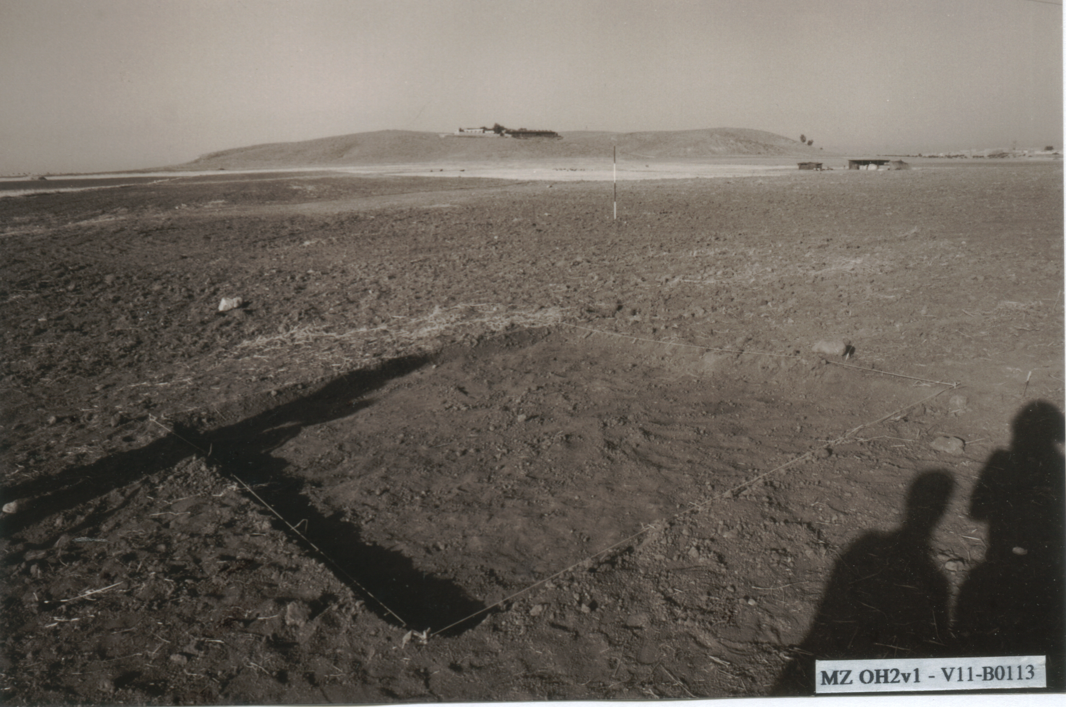
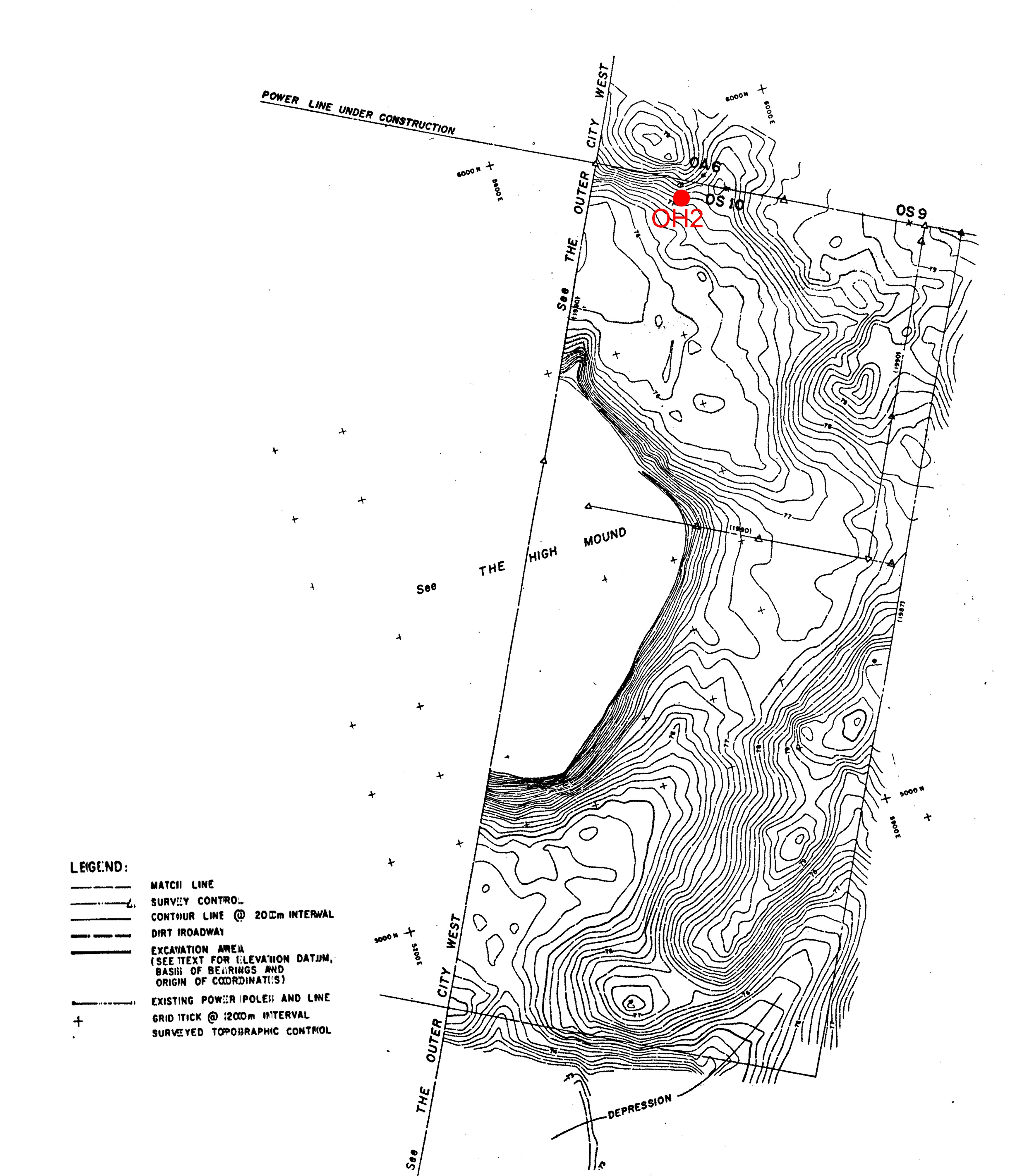
The physiognomy of OH2 was primarily defined by the desired location of the well. The 4x4 meter excavation unit was located just outside of the visible rise that encircles the high mound about 300 meters from the base of the high mound. Earlier survey research had suggested that this rise was the outer city wall.
The original plan for the excavation was only to explore the area as a test for stratified remains and so a strategy of limited excavation was implemented. Only the locus, k1, was opened and it was excavated to an approximate depth of 2 meters. The topmost layers of the excavated area were clearly disturbed by modern plowing with a mix of ceramics types, usually heavily abraded. The layers below this plow line, approximately 70cm below the surface, were the most significant. Within a thick band of clearly marked soil numerous sealings and seal impressions were found. These finds led to the conclusion that the OH2 area was part of the administration complex at Urkesh, and represents the third millennium administrative functions in the outer city area.
Back to top: Overview of Unit OH2
The pertinent areas
Back to top: Overview of Unit OH2
2011 - C. Chaves Yates
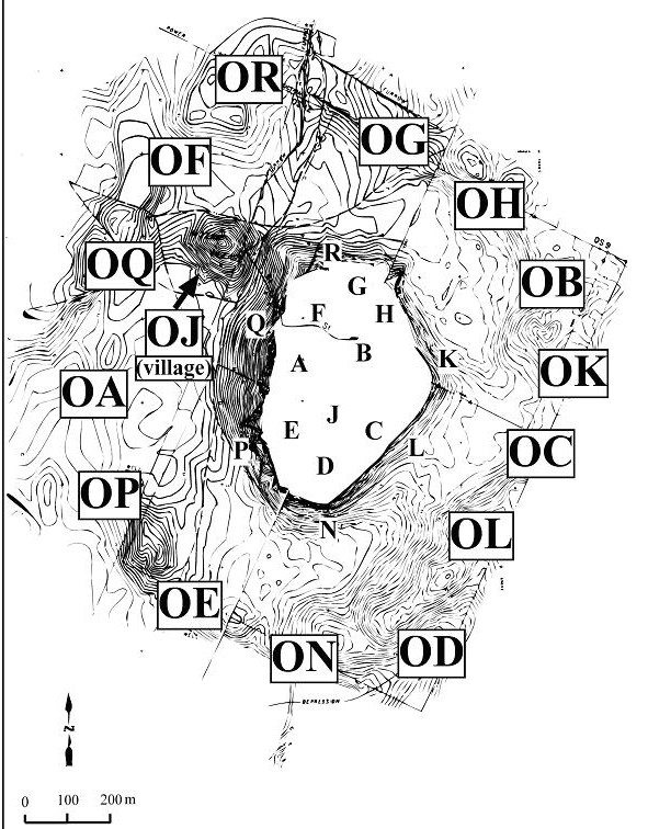
In the outer city areas are always given two letters. The first is always O, to indicate the location in the Outer City and to distinguish from lettered areas on the high mound. The second letter indicates the general location, with the outer city letters corresponding roughly to the same areas on the high mound.
OH2 has only 1 locus, k1, as it was a very limited excavated designed to understand the finds in the area and to determine if it would be proper for the land-owner to build a well on the location. The locus was 4 by 4 meters.
Back to top: Overview of Unit OH2
Location
Back to top: Overview of Unit OH2
2011 - C. Chaves Yates
OH2 is located to the northwest of the site, just outside the rise that indicates the outer city wall. The excavated square is oriented with the sides to the cardinal directions. The location was not chosen arbitrarily, but rather reflects the location where a local farmer wanted to install a well for irrigation farming. The survey results from 1987 survey indicated that the area might have archaeological remains so it was chosen for a short excavation.
Back to top: Overview of Unit OH2
Phases
Back to top: Overview of Unit OH2
2011 - C. Chaves Yates
As discussed below, the materials from the top features were mixed, due to modern plowing and represented no consistent time period. Below the plow-line, however, the materials were uniformly mid-third millennium, contemporary with the Temple BA materials. In the current sequence (JPD), these finds are data to Phase 3.
Back to top: Overview of Unit OH2
Beginning of excavations
Back to top: Overview of Unit OH2
2011 - C. Chaves Yates
The excavations began on July 5, 1998 under the supervision of J. Walker and John Lynch. They were selected to supervise the excavation and were tasked with creating the first complete digital record of the excavations.
Back to top: Overview of Unit OH2
End of excavations as of 1998
Back to top: Overview of Unit OH2
2011 - C. Chaves Yates
The excavations in OH2 were closed on July 14, 1998 when the excavations in area BA were opened. Locus k1 was dug to a depth of approximately 2 meters and the results indicated that the area was archaeologically significant. At this point the excavations were closed and the area backfilled. A few extra days after the excavations were closed the excavators were able to complete the complete digital record, which was originally produced as a CD.
Back to top: Overview of Unit OH2
Main results
Back to top: Overview of Unit OH2
1998 - G. Buccellati
The excavations in OH2 turned out to be much more important than we anticipated. The plow line reaches a depth of about 70 cms: the line is generally uniform, except along the western baulk, where it is lower by some 30 cms: this may have been caused by the presence of extensive animal burrows, which possibly caused the terrain to subside, only to be filled through the smoothing action of the plow. The layers within the plow line yielded a considerable amount of sherds, but no recognizable structural definition could be obtained; in other words, there is no indication as to the original nature of the deposition, much less its original emplacement.
Below the plow line, we came upon an accumulation layer (f4) which was clearly marked in terms of the nature of the soil. And within it, a real surprise: more than a dozen clay sealings, several with clear seal impressions. It was immediately certain that they belonged in the middle of the third millennium, their date matching that of the pottery, and at that point our strategy changed.
Back to top: Overview of Unit OH2
General statistics
| approximate cubic meters | 32 |
| total number of features | 12 |
| total number of items | 59 |
| total number of q-lots | 21 |
| total number of sherds | 656 |
| total number of output files | 661 |
| total number of records | 4,916 |
| total number of hyperlinks | 32,140 |
| total number of photographs | 29 |
| total number of drawings | 4 |
| total file size (with low resolution graphic files) | 4,472,644 |
Back to top: Overview of Unit OH2